

The Destruction of the Medieval Fortifications of Paltzschen
| Place: | Paltzschen (Lommatzsch, Meissen) |
|---|---|
| Type: | Defensive Structures/Fortifications |
| Dating: | High Middle Ages / 12th century | Late Middle Ages / 15th century | 1150–1400 A.D. |
Description
How a loess-covered gravel ridge—which juts out like a spur to the northeast into the Keppritzbach floodplain north of Paltzschen—might have gotten its name has already given rise to all sorts of speculation, since neither the Meilenblatt nor more recent maps mention a “Tanzplatz”“ recorded. If a Slavic “sacred site” were ever to be found here“ had found that changes to “Paltzschener See,” located 15 km to the west,“, the “sacred Lake of the Oracles”“ the Daleminzier, barely visible to the naked eye. Incidentally, there is also a prominent hill between Piskowitz and Prositz that overlooks the Ketzerbach Valley, called “Tanzberg”“ In other words, it stands to reason that visible remnants of ancient structures, such as mounds or ramparts, spark the imagination or. have inspired the customs of the local population and, ultimately, influenced the origin of field names since the late Middle Ages. In any case, both sites have long been known to be significant settlement sites or. Archaeological finds from graves are known.
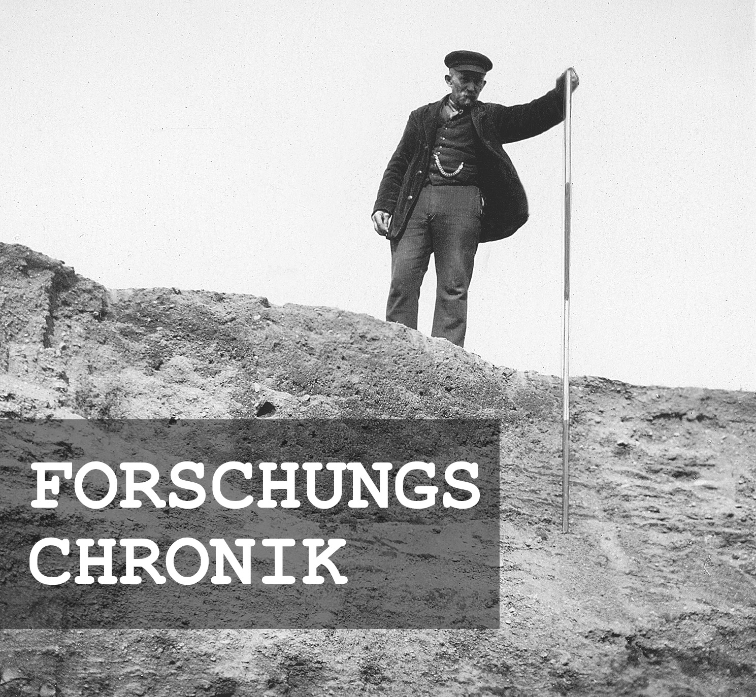
Michael StrobelResearch Chronicle
1840 | “One of the hills in Dörschnitz was surrounded by a rampart” (Schiffner 1840, 414).
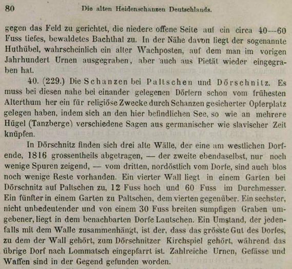
1869 | “A fifth (rampart) in a garden in Paltschen” (Schuster 1869, 80).
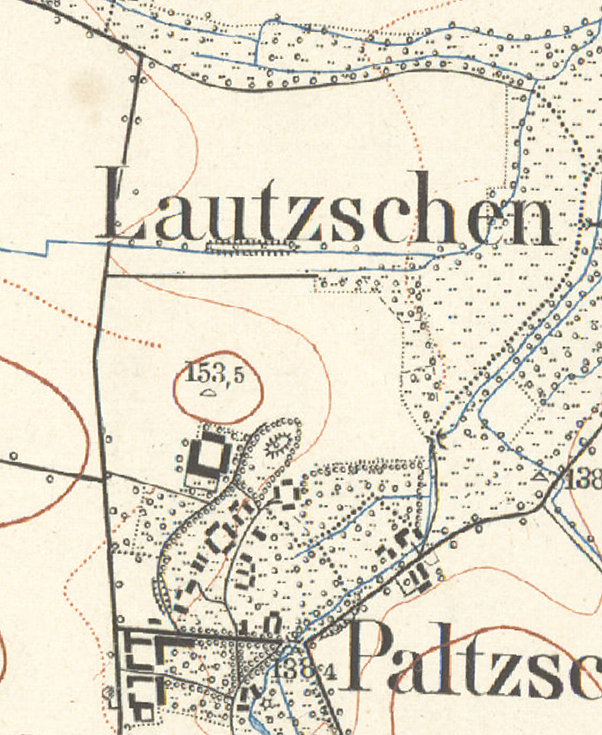
1896 | The remains of the rampart were mapped for the first time.
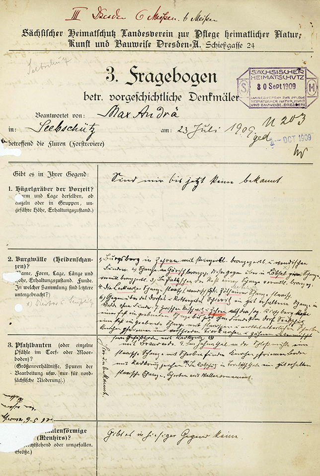
1909 | Max Andrä completed the questionnaire from the Landesverein Sächsischer Heimatschutz (Saxon Heritage Preservation Association).
1937 | Alfred Mirtschin oversaw the construction of a water pipeline.
1938 | Listed on Monument List B.
1976 | Destroyed by the “Helmut Just” agricultural cooperative to create farmland.
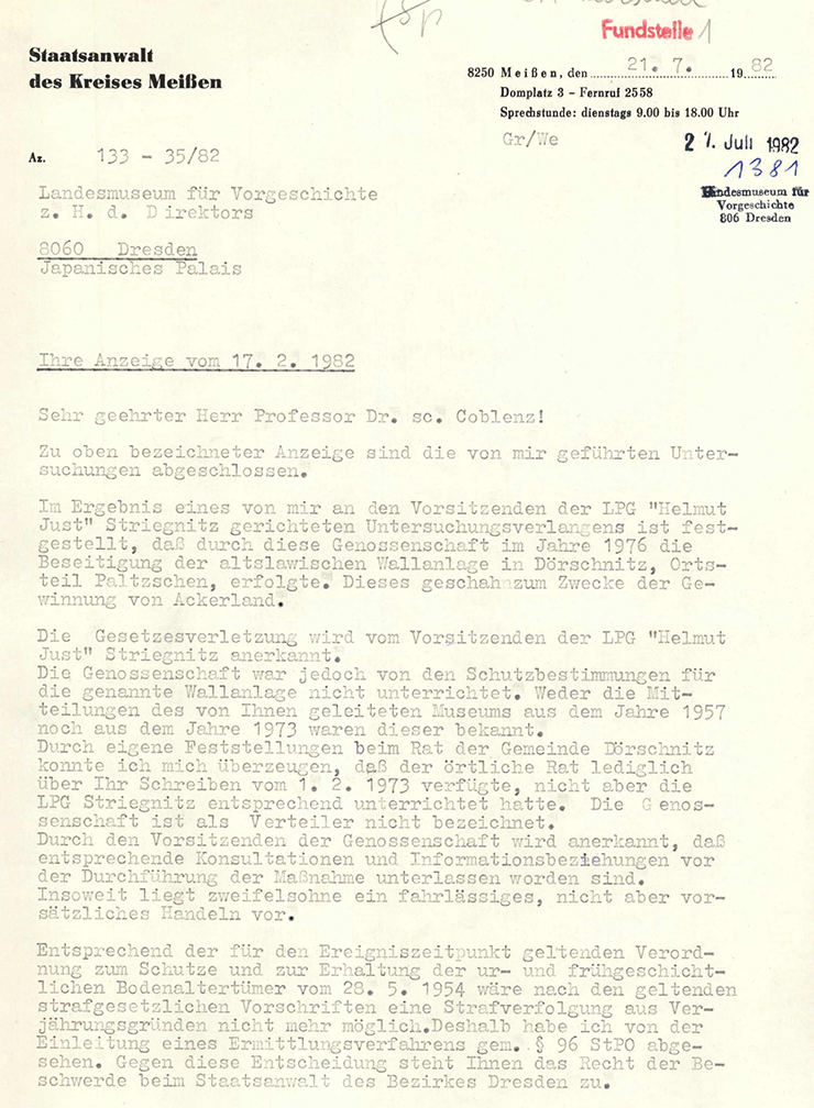
1982 | The Meissen Public Prosecutor’s Office initiates a preliminary investigation.
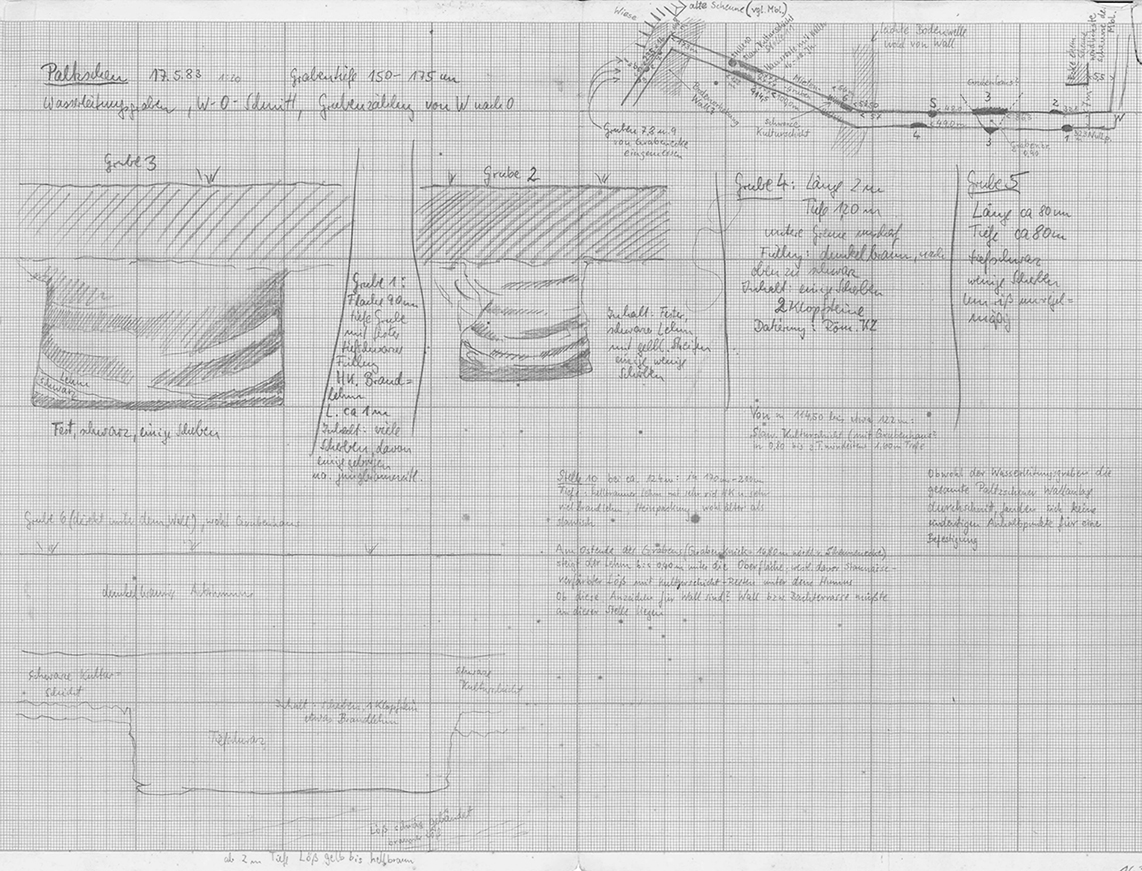
1983 | Archaeological observations in a second pipeline trench by Reinhard Spehr.
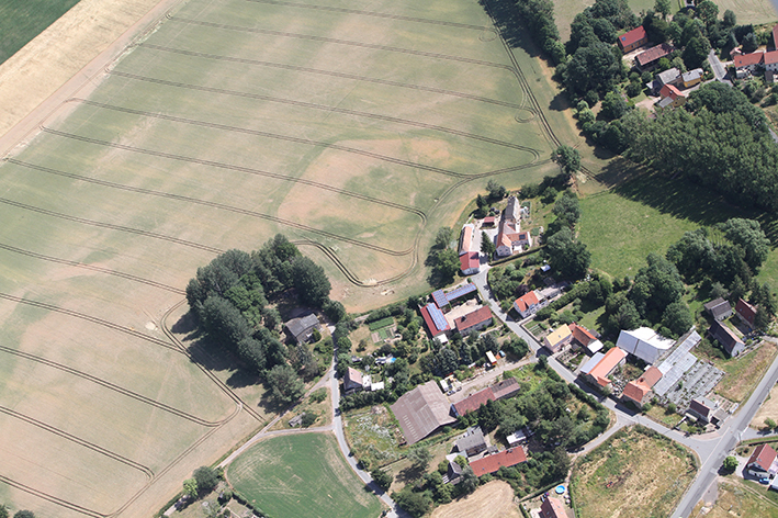
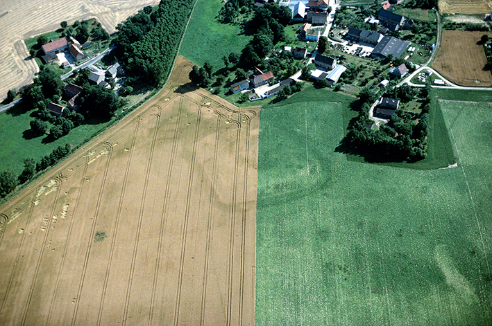
1994 | Aerial photographs show the condition of the “aerial survey site” for the first time.
2004–2005 | Pedological investigations.
Image Source Foto ©LfA 1929.
Exact location unclear
If the Paltzschen fortifications had still been well-preserved in the early 19th century, the grand master of Saxon archaeology, Karl Benjamin Preusker (1786–1871), would certainly have described them or even depicted them. It is unclear whether the Saxon geographer Christian Albert Schiffner (1792–1873) actually had the remains of the rampart on the northern outskirts of Paltzschen in mind when he mentioned, in his *Geography of the Kingdom of Saxony* (1840), it is unclear. Nearly thirty years later, in 1869, the Saxon officer and historian Oscar Schuster (1834–1904) even reported on five “old ramparts” between Dörschnitz and Paltzschen, without pinpointing the exact location of even one (“a fifth in a garden in Paltzschen,” Schuster 1869, 80). None of this information is sufficient for a precise identification.
Michael StrobelImage Source Schuster 1869, 80.
First mapped in 1896
It is only since the late 19th century that archaeological preservation authorities have had at least a more precise understanding of the existence and location of the former fortification. While the Meilenblatt does not yet provide any useful clues, a section of the rampart approximately 50 meters long is at least mapped on the 1896 equidistant map. Whatever lay beyond this short section must have been largely leveled by the time of the topographic survey, though it was likely already leveled by around 1800.
Michael StrobelImage Source Äquidistantenblatt ©LfA/SLUB 1896.
Data Collection via Questionnaires
A note by Max Andrä, a farmer and landowner from Seebschütz, (1866–1946) can refer to—a note he recorded in 1909 under the heading “Castle Ramparts (Pagan Fortifications)” in the questionnaire of the State Association for Saxon Heritage Preservation: “In Paltzschen, the remains of a fortification, presumably from the Bronze Age”. The monument was now officially documented in the archive of prehistoric finds from Saxony. The survey maps also served as the basis for its inclusion in the fortification register twenty years later.
Michael StrobelImage Source OA 61280, 96 ©LfA 1909.
A Preliminary Sketch of the Situation
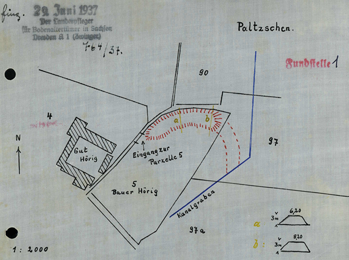
Another ten years would pass before the fortification once again drew the attention of archaeological preservation authorities in the spring of 1937. Since a drainage ditch had been dug through the southeastern section, Alfred Mirtschin (1892–1962), a teacher from Riesa and an expert on archaeological antiquities, was able to trace the course of the fortifications even in places where no rampart was longer visible on the ground.
Michael StrobelImage Source OA 59260, 97 ©LfA 1937.
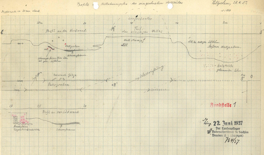
The corresponding profile drawing
Mirtschin’s profile drawing shows not only the eroded rampart body (“rampart stump”), but also an outer ditch at least 2 m deep and up to 8 m wide, as well as a shallower inner ditch. Aerial photographs still clearly show the pipeline that runs parallel to the complex from the north or northeast.
Michael StrobelImage Source OA 59260, 95 ©LfA 1937.
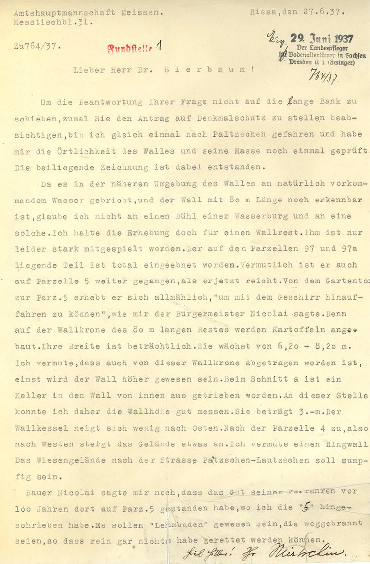
Bühl or Ringwall?
After Georg Bierbaum (1889–1953), the state curator of archaeological antiquities, had written from distant Dresden to express his suspicion that the site was more likely the “Bühl” of a motte-and-bailey castle, his volunteer assistant Mirtschin visited the site a second time in June 1937 to assess the situation. His assessment—that the mound must be the last remnant of a ring wall that had “unfortunately been severely damaged”—was ultimately accepted not only by the State Curator but also by later archaeologists. However, neither the mayor nor the owners—who were even growing potatoes on the top of the rampart—could recall when the majority of the fortification might have been removed. Nevertheless, for the purpose of listing the site as a historic monument, it was by no means insignificant whether a motte or a much larger ring wall should be placed under protection.
Michael StrobelImage Source OA 59260, 88 ©LfA 1937.
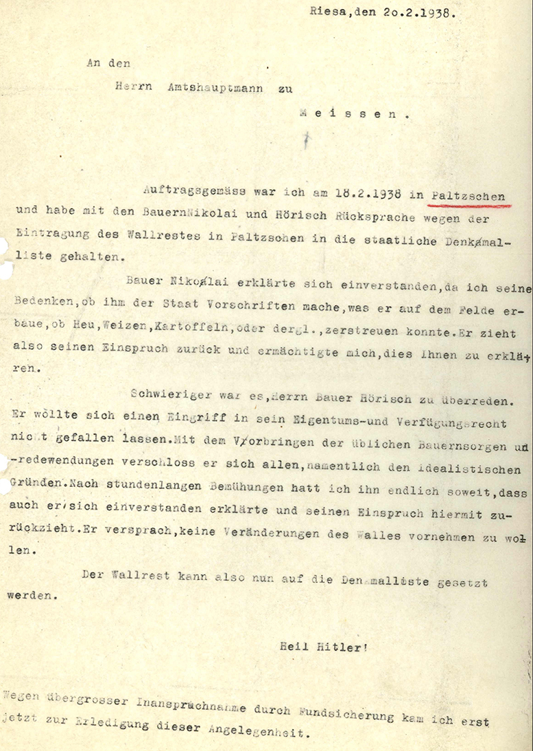
Inclusion on the List of Historic Landmarks
The site’s inclusion on the list of historic monuments was preceded by intensive discussions with the farmers, who were primarily concerned about restrictions on land use. For these complicated negotiations, the district administrator and the state conservator could once again find no more suitable representative than the teacher from Riesa, who apparently had to dispel all sorts of concerns, particularly “farmers’ worries.” On May 9, 1938, the site was finally added to List B of the historic monuments register.
Michael StrobelImage Source OA 59260, 94 ©LfA 1938.
After the Land Reform
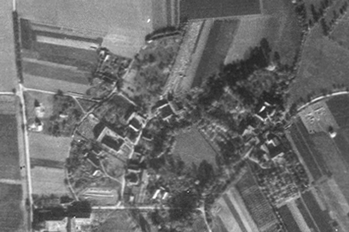
Even after the war ended, the local farmers appear to have kept their promise not to alter the embankment. An aerial photograph from the 1950s reveals that the area was still being used as an orchard meadow, while narrow strips of farmland adjoined it to the east and north.
Michael StrobelImage Source Luftaufnahme 1950er Jahre ©LfULG/LfA
Intact Monument
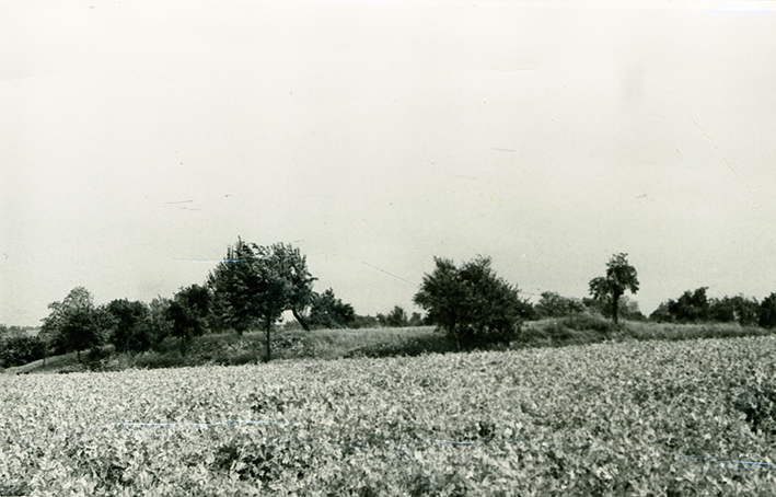
When, many years later, in 1971, an employee of the Dresden State Museum of Prehistory once again stopped by Paltzschen to inspect the site, he found no signs of damage. The rampart still lay at the edge of an orchard meadow, having sustained no major damage from farming activities.
Michael StrobelImage Source OA 59260, 120 ©LfA 1971.
Situation Assessment Through Satellite Reconnaissance
Even the Americans could have seen in 1975 that the fortification still marked the northern boundary of the orchard meadow. Admittedly, the small-scale division of fields that had characterized the agricultural landscape around Paltzschen until the 1960s had long since been absorbed into a single large field. Because the “unproductive” protrusion jutting northward into the field stood in the way of mechanized farming, the embankment and the orchard meadow were a constant thorn in the side of those in charge at the Striegnitz agricultural production cooperative (LPG) “Helmut Just.” The GDR model farm, which had been awarded the “Patriotic Order of Merit in Gold,” did not want to forgo a single square meter of farmland. The removal of the monument was in line with the logic of productivity-oriented complex land improvement (land consolidation), which showed no regard for paths, hedges, or rows of trees.
Michael StrobelImage Source Satellitenaufnahme ©GeoSN/LfA 1975.
Faced with a fait accompli
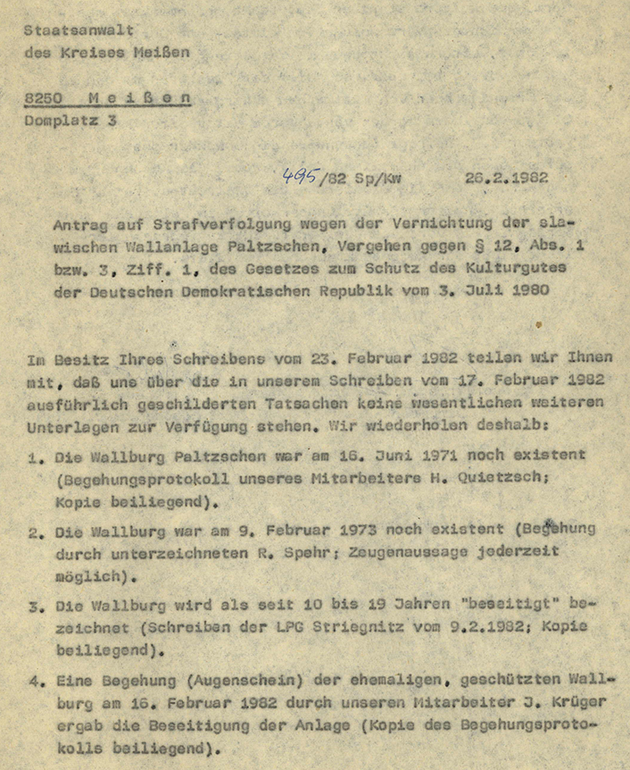
After a staff member from the State Museum had last visited the site in 1973 and installed an information sign, there was great consternation during a follow-up inspection in January 1982 upon learning that, according to local residents, the earthen wall had been and the orchard meadow had been incorporated into the field. In February, the State Museum of Prehistory therefore filed a complaint with the Meissen Public Prosecutor’s Office seeking criminal prosecution for the “destruction of the Slavic Paltzschen rampart” and for a “serious offense against the national cultural heritage of the GDR.” The damage to this “cultural asset” was estimated at 500,000 marks.
Michael StrobelImage Source OA 59260, 137 ©LfA 1982.
Preliminary Investigation
It was all too obvious as early as the winter of 1982 who had ordered the destruction of the wall to gain farmland. The LPG chairman had no choice but to “acknowledge” the “violation of the law” in the course of the prosecutor’s investigation. However, since the municipality had allegedly failed to inform the cooperative of the wall’s protected status, and the chairman could not be accused of acting with intent, the public prosecutor’s office discontinued the investigation in July 1982. Efforts to appeal are said to have led to a retrial and the imposition of a heavy fine on the agricultural production cooperative, but these are not documented in the local records.
Michael StrobelImage Source OA 59260, 145 ©LfA 1982.
Second Pipeline Construction Project
Just one year later, it therefore cannot have been easy for the museum staff to approve the LPG’s plan to construct a water pipeline through the southern edge of the site. However, the archaeological monitoring of the project yielded so many new insights that the benefits seemed to outweigh the damage. Reinhard Spehr was able to document pits from the Early Bronze Age, the Roman Imperial period, and the Early Middle Ages in the excavation profiles.
Michael StrobelImage Source OA 59260, 163 ©LfA 1983.
Early Medieval Pits
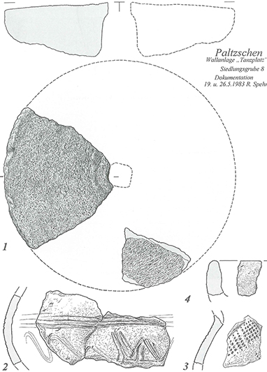
A find dating to the 9th/10th century CE contained not only typical “Slavic” shards, but also fragments of a rotary mill and a clay trough used for roasting grain. Furthermore, numerous surface finds provide evidence of almost continuous use of the site since the Linear Pottery culture. However, the investigations do not appear to have contributed anything to the dating of the fortification itself. The wide range of surface finds illustrates once again how problematic it can be to base a chronological classification solely on surface finds.
Michael StrobelImage Source R. Spehr 2011, Abb. 80.
Variable Dating
For decades, the fortification was considered a “Slavic” hillfort. The temptation must always have been great to infer a temporal connection from the geographical proximity to “Paltzschener See” and to identify the “Tanzplatz” as a central tribal fortress of the Daleminzier.
Michael StrobelImage Source R. Heynowski, Foto Luft_3127_043 ©LfA 2019.
High Middle Ages Manor House
However, the size and layout of the site are difficult to reconcile with a castle from the 9th/10th century CE. Reinhard Spehr has instead suggested interpreting the structures as the remains of a fortified medieval residential and farmstead complex and thus the seat of a ministerial family. The owner may have been a “Lampertus de Pulzan,” who is attested in 1206. By the first half of the 14th century at the latest, the manor belonged as an allod to the Meissen district, to which the village community was also liable for taxes. After the mid-14th century, the Lords of Polenz, who resided at Hirschstein Castle, appear to have drawn income from Paltzschen until the property passed to citizens of Meissen and ultimately to Margrave Wilhelm the One-Eyed.
Michael StrobelImage Source R. Spehr 2011, Abb. 81
The destruction is irreversible
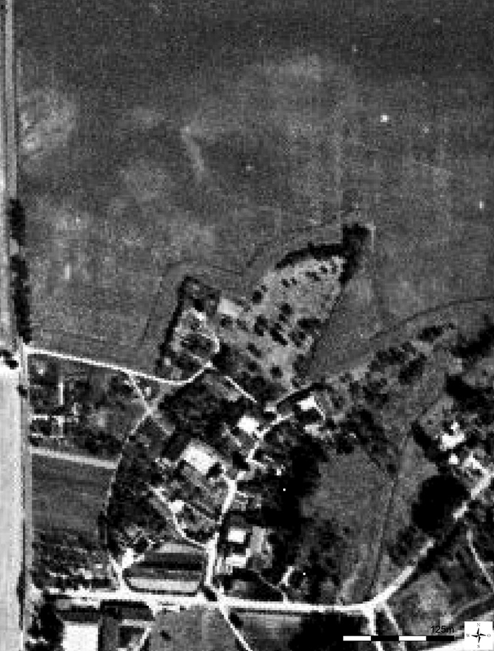
When assessing the incident in 1976, the date of the fortification is completely irrelevant: Within a few days, an archaeological cultural monument—still partially visible above ground—was destroyed, and its significance could not have been completely forgotten even forty years after it was placed under protection. Anyone who lived in the area knew what was rising before their eyes from the orchard meadow. This also applies to the former LPG chairman. Like many other archaeological sites in this intensively farmed agricultural landscape, the manor house on the “Tanzplatz” survives today only as a “monument visible from the air,” but is no less threatened by erosion and mechanical wear and tear.
Michael StrobelImage Source O. Braasch, Foto Luft_4744/066-03 ©LfA 1994.
Monitoring After 30 Years
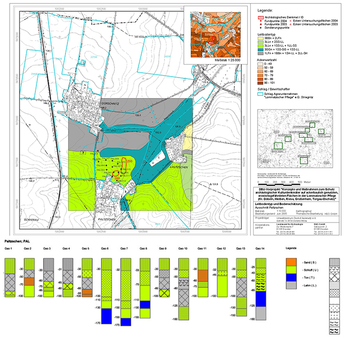
To investigate the condition of the castle site and the Linear Pottery culture settlement adjacent to its north, the area was extensively drilled in 2004–2005. The castle is situated on a broad spur that slopes gently toward the northeast, with steep slopes on the north and east sides that descend into the damp lowlands. Fourteen test pits reveal a slight loss of soil depth of approximately 30 cm on the plateau and, in some places, more than 1 m on the slopes. Traces of the fortification’s leveling were identified, as were signs of material fill following the demolition of a building. In the lowlands, colluvial deposits have accumulated to a thickness of up to 60 cm. This suggests that erosion on the leveled area has been minimal. However, the last traces of the fortification are gradually being leveled out and spread apart by soil cultivation.
Michael StrobelImage Source R. Vogt, Grafik ©LfA 2005
Literature
Werner Coblenz, Bemerkungen zur Chronologie in den slawischen Gauen Daleminzien und Nisan. Archaeologia Polski 16, 1971, 401-417.
Werner Coblenz, Einige Bemerkungen zur Archäologie des sächsischen Raumes in der Zeit zwischen deutscher Eroberung und dem Beginn der Kolonisation. In: Michael Gockel/Volker Wahl (Hrsg.), Festschrift für Hans Eberhardt zum 85. Geburtstag. Thüringische Forschungen (Weimar/Köln/Wien 1993) 1-22.
Martin Fröhner/Michael Strobel, Zwei Landwirte als Archäologen: Max Andrä (1866-1946) und Oskar Wallrabe (1870-1956). Archaeo 13, 2017, 38-47.
Hans-Jürgen Hardtke/Sarah Jacob/Karl Mannsfeld/Haik Thomas Porada/Michael Strobel/André Thieme/Thomas Westphalen (Hrsg.), Zwischen Lommatzsch und Wilsdruff. Eine landeskundliche Bestandsaufnahme. Landschaften in Deutschland 83 (Köln 2022).
Albert Schiffner, Handbuch der Geographie, Statistik und Topographie des Königreich Sachsens. Zweite Lieferung, den Dresdener Kreisdirectionsbezirk enthaltend (Leipzig 1840).
Oscar Schuster, Die alten Heidenschanzen Deutschlands mit specieller Beschreibung des Oberlausitzer Schanzensystems (Dresden 1869).
Reinhard Spehr, Gana – Paltzschen – Zehren. Eine archäologisch-historische Wanderung durch das Lommatzscher Land (Dresden 2011).
Note on monument protection
Archaeological monuments are protected by the Saxon Monument Protection Act. A permit under monument law is required for ground interventions or construction measures.
Permalink
https://archaeo-sn.de/en/ort/die-zerstoerung-der-mittelalterlichen-befestigung-von-paltzschen/
Citation
Michael Strobel, The Destruction of the Medieval Fortifications of Paltzschen. In: Landesamt für Archäologie Sachsen, Website archaeo | SN (04.06.2026). https://archaeo-sn.de/en/ort/die-zerstoerung-der-mittelalterlichen-befestigung-von-paltzschen/ (Stand: 29.09.2026)
