

The “Schloßturnplatz” – Physical Exercise Above a Medieval “Curia”
| Place: | Naunhof (Naunhof, Leipzig) |
|---|---|
| Type: | Water Castle |
| Dating: | High Middle Ages | Late Middle Ages | 1250–1500 A.D. |
Description
South of Naunhof, the Parthe flows northward through one of the larger contiguous forest areas in western Saxony. Field names that contain the word “Bruch”“ indicate moist to swampy conditions extending up to 20. Jh. often even flooded sites where, above all, so-called. Alder-dominant forests grow. There are strict limits on profit-oriented forestry here. This makes the areas designated for flood protection all the more important. In addition, the high groundwater level in the city is said to have prevented the construction of basements in buildings for a long time. The medieval “Old Castle”“ At the southern end of town, it lay right on the river in the marshy floodplain.
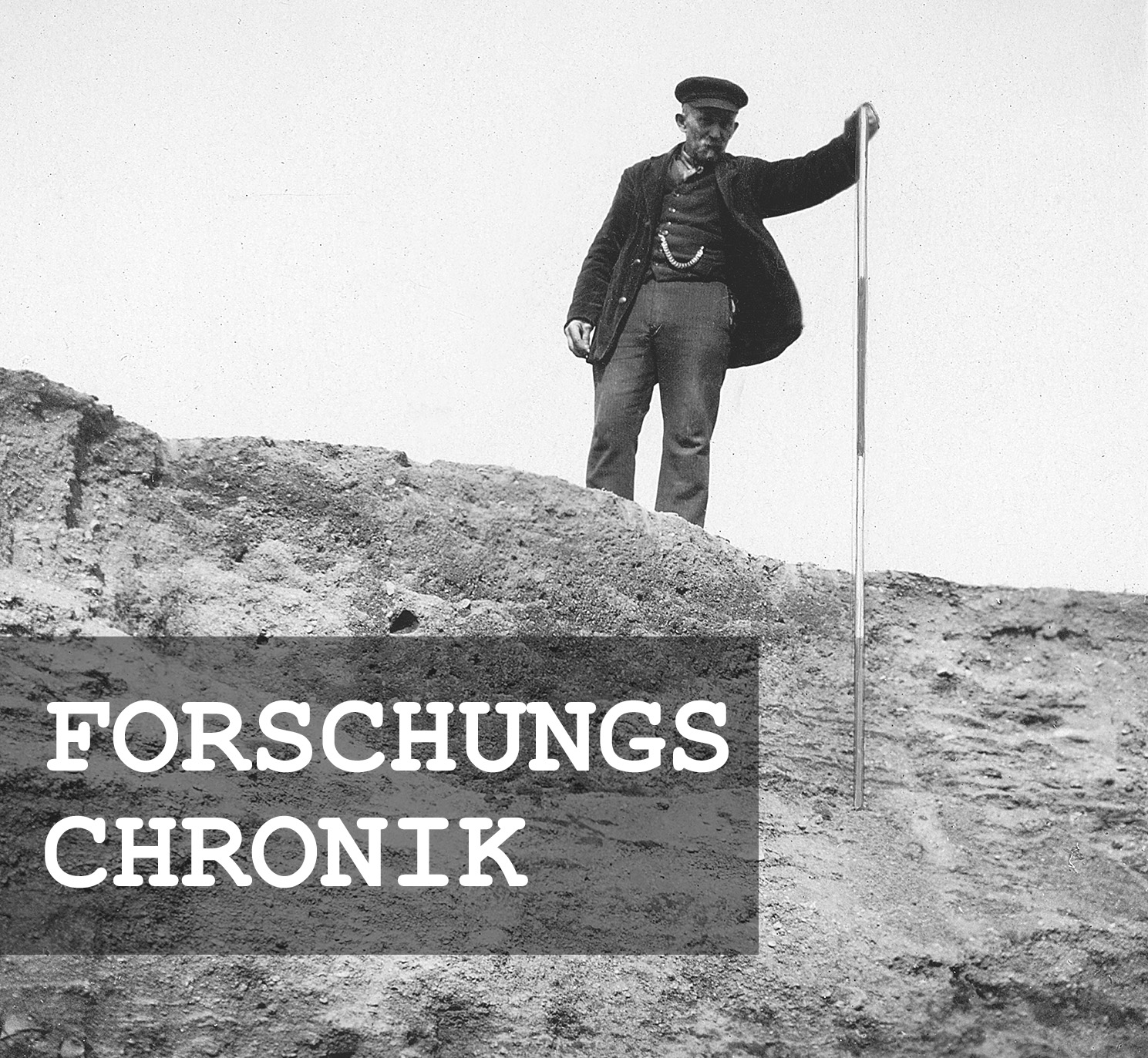
Michael StrobelResearch Chronicle
Until the 19th century | The floodplain forests of the Parthe River were repeatedly flooded.
August 2, 1927 | The gymnastics club purchases the 2.1-hectare plot of land from the Prince of Schönburg-Waldenburg.
May 19, 1928 | Members of the gymnastics club begin leveling the castle hill to build the sports field.
June 9, 1928 | Werner Radig reports the extent of the hill’s destruction to the Dresden Museum.
By fall 1931 | The course of the Parthe River must be regulated.
July 1934 | Inauguration of the Schlossturnplatz.
January 19, 1937 | Application for the medieval fortifications to be listed on “State Monument List B.”
January through February 1937 | Hearings with the municipality and the sports club.
May 20, 1937 | The Leipzig District Administration completes the registration.
July 31, 1937 | The sports club files an “objection.”
August 20, 1937 | The Supreme Authority for the Protection of Historical Monuments rejects the appeal.
Since 2018 | Medieval walls are visible for the first time in aerial photographs.
Image Source Foto ©LfA 1929.
Nothing more than a field name?
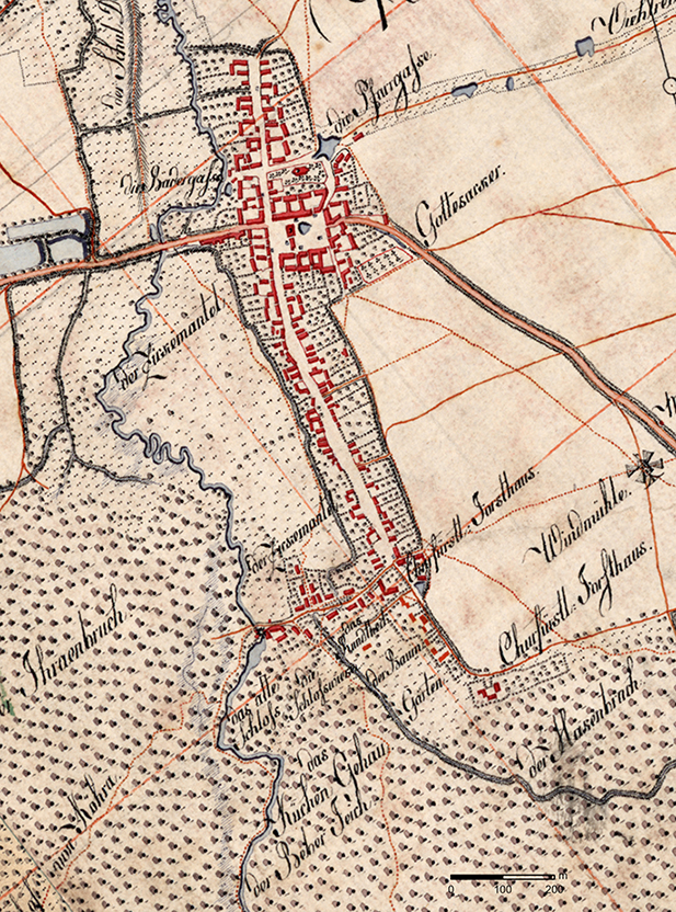
Since the surveyors of the early 19th century were also able to draw on local field-name traditions, they recorded the “Alte Schloß” in the Saxon Mile Sheet as being located more or less exactly in the swampy forest—just like the “Bruchwälder” in the surrounding area. It is surprising, however, that the surveyors chose not to map the hill, which must have risen as much as 3 meters above the marshy woodland.
Michael StrobelImage Source Berliner Meilenblatt ©Staatsbibliothek Berlin/SLUB/LfA Sachsen
The cultural landscape is changing
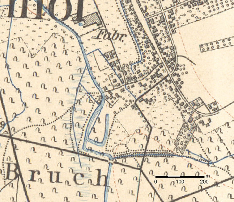
The profound impact that land improvement and river regulation measures had on the landscape throughout the 19th century becomes evident—several decades later—in the equidistant map, from which the “Old Castle” had already disappeared by the 1876 edition. The numerous meanders have given way to a heavily straightened riverbed. What might give the impression of a moat in the 1888 map turns out to be an artificial, approximately 100-meter-long side channel of the Parthe, whose floodplain extends over 100 meters westward into the forest.
Michael StrobelImage Source Äquidistantenkarte 27, Section Naunhof 1888 ©SLUB
A marsh meadow without the “Old Castle”
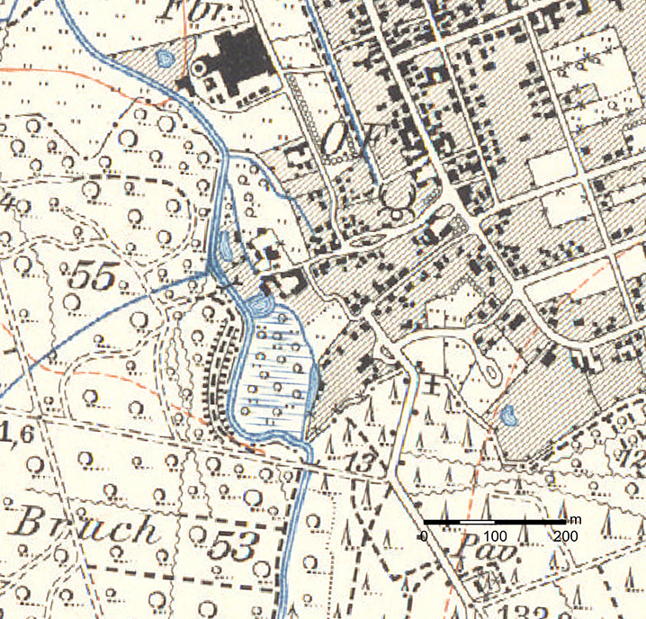
To prevent the Parthe from regularly flooding into the forest during high water, the left bank was embanked by 1905, and a side channel was dug to the east, around the marshy meadow, extending as far as the Mühlteich; the “Schlosshügel” was located in the southern part of this meadow, which is not shown on the survey map.
Michael StrobelImage Source Meßtischblatt 27, Naunhof 1905-1907 mit Nachtrag 1912, 1:25000 ©SLUB
A "bargain"
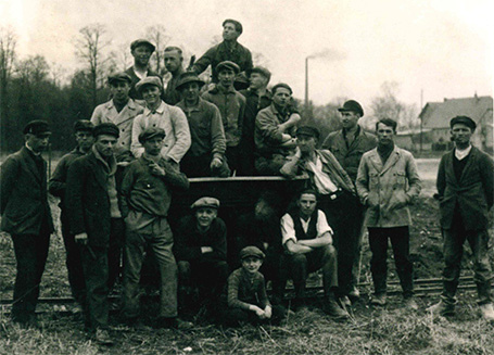
For the owner of the “Schloßflurstücke,” Prince Günther von Schönburg-Waldenburg, who resided at the Pomßen manor—which in 1925 comprised 815 hectares of farmland and meadows as well as 513 hectares of forest—the marshy area was hardly suitable for economic use. For the Naunhof Gymnastics Club, on the other hand—which had been searching in vain for a new sports field site until then—the purchase price of 6,000 Reichsmarks must have been almost like a “gift.” Without a loan of 5,000 RM from the Saxon Welfare Assistance Fund, however, the club would not have been able to raise even this amount, not to mention the construction work that members and residents had to carry out on their own over the next six years.
Michael StrobelImage Source SV Naunhof 1920 e.V. (Hrsg.), Geschichten über 100 Jahre Fußball in Naunhof (Leipzig 2020) 28.
Groundbreaking Ceremony for a Destructive Construction Project
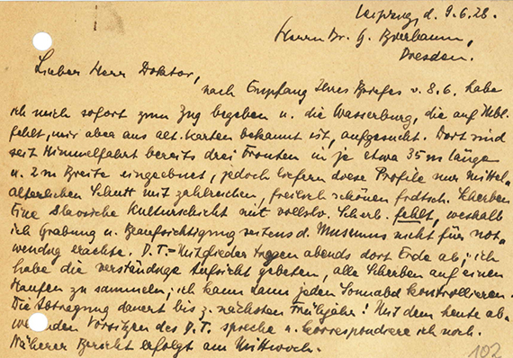
The groundbreaking ceremony took place on May 17, 1928, and focused on the 3-meter-high “castle mound,” the excavation of which, after three weeks, had become known even to the director of the Archive of Prehistoric Finds in Saxony, Georg Bierbaum (1889–1953). Bierbaum sent the young Leipzig archaeologist Werner Radig (1903–1985), who had been assigned to document the prehistoric and early historic ramparts in Central and Western Saxony, to Naunhof. The prospective employee at the Dresden Museum noted with regret that “three sections, each about 35 m long and 2 m wide,” had already been excavated in the mound and that “beautiful prehistoric shards” had been found. However, since a “Slavic cultural layer” was missing, he advised the state archaeologist against an “excavation and supervision by the museum” and instead offered to make regular inspection visits on Saturdays.
Michael StrobelImage Source Ortsakte 42670, 98 ©LfA 1928
The "Schlosshügel" is being skied down
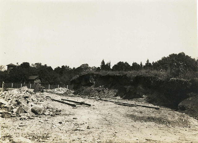
According to the records, Bierbaum was unwilling to commit to either an excavation or ongoing construction supervision, nor was he willing to send Radig to Naunhof weekly for inspections, even though he was aware of the scope of the work. Since not only substantial amounts of earth but also large stones had to be moved, dump cars were even used on temporarily laid tracks for the grading work to haul away the material.
Michael StrobelImage Source Ortsakte 42670, 98 ©LfA 1928
Powerless Preservation of Historical Monuments
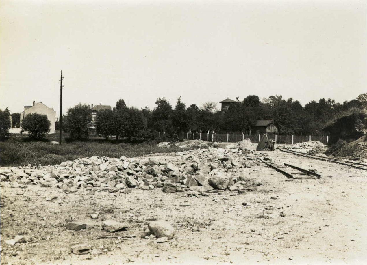
While the gymnastics club, in a sense, acted on its own initiative—but by no means out of ignorance or with malicious intent—destroyed a high-ranking archaeological cultural monument visible from the surface without reporting the excavation work to the Archive of Prehistoric Finds, conversely, the director of the archive in Dresden lacked the resources and legal authority to ensure an excavation or at least continuous monitoring of the work. A law for the protection of historical monuments was not enacted until 1934 by the National Socialist state government. The loss of the structure must have pained Bierbaum all the more, as the manor house had presumably evolved from a moated castle, was first mentioned in 1210/75 as “nova curia,” and had quite obviously been expanded using stone, as records from 1555 describe an overgrown ruin referred to as a “castle.” Accordingly, the margrave’s fortification had likely lost its control and administrative functions at the former crossing of the Parthe River by the early 16th century at the latest.
Michael StrobelImage Source Ortsakte 42670, 96 ©LfA 1928
Built of stone
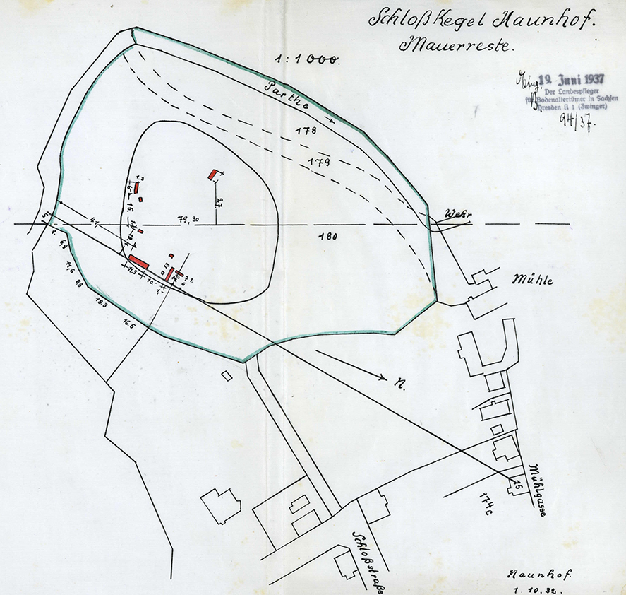
The actual size of the mound can be determined from a plan that must have been drawn up on behalf of the gymnastics club by early October 1932. For a motte, the diameter of the “castle cone”—approximately 60–80 meters—would have been far too large. Furthermore, remnants of walls are marked in several places; these indicate not just a single building but a walled complex—in other words, a “courtyard” or “curia”—and are still present in the ground today. The enormous quantities of stone also point in this direction. Ultimately, however, it remains unclear exactly where the older, presumably much smaller moated castle—the core of the stately center—is located.
Michael StrobelImage Source Ortsakte 42670, 82 ©LfA 1937
Opening Ceremony Under Swastika Flags
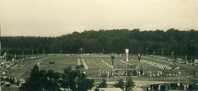
When the sports field of the gymnastics club—which had by then been brought into line with the “German Reich Federation for Physical Exercise”—was officially opened on July 22, 1934, nothing remained of the “Old Castle.” Nevertheless, in January 1937, the state conservator had good reasons to apply to the Leipzig District Administration for the remains still buried in the ground to be entered on the State Monument List B.
Michael StrobelImage Source SV Naunhof 1920 e.V. (Hrsg.), Geschichten über 100 Jahre Fussball in Naunhof (Leipzig 2020) 30.
Inclusion on the List of Historic Landmarks
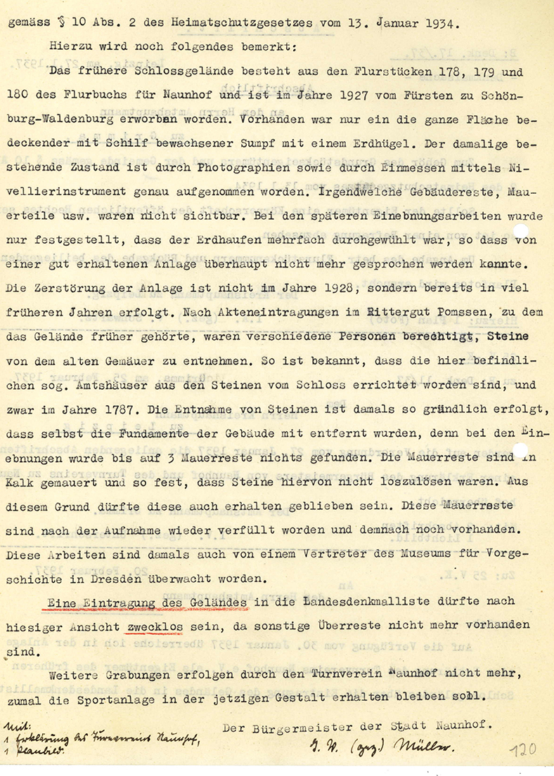
The subsequent hearing with the municipality and the gymnastics club failed to convince either the archaeologists or the legal experts from the higher and highest-level historic preservation authorities, and serves as a prime example of why, even back then, when property owners were involved, all sorts of special interests were at play, rather than professional grounds, were cited to cast doubt on the site’s status as a historic monument. However, the new information obtained during the hearing process was useful to the state heritage officer in that he learned that the “Old Castle” had served as a quarry until the 18th century and that remnants of walls had been left in the ground during the excavation work. This refuted the widely repeated claim that listing was unnecessary because no remains were left in the ground. Nor, of course, had it been forgotten that in June 1928, the state archaeologist’s representative had visited the construction site only once.
Michael StrobelImage Source Ortsakte 42670, 120 ©LfA 1937
Gymnastics Club in Conflict
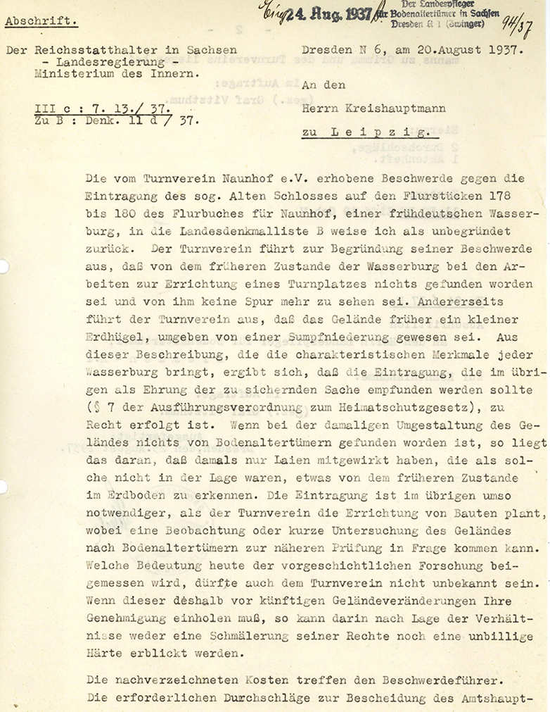
After the district administration finally ordered the listing in May 1937, the “association leader” filed an “objection” with the Saxon Ministry of the Interior at the end of July. In the list of reasons why the designation as a historic monument constituted a restriction on the owners’ rights and was therefore unreasonable, he did not fail to mention the “great sacrifices” made by the association’s members, the “magnificent location of the site,” or the presence of Gauleiter and Reich Governor Martin Mutschmann at the BDM sports festival in the summer of 1936. Nevertheless, the Supreme Authority for the Protection of Historical Monuments agreed with the state heritage officer’s reasoning and rejected the “complaint” in its entirety at the end of August. The registration and future requirement for approval of changes to the monument were in the “public interest” and could not be considered “undue hardship.” The complainant was also required to bear the costs of the proceedings.
Michael StrobelImage Source Ortsakte 42670, 110 ©LfA 1937
The “Old Castle” Is Becoming Visible Again
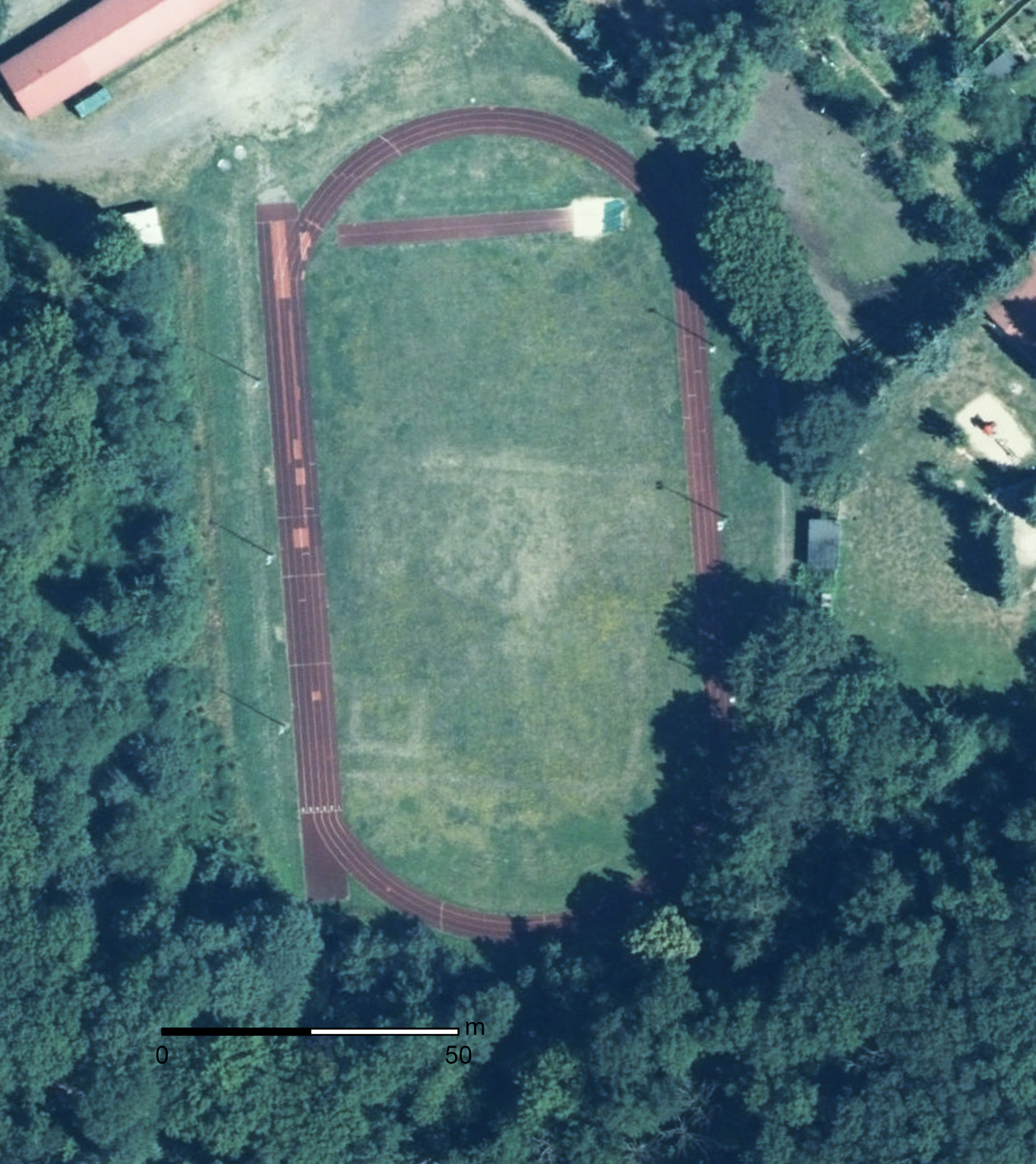
What the state conservation officer would have done if, for example, changing rooms had been built in the area of the historic monument is another matter entirely. Fortunately, no further extensive excavation work has taken place to date. Since the grass field is no longer used or maintained for soccer games, the wall structures of the “curia” are even clearly visible in aerial photographs: On the one hand, an almost square enclosure in the southern half; on the other, the square floor plan of a stone building in the far southwest, which is presumably the foundation of a tower. The remains left in the ground are better protected beneath the sports field than they would be on farmland. However, should construction ever take place on the site again, pre-construction excavations would be unavoidable.
Michael StrobelImage Source DOP 2023 ©GeoSN
Literature
Rudolf Irmscher, Urgeschichte als Unterrichtsfach in der Volksschule. In: Walter Frenzel/Werner Radig/Otto Reche (Hrsg.), Grundriß der Vorgeschichte Sachsens (Leipzig 1934) 369-372.
SV Naunhof 1920 e.V. (Hrsg.), Geschichten über 100 Jahre Fussball in Naunhof. Der Verein aus dem Cladewald (Leipzig 2020).
Note on monument protection
Archaeological monuments are protected by the Saxon Monument Protection Act. A permit under monument law is required for ground interventions or construction measures.
Permalink
https://archaeo-sn.de/en/ort/der-schlossturnplatz-leibesuebungen-ueber-einer-mittelalterlichen-curia/
Citation
Michael Strobel, The “Schloßturnplatz” – Physical Exercise Above a Medieval “Curia”. In: Landesamt für Archäologie Sachsen, Website archaeo | SN (01.12.2025). https://archaeo-sn.de/en/ort/der-schlossturnplatz-leibesuebungen-ueber-einer-mittelalterlichen-curia/ (Stand: 29.09.2026)
