

A Bronze Age fortification on the Bosel
| Place: | Sörnewitz (Coswig, Meissen) |
|---|---|
| Type: | Defensive Structures/Fortifications |
| Dating: | Early Bronze Age / Lusatian Culture | 1200–800 B.C. |
Description
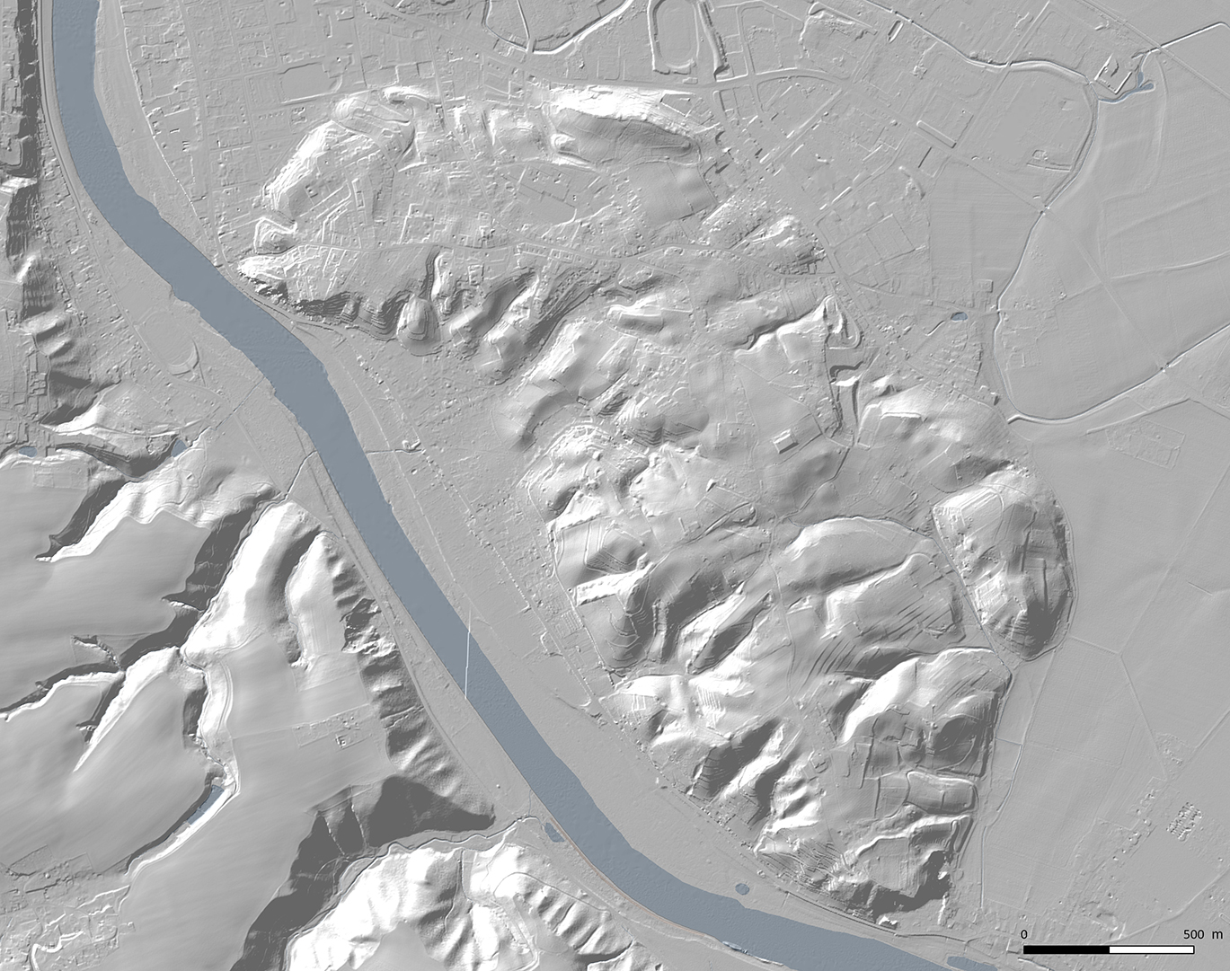
At the southern, spur-like end of the “Spaar Mountains”“, the “Boselspitze”“ There is a Bronze Age rampart. The "Spaar Mountains"“ Between Sörnewitz in the southeast (City of Coswig) and Nieder-Spaar (City of Meissen) in the northwest lies the “smallest mountain range”“ It is known as the Saxony Massif and is part of the Meissen syenite-granite massif.
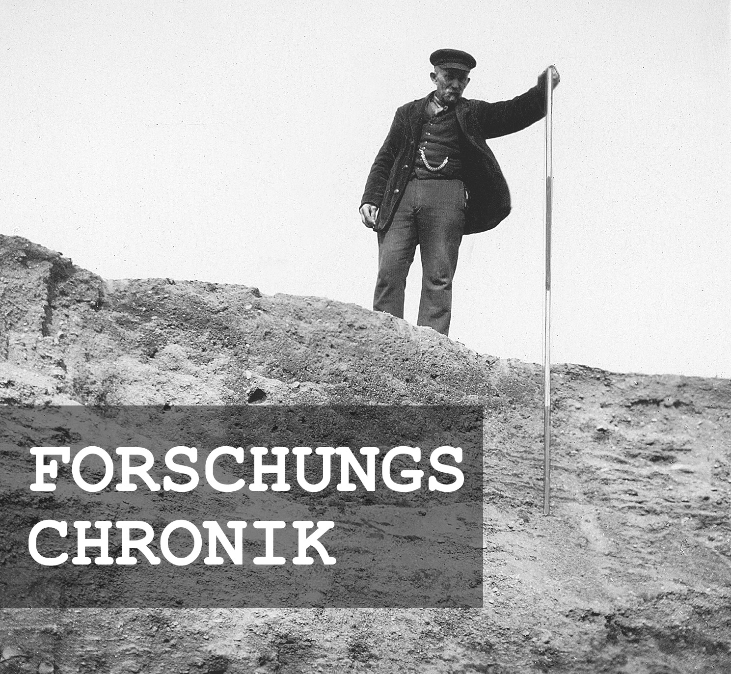
Michael StrobelResearch Chronicle
1844 | An Overlooked Bronze Age Fortification.
1872 | First report of a rampart approximately 130 m long.
1878 | The rampart is described in detail for the first time and correctly dated.
1908 | Land acquired by the Saxon Heritage Association.
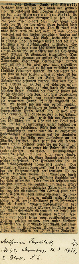
March–April 1933 | Excavations commissioned by the Meissen City Museum.
March 13, 1933 | State archaeologist Georg Bierbaum learns of the investigations from the press.
March 16, 1933 | Walter Kersten (1907–1944) inspects the excavation.
April 20–24, 1933 | Kersten documents the rampart profile.
May 1934 | Aftermath for a Social Democratic city archivist.
June 11, 1938 | Late entry into the List of Historic Monuments B (“Archaeological Sites”).
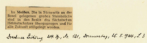
through 1944 | Further land acquisitions and closure of the quarries.
Since 1955 | Reforestation of the interior area.
1992–2018 | Further land acquisitions by the Landesverein Sächsischer Heimatschutz (Saxon Heritage Association).
Since 2018 | Forest restructuring adapted to climate and site conditions.
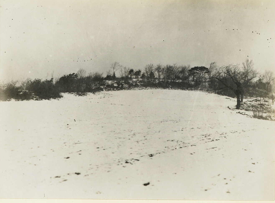
Image Source Foto ©LfA 1929.
"Saxony's smallest mountain range"
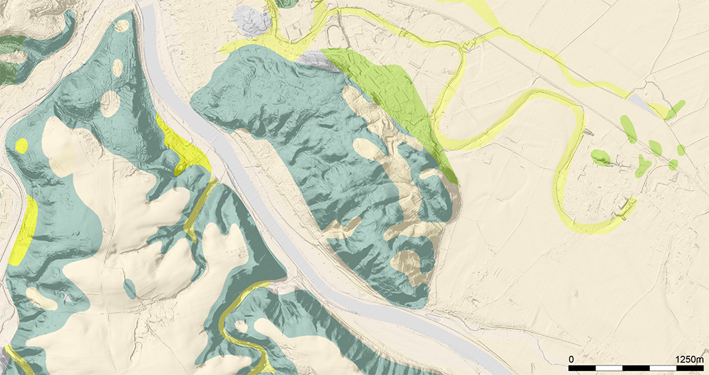
The biotite granodiorite ridge owes its formation to an Early Pleistocene breakthrough of the Elbe River, which separated this part of the Meissen Massif from the area on the left bank of the Elbe. Today, the Elbe flows through a narrow valley deeply carved into the rocky bedrock, bordered on both sides by steep slopes.
Michael StrobelImage Source DGM und GK50 Eiszeit ©GeoSN/LfULG.
An island between river branches
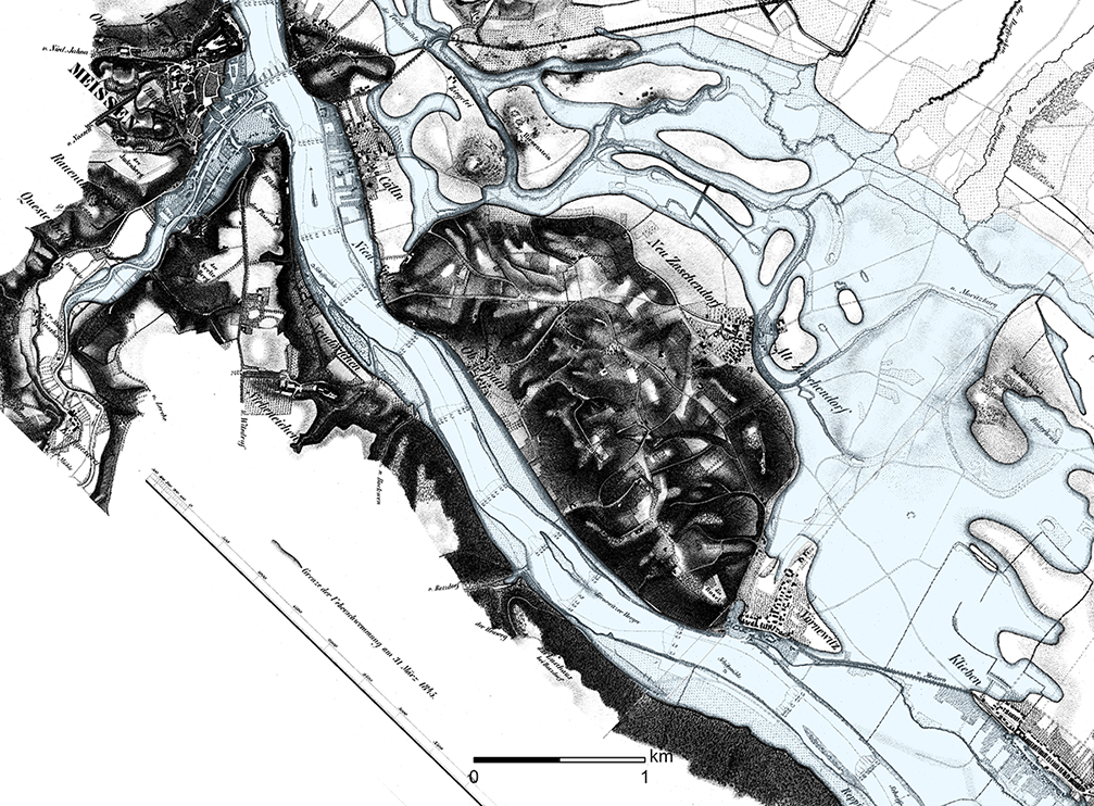
During exceptional flood events, however, the river also reclaimed the lowlands east of the “Spaargebirge,” which—not coincidentally—are called “Nassau,” meaning “wet floodplain.” In the spring of 1845, the Elbe once again poured into its old flood channels and flooded large parts of the Nassau, from which only a few flood-free islands—and, highest of all, the “Spaargebirge”—protruded. Widespread floodplain loam deposits indicate that, well into the Holocene, the Elbe must have repeatedly flowed eastward past the “mountain range.”
Michael StrobelImage Source Karte der Elbe mit dem Hochwasser 1845, Lithographie ©LfA/SLUB 2025.
A throne above brown waters
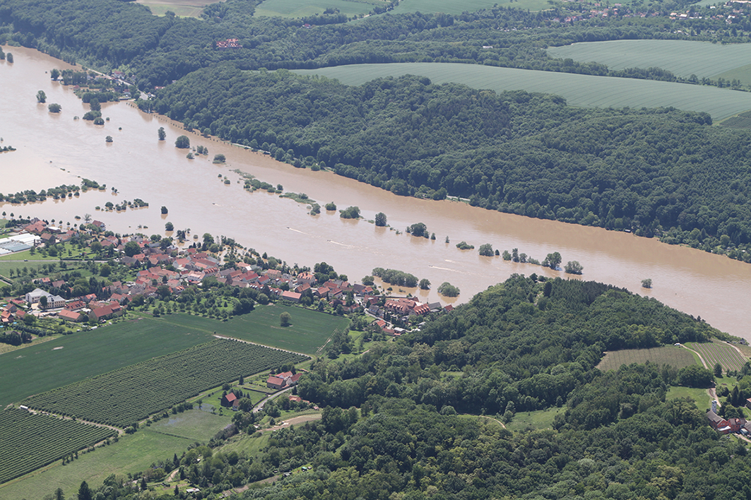
When the Elbe once again burst its banks on a massive scale in the spring of 2013, the flood protection measures implemented since 2002 prevented the worst from happening. At least the brown floodwaters no longer poured into the plain between Niederau and Sörnewitz. Otherwise, the Spaar Mountains would have been cut off by the water, just as they were in 1845.
Michael StrobelImage Source R. Heynowski, Foto ©LfA 2013.
Dynamic Relief
The plateau of the Spaar Mountains consists of numerous hills, ridges, and valleys through which water flows only occasionally, especially during heavy rain. Heat-loving vegetation has established itself in shallow, dry areas. The peripheral areas, furrowed by V-shaped valleys, are in turn divided into many spur-like outcrops that are naturally sheltered on three sides, some of which would have been suitable for building fortifications.
Michael StrobelImage Source DGM und WebAtlasSN, farbig ©LfA/GeoSN.
In a commanding position
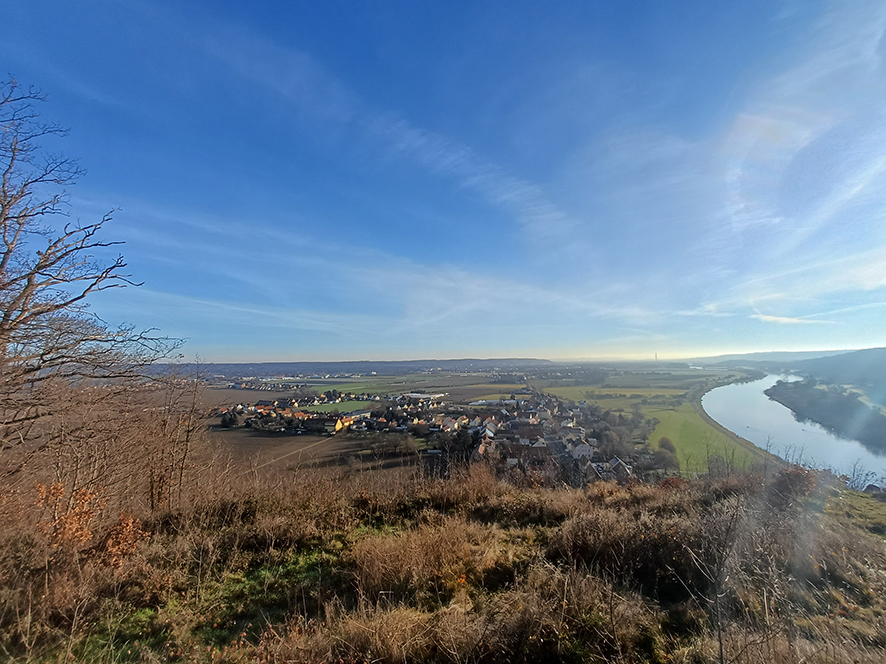
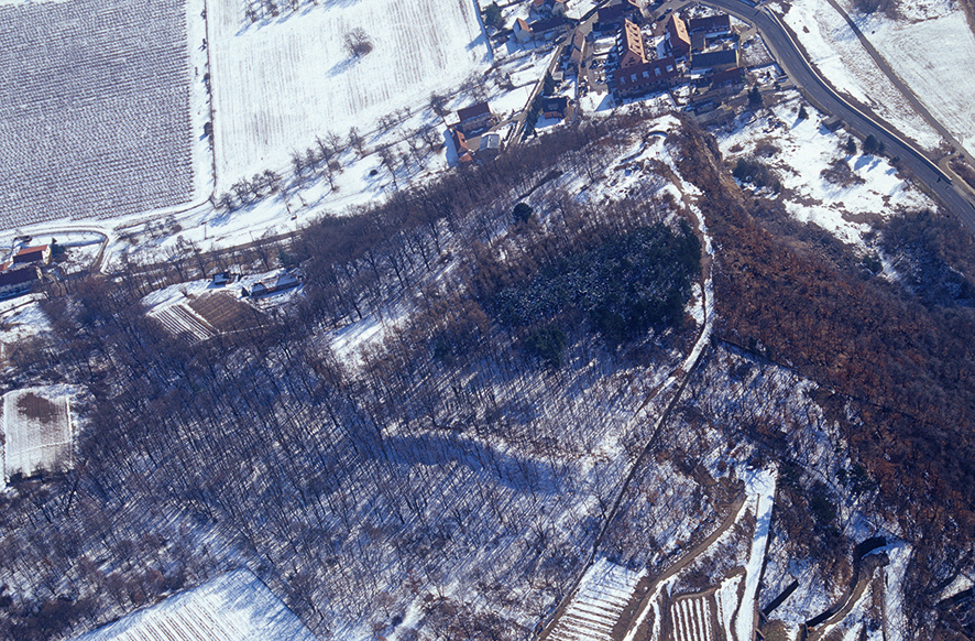
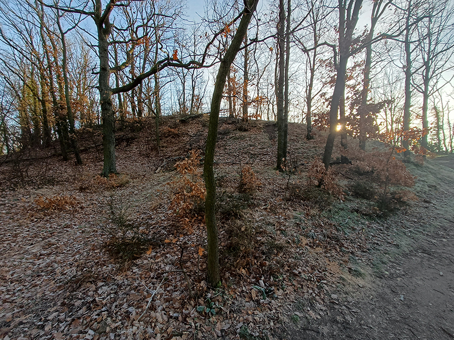
However, no other feature towers over its surroundings as dominantly as the “Boselspitze,” which offers a sweeping view of the Dresden Elbe Valley as far as Saxon Switzerland. At the same time, the fortification dominates the southeastern entrance to the Elbe Gorge toward Meissen and thus an area that was densely populated during the Bronze Age.
Michael StrobelImage Source M. Strobel, Foto ©LfA 2025.
Different Levels of Preservation
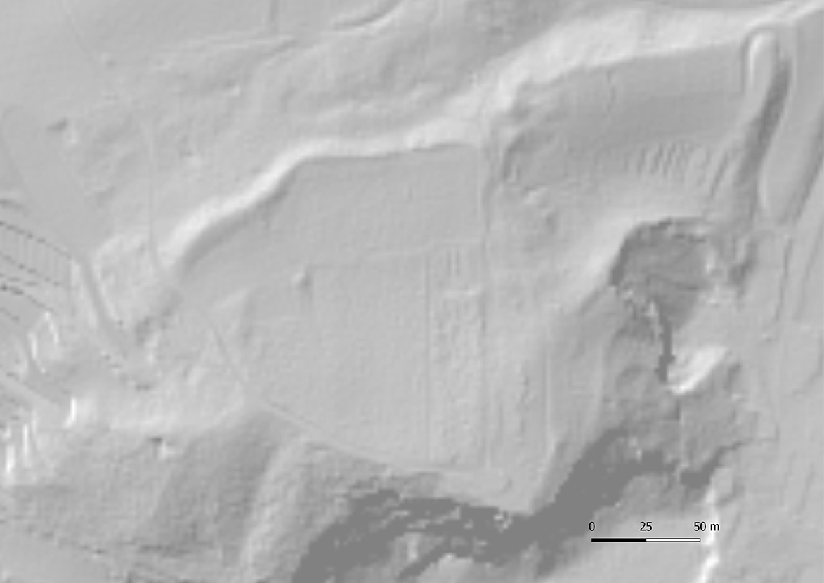
The slightly curved interior area, sealed off to the north by a section of rampart, covers approximately 2 ha—large enough to accommodate denser development and several hundred people. The defensive line, approximately 160 m long in total, runs from the rocky, steep slope on the Elbe side in the southwest across the plateau to a valley cut in the east. The rampart, which is up to 5 m high, transitions after 80 m—and a slight bend in its eastern half—into a terraced area with a gently sloping inner embankment and a vineyard wall built on top of it. Only the final remnants of the structure are expected to remain here. In the northeast corner, this step—which curves toward the south-southeast—even gives the deceptive impression of a gateway. It is surprising that this impressive monument was overlooked for so long.
Michael StrobelImage Source DGM ©LfA/GeoSN.
The Unappreciated Wall
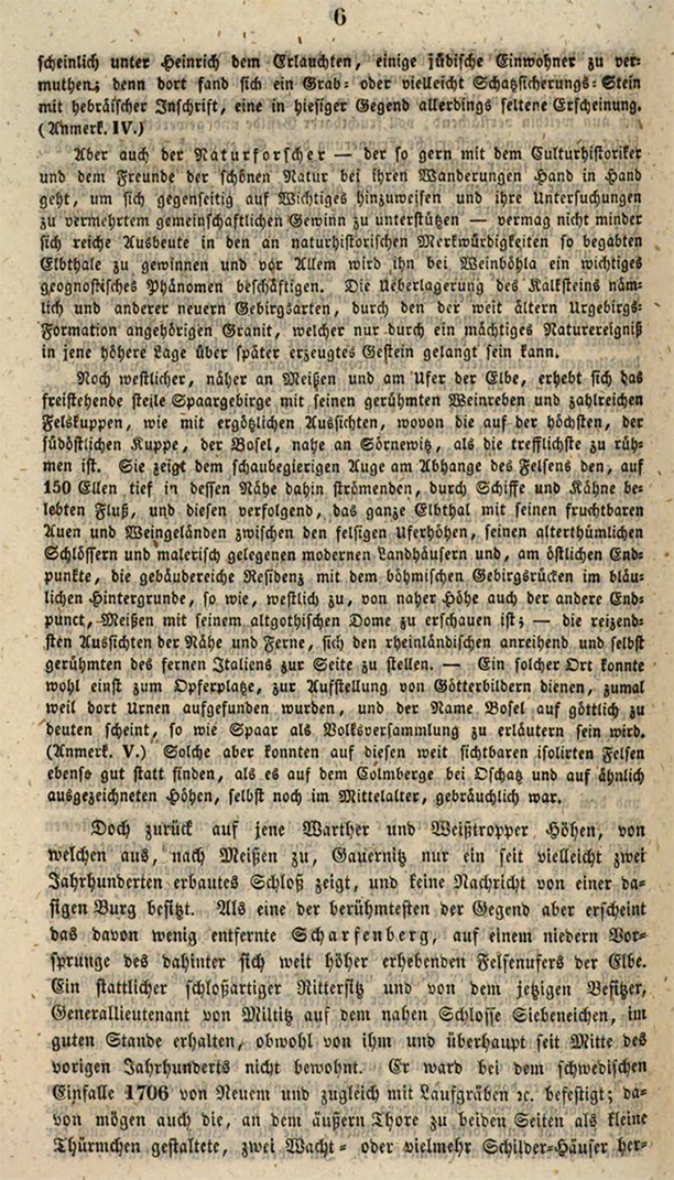
The grand master of Saxon archaeology, Karl Benjamin Preusker (1786–1871), does indeed praise the “delightful views” of the “entire Elbe Valley,” which he compares to those of the “Rhineland” and indeed “even the much-vaunted distant Italy,” he does not say a word about the rampart. Since urns had been found on the Bosel and the name alone seemed “to suggest a divine origin,” such a place might “once have served as a sacrificial site or a place for the display of statues of gods.”
Michael StrobelImage Source Preusker 1844, 6.
Early Descriptions
It was not until 1872 that the porcelain painter Ernst Fischer (1818–1886) reported at a meeting of the Dresden Natural Science Society ISIS on a rampart approximately 130 m long in the “Poselgebirge,” and then, six years later, in the context of a systematic compilation of prehistoric and medieval hilltop settlements in the region, he discussed the “Langwall” in greater detail, noting that it was “constructed from stones and earth on the upper side” and contained “entire charred tree trunks” on the “inner side.” “The entire plateau” was “littered with shards of the oldest kind after each plowing.” In 1882, Fischer finally distinguished between stone, burnt, earth, and rubble ramparts. He also classified the structure on the Bosel as the latter. It is therefore all the more surprising that, until 1940, the fortification continued to be referred to—against better judgment—either as a Slavic sanctuary or a “late Slavic border fortress rampart,” even though not a single shard dating to that period had been found.
Michael StrobelImage Source R. Heynowski, Foto ©LfA 2006.
The Cultural Landscape Is Changing
While deciduous trees had likely been growing on the rampart for a long time, the inner area was used for growing grain and potatoes well into the postwar period. The inner slope of the rampart in particular is thought to have suffered greatly as a result. It was not until the 1950s that this marginally productive land lost its agricultural significance, and after 1955 it was reforested with pine and larch, among other species.
Michael StrobelImage Source OA 59130, 55 ©LfA 1929.
Excavations commissioned by the Meissen City Museum
Whatever may have prompted Helmuth Gröger (1890–1957), the Meissen city archivist and director of the Museum of Local History, to conduct an excavation on the Bosel in the spring of 1933, was likely primarily the desire to obtain significant artifacts for the museum’s reorganization and re-display, and to utilize for this purpose the job creation programs that had been established since 1931 by the Reich Institute for Employment Placement and Unemployment Insurance for young unemployed people. The young men assigned to the excavation at Bosel came from a camp of the Volunteer Labor Service (FAD), which was run by the Young German Order. Founded in 1920, this organization was one of the many offshoots in the broad spectrum of paramilitary, nationalist, and even ultra-nationalist associations of the Weimar Republic, with an anti-Semitic and anti-Bolshevik agenda, though not explicitly anti-constitutional. It was banned and dissolved in 1933 following the National Socialists’ rise to power.
Michael StrobelImage Source ©Stadtmuseum Meißen.
An amateurish approach
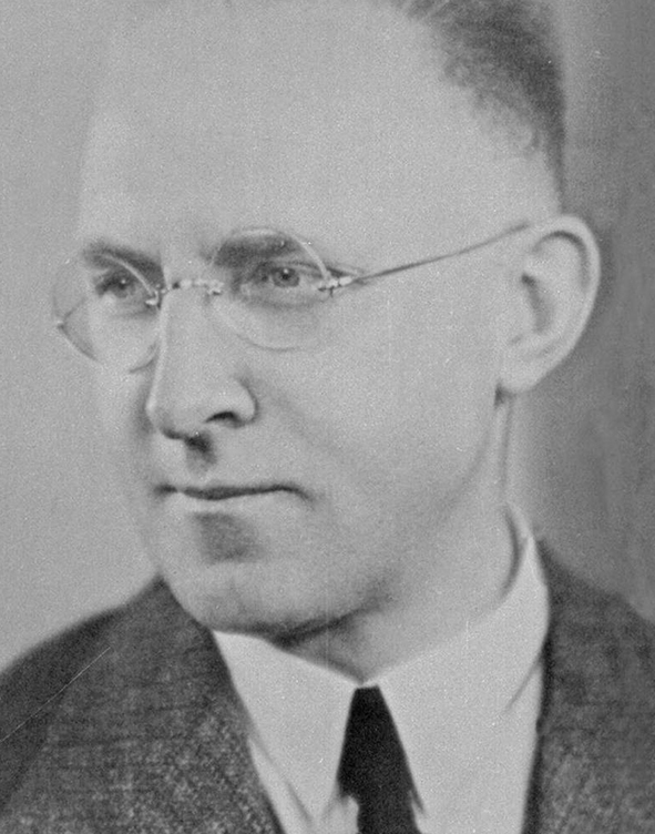
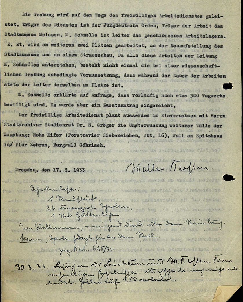
Georg Bierbaum (1889–1953), director of the Archive of Prehistoric Finds from Saxony, learned of the improper examinations from the press. On March 16, 1933, he immediately sent his young research assistant, Walter Kersten (1907–1944) to the Bosel; Kersten must have been appalled by the amateurish methods and the superficially dug trenches and holes, but he did not wish to deny that the completely overwhelmed excavation director, Martin Schnelle, had shown a certain degree of care and good will.
Michael StrobelImage Source OA 59130, 59 ©LfA 1933.
A Paralyzed Heritage Preservation System
The student was not a professional archaeologist. He promised to correct the deficiencies and widen the trench sections, which were only 60 cm wide. Legally speaking, Kersten and his boss’s hands were tied anyway. Without a historic preservation law and financial resources, the two could neither bring about a halt to the excavation nor take over the investigation themselves. In fact, staff members of the Museum of Mineralogy, Geology, and Prehistory had even been prohibited from going on business trips since the summer of 1932.
Michael StrobelImage Source OA 59130, 64 ©LfA 1933.
Archaeology and Job Creation Programs
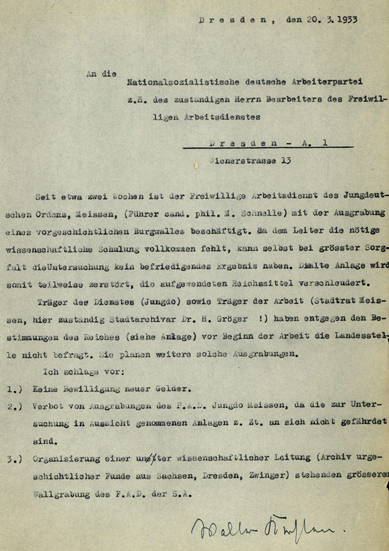
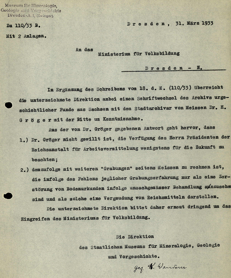
The museum director, curator, and research assistant could therefore do no more than intervene at various levels and point out that Gröger had violated a provision of the Reich Ministry of Labor that made the use of the FAD at excavation sites contingent upon the involvement of the competent state authority. While Bierbaum informed the city archivist of his failure to act and Museum Director Eberhard Rimann (1882–1944) appealed to the higher-level Ministry of Public Education, Kersten, a long-time NSDAP member (since 1931), who was also the Gau Leadership’s case officer for prehistory, urged his party colleague in charge of the FAD to prevent any further excavations by the City Museum or the Young German Order—and thus any future waste of Reich funds.
Michael StrobelImage Source OA 59130, 69 ©LfA 1933.
The Employment Service Steps In
However, since the city archivist had indicated his intention to disregard the labor administration’s directive and expand the excavations to include additional fortifications (Hohe Eifer, Zehrener Burgberg, Göhrisch), the museum administration once again contacted the ministry, pointing out that valuable archaeological evidence would be destroyed by the improper excavations and that Reich funds would be needlessly squandered. Consequently, the Meissen Employment Office was instructed by the Saxony District Commission for the FAD to make continued funding of the excavations after April 29, 1933, contingent upon the approval and supervision of the Archive of Prehistoric Finds. The excavations on the Hohe Eifer above the Triebisch Valley—which apparently also began in April and for which no documentation exists at all—were in fact not halted until after this intervention by the State Labor Office.
Michael StrobelImage Source OA 59130, 72 ©LfA 1933.
Profile Documentation
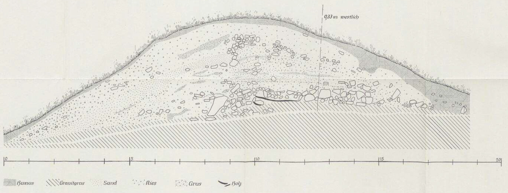
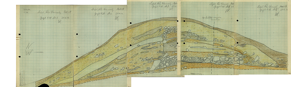
Upon completion of the excavation work at Bosel, Kersten was finally able to produce a drawing and description—at least of the eastern profile—of a wall section that had been widened to 1.5 m and excavated down to the natural soil. To this end, he had joined the FAD camp from April 20–24, 1933. Since no survey plans have survived, the exact location of the section remains unknown. The defensive wall, built directly on the gravel or rock fill, likely had a vertical outer face composed of horizontally layered wooden beams, perhaps also layers of stone and vertical posts with large blocks at the base, which was supported from the outside by a sloping embankment of stone and earth. The base of the rampart, approximately 6 m wide and up to 1 m high, consisted of stone blocks with embedded horizontal crossbeams, which were presumably integrated into the outer face. Above this were layers of gravel, sand, and boulders. Toward the interior of the castle, these embankments are said to have been sloped like a ramp.
Michael StrobelImage Source Coblenz 1962, Abb. 8.
Alternative Interpretation
However, Kersten’s original drawing also allows for an alternative interpretation of the interior: blocks laid in layers and a 2-meter-wide stone filling could very well indicate a vertical interior face. Diagonally sloping, possibly fallen blocks at the base of the embankment also point in this direction. Furthermore, another layer of stone packing in the upper half of the rampart, near the outer face, may be linked to a raising of the defensive wall—which may initially have been a double-shell structure after all—and thus to a multi-phase construction process. Ultimately, however, many details of the rampart’s construction remain unclear.
Michael StrobelImage Source OA 59130, 110-114 ©LfA 1933.
Consequences of an Improper Excavation
Since no artifacts were recovered from the rampart itself, there is no evidence to suggest that earthen material from an existing settlement was used in its construction. The fortification was therefore not built to retroactively fortify an open, older settlement. The artifacts date to the Early Bronze Age. Thus, the amateur excavation had at least yielded initial insights into the rampart’s construction and the chronology of the fortification on the Bosel.
Michael StrobelImage Source M. Strobel, Foto ©LfA 2025.
Aftermath
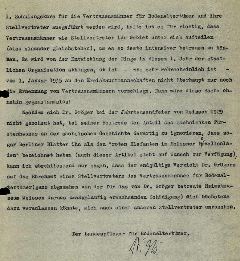
A year later, in January 1934, after Saxony’s “Heimatschutzgesetz” (Law for the Protection of the Homeland) had been enacted and Curator Bierbaum had been appointed honorary State Conservator, nothing stood in the way of a reorganization of archaeological heritage preservation in Nazi Saxony. The appointment of the honorary “trustees for archaeological antiquities,” upon the recommendation of the State Curator, was the responsibility of the district administrations, as were the entries in the list of historic monuments. As much as the experiences of the previous year may have spoken against the appointment of the Meissen City Archivist in May 1934, Bierbaum need not have recalled in his explanatory letter that the Social Democrat, in his 1929 commemorative speech marking the city’s 1,000thanniversary of the city, had “ignored the role of the Saxon royal house in Saxon history to such an extent” that “even Berlin newspapers had described him as ‘the red elephant in the Meissen porcelain shop.’” Gröger himself appears to have ultimately declined the honorary position of deputy union representative.
Michael StrobelImage Source OA 59130, 89 ©LfA 1934.
Inclusion on the List of Historic Landmarks
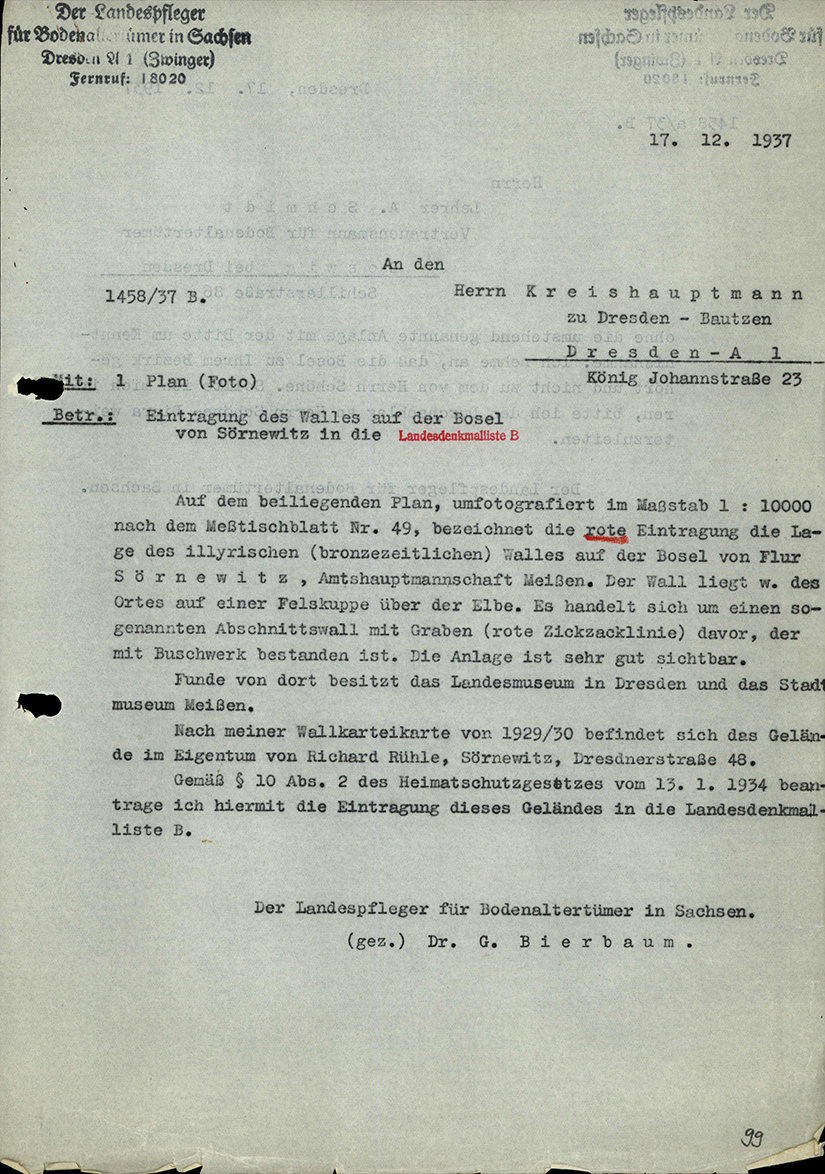
Surprisingly, the State Conservator took a long time—namely, until December 1937—to apply for the fortification on the Bosel to be entered into List B (“Archaeological Monuments”), a process that was not completed until the summer of 1938. Even though the Saxon Heritage Association had acquired a plot of land at the edge of the quarry and had a botanical garden laid out there as early as 1908, the year of its founding, stone quarrying nevertheless continued.
Michael StrobelImage Source OA 59130, 99 ©LfA 1937.
Quarry Closure
If plans to move the edge of the quarry and the lookout point back had actually been carried out, Bierbaum would once again have had to choose between confronting the operator or conducting an emergency excavation. It was only after the Landesverein acquired additional land and the quarries were shut down in 1943–44 that he was relieved of these concerns.
Michael StrobelImage Source OA 59130, 109 ©LfA 1944.
Another Land Acquisition
It is a great stroke of luck that the state association, which was expropriated in 1948, was able to reacquire the entire area of the fortifications between 1992 and 2018 and initiate forest restoration measures adapted to the climate and site conditions. These measures also serve to protect the archaeological site.
Michael StrobelImage Source M. Strobel, Foto ©LfA 2025.
Literature
Werner Coblenz, Der Wall auf der Deutschen Bosel bei Sörnewitz. Arbeits- und Forschungsberichte zur Sächsischen Bodendenkmalpflege 10, 1962, 153-164.
Ernst Fischer, Ueber einige Heidenwälle, Feuerstationen und Fundorte der Dresdner Umgebung. Sitzungsberichte und Abhandlungen der Naturwissenschaftlichen Gesellschaft ISIS e. V. Dresden 1878, 15-26.
Steffen Förster, Artikel: Helmuth Gröger, In: Sächsische Biografie, hrsg. vom Institut für Sächsische Geschichte und Volkskunde, https://saebi.isgv.de/biografie/24975 [Zugriff 12.12.2025].
Stefan Koch/Michael Strobel, Nahe am Wasser gebaut. Bronzezeitliche Siedlungen im Überschwemmungsgebiet der Elbe bei Radebeul. Archaeo 5, 2008, 22-25.
Helga Petzold/Barbara Ditsch, 100 Jahre Pflanzengarten auf der Bosel. Mitteilungen Landesverein Sächsischer Heimatschutz 1/2010, 31-34.
Karl Benjamin Preusker, Blicke in die vaterländische Vorzeit. Drittes Bändchen (Leipzig 1844).
Peter A. Schmidt, Die Bosel – ein Kleinod mit wertvoller Naturausstattung und Zeugen des Wandels der Landnutzung im wärmegetönten Elbtal. Mitteilungen Landesverein Sächsischer Heimatschutz 1/2020, 15-32.
Note on monument protection
Archaeological monuments are protected by the Saxon Monument Protection Act. A permit under monument law is required for ground interventions or construction measures.
Permalink
https://archaeo-sn.de/en/ort/eine-bronzezeitliche-befestigung-auf-der-bosel/
Citation
Michael Strobel, A Bronze Age fortification on the Bosel. In: Landesamt für Archäologie Sachsen, Website archaeo | SN (18.12.2025). https://archaeo-sn.de/en/ort/eine-bronzezeitliche-befestigung-auf-der-bosel/ (Stand: 29.09.2026)
