

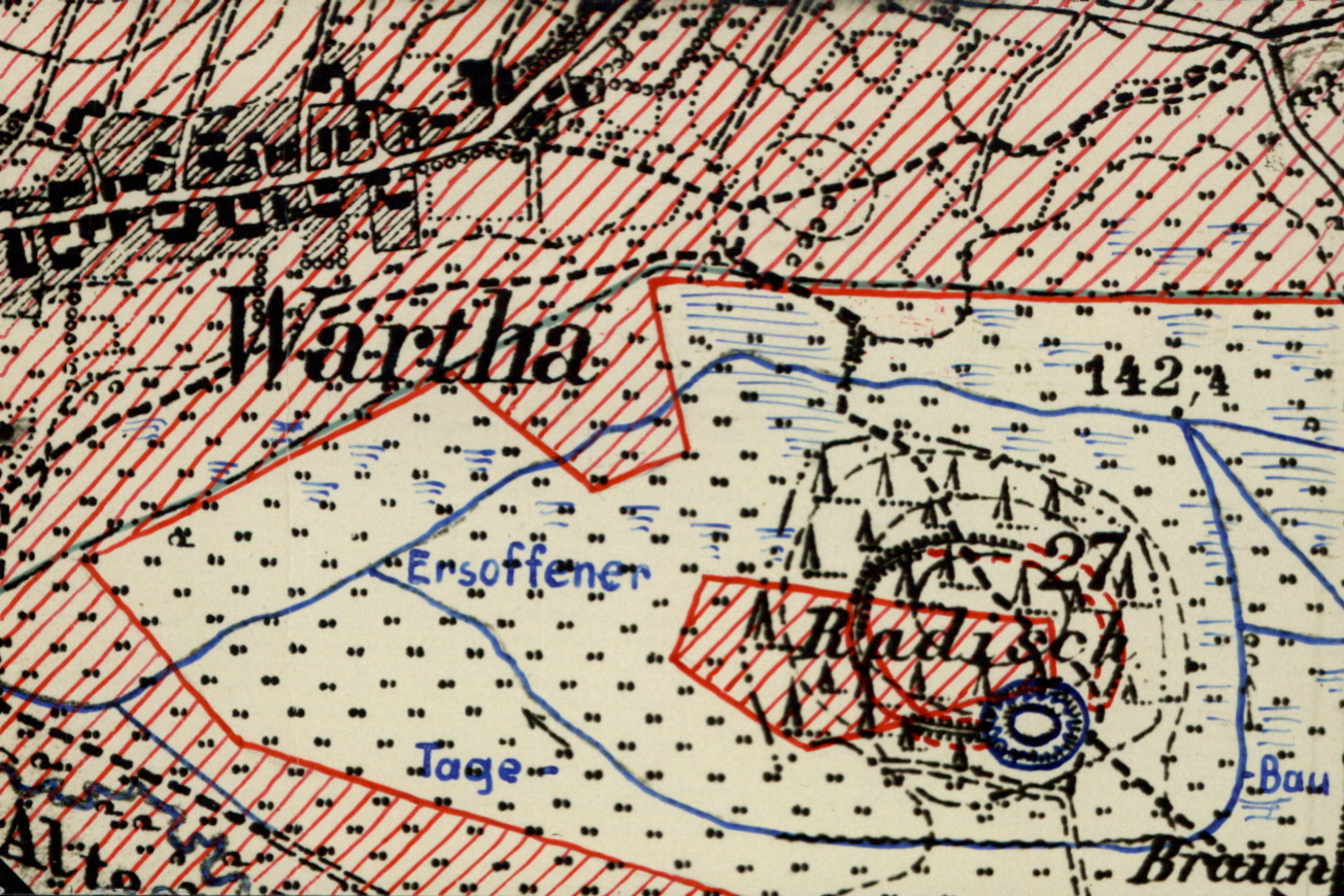
Radisch Castle in Lake Olba
| Place: | Kleinsaubernitz (Malschwitz, Bautzen) |
|---|---|
| Type: | Fortified complex | tower mound castle |
| Dating: | Lusatian culture | Billendorf culture | 1200 - 1000 | 700 - 600 B.C. | ca. 1300 A.D. |
Description
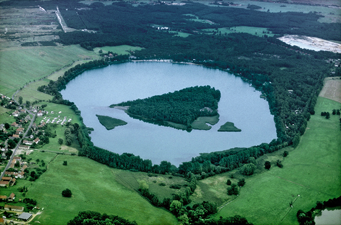
Radisch Castle is located on an island in Lake Olba in the Upper Lusatian heath and pond region north-east of Bautzen near Kleinsaubernitz (Zubornička). The small medieval lowland castle was built into the still high rampart of a much older fortification from the early Iron Age. Towards the end of the 19th century. Century and at the beginning of the 20. The first archaeological investigations of the rampart took place at the end of the 19th century. The structure of the rampart and the finds indicated the construction of the Billendorf culture of the early pre-Roman Iron Age (700-600 BCE). Chr.) to. Even before that, an unfortified settlement from the Late Bronze Age (1200-1000 BC. Chr.) were there. In the Middle Ages, an oval lowland castle was built on the southern edge of the prehistoric site on the former marshland island. Around the time of the First World War, lignite was mined on the site in open-cast mining, which largely destroyed the Iron Age ramparts. Lake Olba, which has become a popular local recreation destination, was created from the later flooded area. Only a few remains of the prehistoric complex are still preserved today, but it is not allowed to enter due to the danger of slipping.
Annemarie ReckResearch history
The rampart is already recorded on the Saxon mileage sheet. However, it was not until the middle of the 19th century that the Radisch was also recognized as an archaeological structure. In 1893, the rampart was first mentioned in a meeting report of the ISIS natural research society, which carried out the first archaeological excavations at the beginning of the 20th century together with the Bautzen Society for Anthropology and Prehistory and the state curator Johannes Deichmüller. In 1903, Richard Needon reported for the first time on the results of the excavations, which were continued in the following years. From 1911 to the 1920s, an estimated 3400 square meters were investigated. At the same time, open-cast mining began around the time of the First World War, as lignite was found at shallow depths in the immediate vicinity. In 1927, a fire broke out in the open-cast lignite mine and the area had to be flooded, resulting in Lake Olba. However, this also led to the extensive destruction of the prehistoric site. In addition, most of the finds and the excavation documentation were lost during the Second World War.
Annemarie ReckImage Source O. Braasch, Foto Olbasee ©LfA 1994.
Bronze Age settlement and rampart
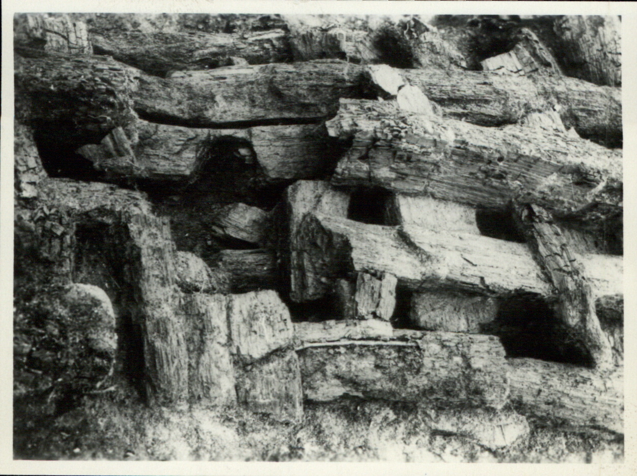
During the Iron Age, the island, consisting of valley sands, was located in the middle of an extensive marshland, which was due to the high water level. The island covered an area of approx. 250 x 200 meters. During the Late Bronze Age, the first open settlement of approx. 2.4 hectares was established there. It was not until the 7th century BC that the islanders began to fortify their settlement with a wooden wall measuring 196 x 162 meters. A layer of gravel up to 60 cm deep has been found on some sections of the wall, which probably served as the foundation for the planned wall construction. In others, a stone pavement stabilized the ground. In some places, however, it was based directly on the gravelly alluvial sand of the natural soil. The rampart fortification itself consisted of a mound of earth stabilized by oak trunks up to 40 cm thick, laid crosswise and stacked like rust.
Annemarie ReckImage Source OA 14990, 179, Foto ©LfA 1910.
Iron Age settlement
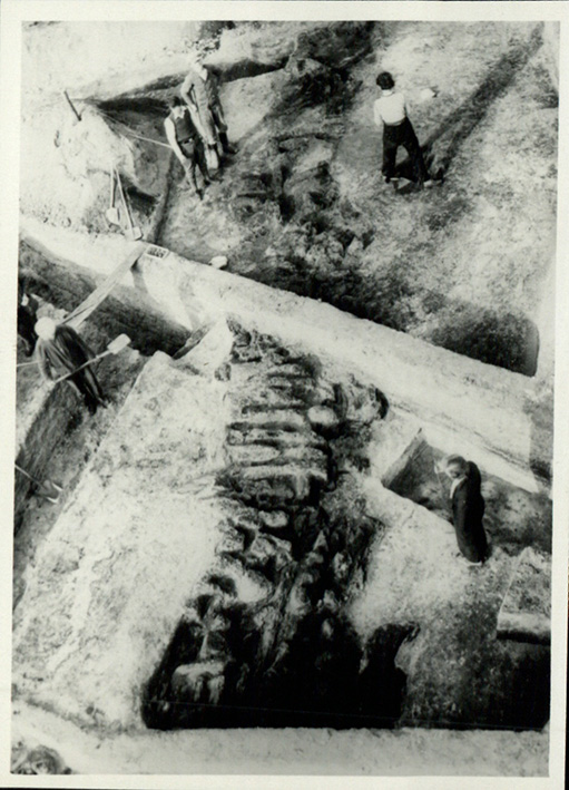
The inner area was still 1.8 ha and was densely built up with rectangular houses arranged in dense rows. It is estimated that the settlement had room for around 400-600 people. During the excavations, hundreds of adjoining features of pits, rows of posts and hearths were examined, testifying to a very dense settlement. The sites of Biehla and Biskupin in Poland are comparable. The sherds can be assigned to the Iron Age Billendorf culture. Between the settlement features, the excavators came across several cremation burials, including the grave of an infant, which can be assigned to the 10th to 9th century BC. The burial sites of the Lusatian culture are usually located further away from the settlements. In fact, there is an Early Iron Age burial ground on the Lorenzberg about 1 km south of Lake Olba, which is probably connected to the settlement.
Annemarie ReckImage Source OA 14990, 308, Foto ©LfA 1910.
Finds and interpretation
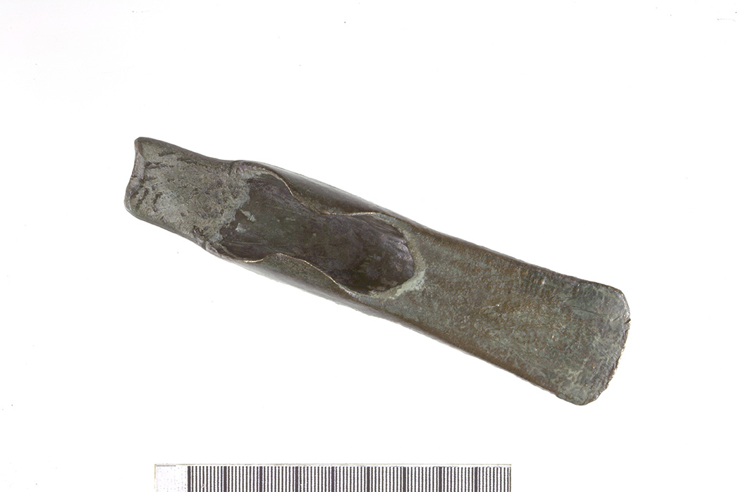
Weaving weights and pottery remains were found, indicating various domestic activities. According to Friederike Koch-Heinrichs, round "clay lumps" were probably related to local pottery production. Stone casting molds as well as bronze ingots and lumps of molten metal indicate the existence of foundry workshops and metal processing on site. Furthermore, a sickle, a flap axe, bronze needles and neck rings belong to the Late Bronze Age to Early Iron Age find spectrum. Also noteworthy is the large number of over 50 millstones, which, despite the settlement's hidden location in the swamp, suggest that it played a not insignificant role as a grain handling site. Koch-Heinrichs suspects that the densely populated and well-fortified site could have been a territorial seat and retreat within the Upper Lusatian settlement structure. Overpopulation, climate deterioration and increasing threats from outside probably ultimately led to the abandonment of the castle complex around 550 BC. A Germanic crossbow brooch made of bronze only indicates a selective visit to the valley sand island in the 3rd century AD.
Annemarie ReckImage Source U. Wohmann, Foto ©LfA 2013.
Radisch Castle
In the late Middle Ages, the remaining remains of the prehistoric fortifications were reused to protect a lowland castle in the swamp, Radisch Castle. Around the time of the First World War, lignite was mined on the site in open-cast mining, which largely destroyed the Iron Age ramparts. Today, the Olba Lake is located in the residual open-cast mining hole. The illustration shows a sketch from 1973, on which today's island and the former sand island with the rampart and the castle complex can be seen.
Annemarie ReckImage Source OA 14990, 291, Skizze ©LfA 1973.
Literature
Friedericke Koch-Heinrichs, Der „Radisch“ von Kleinsaubernitz. Zwischen Großer Röder und Kleiner Spree 11, 2021, 102–103.
Heinz-Joachim Vogt, Der Radisch von Kleinsaubernitz. Arbeits- und Forschungsberichte zur sächsischen Bodendenkmalpflege 10, 1962, 21–68.
Note on monument protection
Archaeological monuments are protected by the Saxon Monument Protection Act. A permit under monument law is required for ground interventions or construction measures.
Permalink
https://archaeo-sn.de/en/ort/radisch-castle-in-lake-olba/
Citation
Annemarie Reck, Radisch Castle in Lake Olba. In: Landesamt für Archäologie Sachsen, Website archaeo | SN (21.10.2024). https://archaeo-sn.de/en/ort/radisch-castle-in-lake-olba/ (Stand: 29.09.2026)
