

Heidenschanze Coschütz
| Place: | Coschütz (Dresden, Dresden City) |
|---|---|
| Type: | Fortified system |
| Dating: | Lusatian Culture | Billendorf Group | 1000 - 500 B.C. | 800 - 1200 A.D. |
Description
The Heidenschanze in Dresden-Coschütz is located on a mountain spur around 80 m above the Weißeritz valley. Before the river enters the Dresden Elbe basin from the Döhlen basin, it flows through an approximately 3 km long and in places only 60 m wide bed valley, the Plauenscher Grund, which is dug about 80 m deep into the bedrock and flanked by rocky steep slopes.
Michael StrobelResearch chronicle
Image Source Foto ©LfA 2024.
Baroque opulence and wild romance
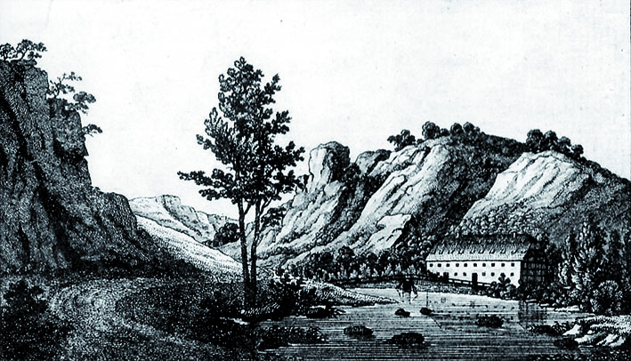
The scenic beauty of the "Plauenscher Grund", where Augustus the Strong had an opulent "Saturn Festival" held in September 1719 to celebrate the marriage of his son Friedrich August to Maria Josepha of Austria, inspired writers and painters of the early 19th century to create rapturous poems and romantic paintings. They give an idea of how much of its "originality" the valley has lost since around 1850 due to quarries, factory buildings and transportation infrastructure.
Michael StrobelImage Source K. Jünger 2020, 14, Abb. 1b.
Location and destruction
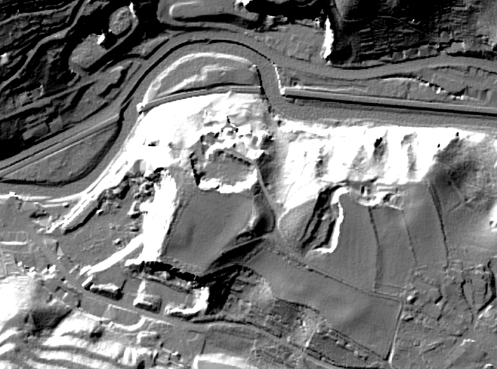
The spur location dominating the valley was predestined for a castle complex. While steep rocky slopes on three sides offered natural protection, the vulnerable narrow point at the transition to the Coschütz plateau was secured by a section of fortification at least 10 m high. At the other points, a weaker edge reinforcement, i.e. only a simple palisade, was probably sufficient. Unfortunately, the edges of the plateau and the edges of the inner area have fallen victim to stone quarrying. While the site was originally around 3.5 ha in size, at least 1 ha has been destroyed by the operation of several quarries since the 19th century.
Michael StrobelImage Source DGM ©LfA/GeoSN 2020.
Beginnings of research
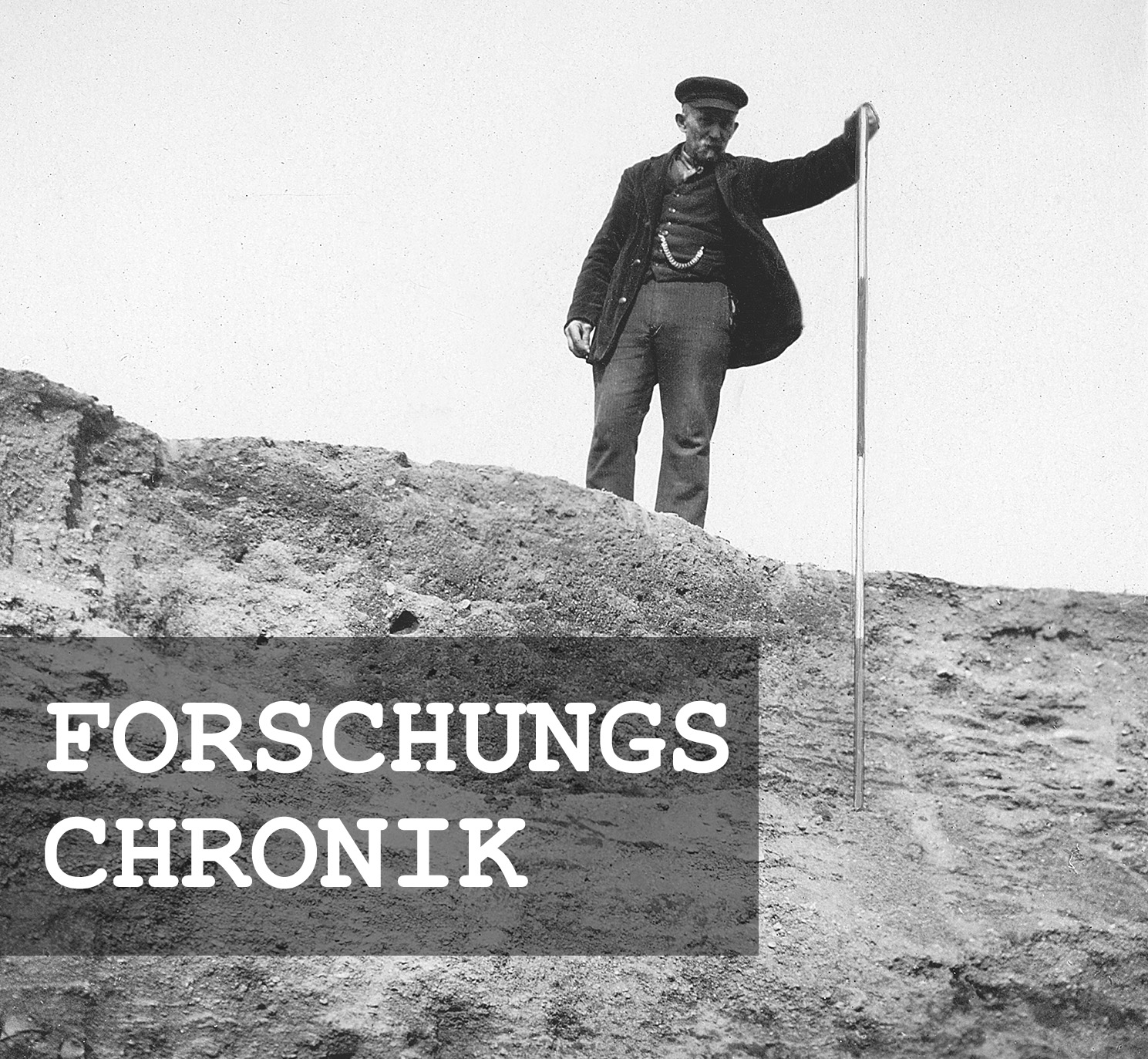
The condition of the rampart and inner area was already deplorable at the end of the 19th century. The intensive use of the site for agriculture constantly brought finds to light. According to Rudolf Virchow in 1896, "only a faint hint of the rampart remains here and there." Nevertheless, the Heidenschanze was under constant observation by interested prehistory enthusiasts from the village of Coschütz and the nearby state capital. However, this attention and supra-regional fame did nothing to change the progressive destruction caused by stone extraction.
Michael StrobelImage Source W. Hahn, Foto ©LfA 2024.
A propaganda advertisement
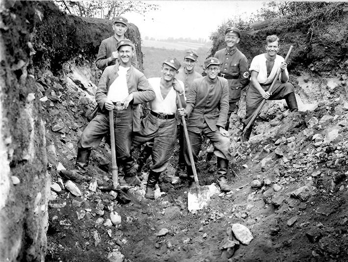
After systematic investigations had never been carried out until 1933, mainly for cost reasons, the hour of the excavators struck after the transfer of power to the NSDAP. The Zittau archaeologist Walter Kersten (1907-1944), a party member since 1932 (shown here in party uniform) and a close collaborator of the chief monument conservator in the Free State of Saxony at the time, Georg Bierbaum (1889-1954), cleverly knew how to make political propaganda capital out of a rescue excavation that was necessary for monument conservation.
Michael StrobelImage Source Foto ©LfA 2024.
Scientist and National Socialist
Kersten was not only a well-trained excavator and brilliant organizer who was able to mobilize the Voluntary Labour Service (FAD) for the excavation work, he was also a convinced National Socialist and NSDAP district specialist for prehistory, who played a decisive role in shaping the Nazi-compliant reorientation of Saxony's archaeological heritage management from within the party apparatus.
Michael StrobelImage Source Foto ©LfA 2024.
Modern excavation methods
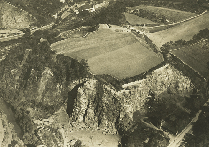
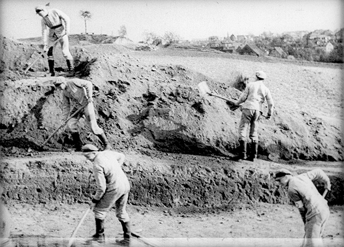
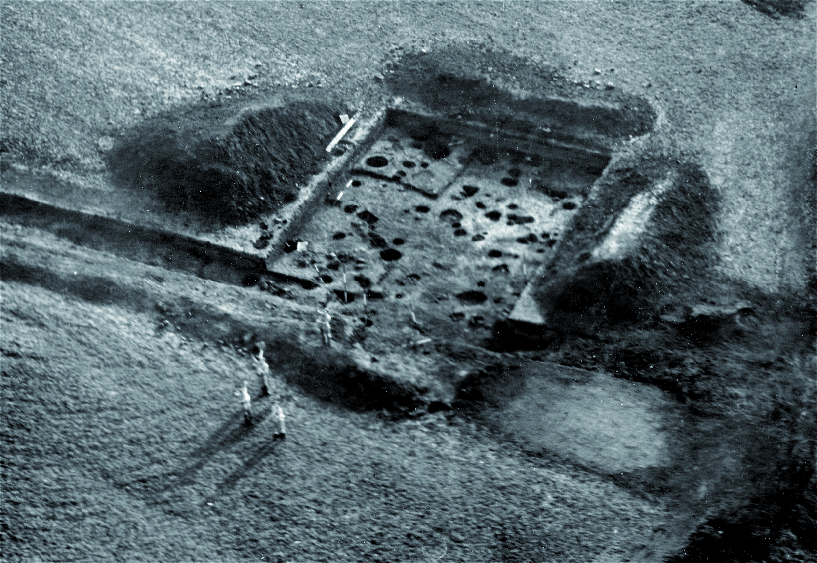
On the one hand, his organizational talent extended to the execution and management of the excavation, which was technically and methodologically at the cutting edge of the times: this included wall cuts as well as the large-scale uncovering of house foundations, fireplaces and workplaces, which were documented photographically and in drawings. The high standard of the excavation documentation can be seen not least in the aerial photographs.
Michael StrobelImage Source K. Jünger 2020, 38, Abb. 22a.
Public relations
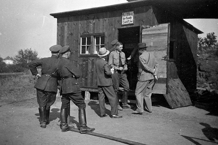
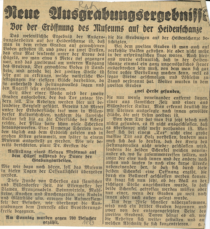
On the other hand, the young up-and-coming archaeologist mastered the entire spectrum of "modern" public relations work, ranging from regular guided tours and the establishment of a small museum in barracks to press articles, radio interviews and filming. Within a few months, the excavations were visited by around 25,000 people, including over 10,000 schoolchildren and 350 teachers as well as many prominent party figures and representatives of the higher ministerial bureaucracy. As much as these numbers may have exceeded initial expectations, the easy accessibility of the prehistoric fortification for an urban audience may have had a decisive influence on the choice of excavation site.
Michael StrobelImage Source OA 02040, 1423 ©LfA 2024.
The 1934 excavation
The response the following year was all the more disappointing: the halving of the number of visitors can hardly be attributed to a lack of public relations work. However, the new excavation manager Otto Kleemann (1911-1996) was nowhere near as well connected as his predecessor. This campaign could not have been carried out without the support of 20 workmen.
Michael StrobelImage Source Foto ©LfA 1934.
Heidenschanze and the "Homeland Security Act"
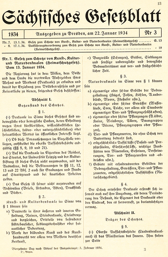
The crowds of visitors and public attention in the summer and fall of 1933 seem to have made such an impression on the party and civil servants that the enactment of a monument protection law in January 1934 by Reich Governor Martin Mutschmann (1879-1947) and Minister President Manfred von Killinger (1886-1944) must also be attributed to the activity and "lobbying" of the excavation manager at the time, Walter Kersten. However, the new "Heritage Protection Act" and the entry of the Heidenschanze in the list of monuments could not prevent the quarry operations from being intensified at the expense of the ground monument from 1936 onwards.
Michael StrobelImage Source Denkmalgesetz 1934 ©LfA 2024.
Rescue excavations on the precipice
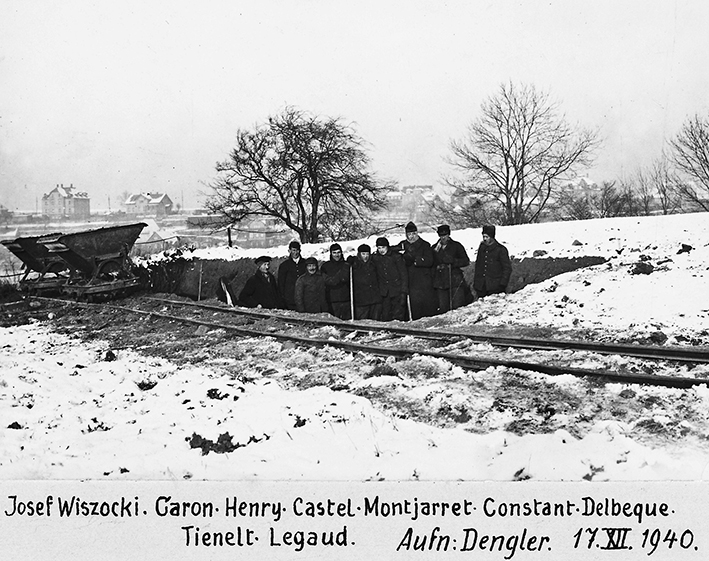
Although the investigations accompanying the excavations initially fell far short of the standards set in 1933 and 1934, Hermann Dengler (1890-1945), a long-time employee of the State Museum of Prehistory in Dresden, at least succeeded in documenting a further area and recovering finds in the winter of 1940/41 under adverse conditions. The earth was so frozen that the layers containing the finds had to be blasted out. Ten French prisoners of war were used for this dangerous work at the edge of the quarry.
Michael StrobelImage Source H. Dengler, Foto ©LfA 1940.
The destruction continues
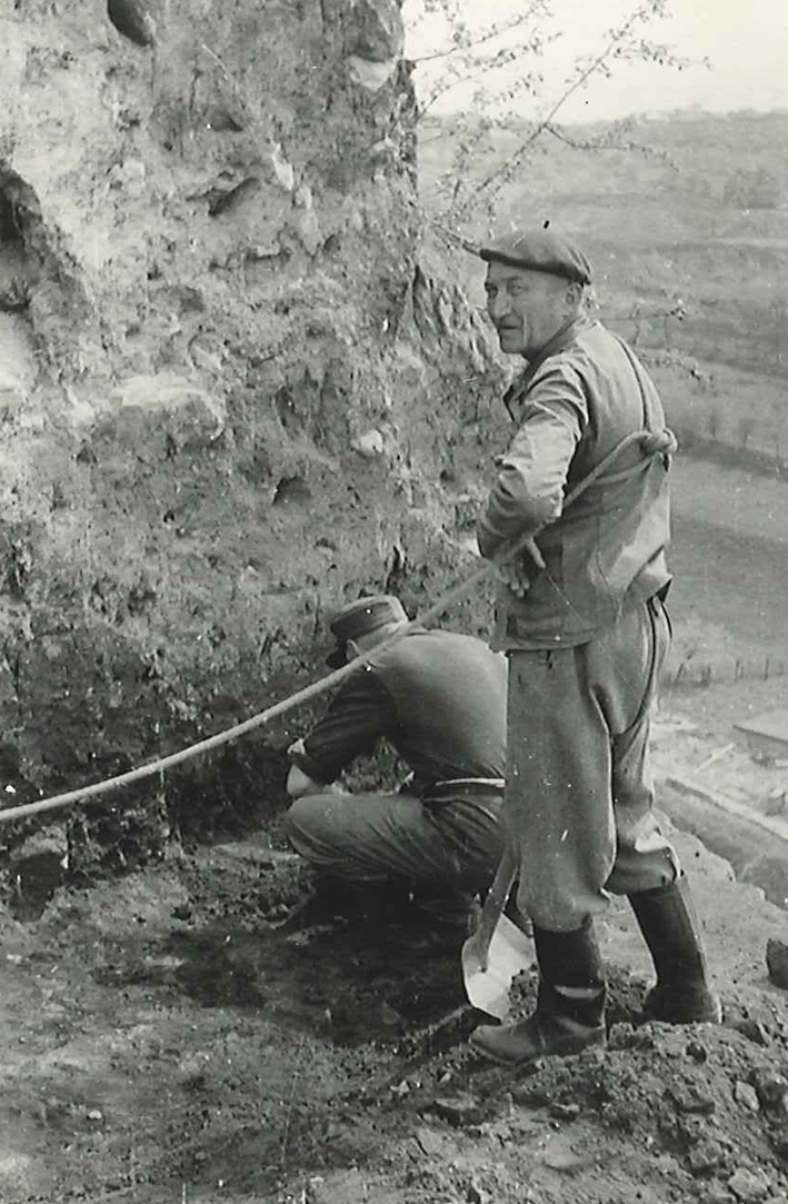
As there were no plans to stop quarrying stone even after the end of the war and economic interests took precedence over the preservation of the archaeological monument, a larger area at the edge of the plateau had to be uncovered again in 1956/1957 under the local management of Artur Pietzsch (1901-1975), which provided interesting insights into the features. Archaeologically investigating a cultural layer package up to 6 m thick directly on the edge of the quarry was not only a dangerous but also technically challenging undertaking.
Michael StrobelImage Source K. Jünger 2020, 43, Abb. 38.
A "Bronze Age city"?
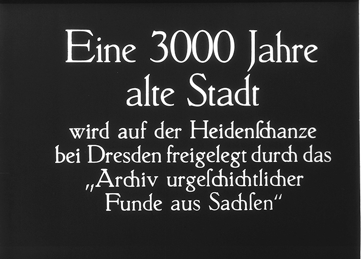
Newspaper articles in 1933 and 1934 repeatedly referred to a "Bronze Age town". The Heidenschanze was also referred to as "a 3000-year-old town" in a radio interview and in a film. Kersten obviously wanted to use the term "town" to emphasize the importance of the prehistoric rampart. Presumably the costly excavations were under a certain amount of pressure to justify themselves. Today, one would no longer speak of a "town", but certainly of an important hilltop settlement of the Lusatian culture. 90 years have passed since the first systematic excavations in 1933. It is therefore not easy to reconstruct the history and structure of the fortification from the surviving excavation documents.
Michael StrobelImage Source K. Jünger/J. Schachtmann 2010, Abb. 2.
A "cinder block wall"
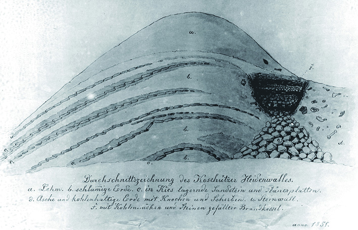
While burnt stones and timbers from the section wall had already attracted the attention of researchers in the 19th century, the sections from 1933 and 1934 confirmed that the fortification must have been destroyed at least once by a major fire. In the 19th century, the term "slag wall" was coined for this phenomenon because the numerous heavily burnt, "slagged" stones were particularly conspicuous.
Michael StrobelImage Source K. Jünger 2020, 18, Abb. 5a.
Destroyed and rebuilt
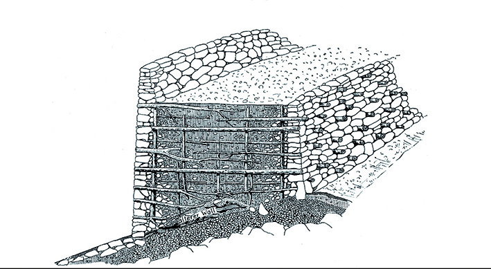
With the exception of isolated Neolithic finds, the plateau of the Heidenschanze seems to have been used more intensively for the first time during the Late Bronze Age, but was at best fortified with a rampart-like fill. Around 1000 BC at the earliest, at the beginning of the Late Bronze Age, an approximately 4-5 m wide defensive wall with an outer stone front was erected. The dry stone wall was anchored in an earth fill with wooden beams. After its destruction, it was rebuilt with two wall shells, which were also held together by wooden anchors and apparently formed the fortification until the 7th century BC, i.e. into the older Pre-Roman Iron Age. The approximately 5 m wide space in between was filled with stones and earth.
Michael StrobelImage Source K. Jünger 2020, 118, Abb. 91,7.
Traces of dense development
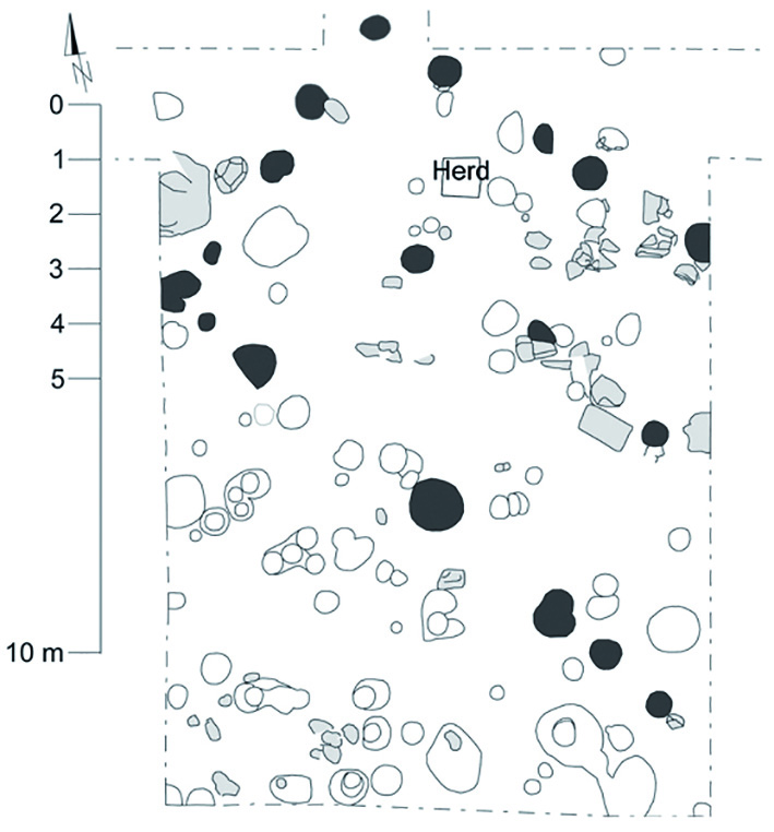
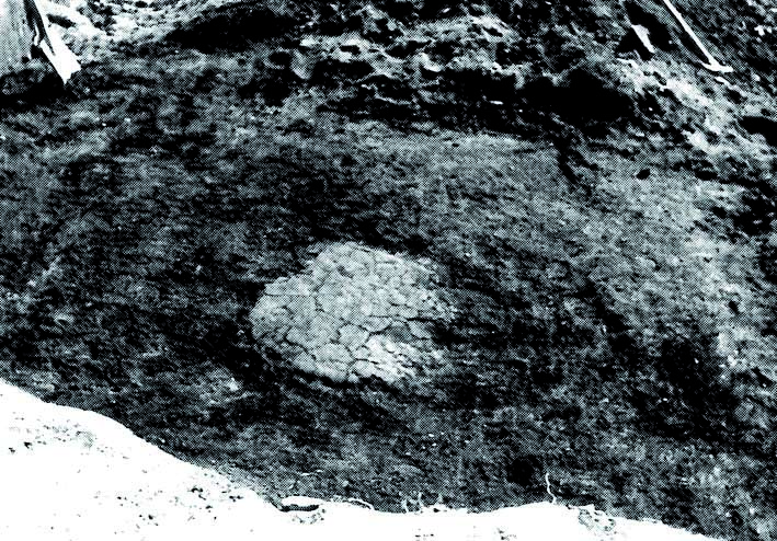
Over the course of several centuries, cultural layers up to 1 m thick and even up to 6 m thick at the edges have been deposited on the plateau. They include the remains of houses, workplaces, former surfaces and numerous settlement wastes. It is very difficult to distinguish individual construction phases in these packages on the basis of the available documents. Only a 5.5 x 11.5 m, two-aisled post structure can be reconstructed. However, the sheer number of postholes and pits alone suggests a dense development.
Michael StrobelImage Source K. Jünger 2020, 94, Abb. 94c.
Houses
The buildings had clay floors and were equipped with fireplaces. The walls were probably made of split planks or wattle and daub and were plastered with clay. At least the interior walls were covered with a layer of lime that had been renewed several times, perhaps even painted in some cases. There may also have been log buildings. Between the buildings were storage pits that had been dug into the weathered rock or older layers and later filled with garbage.
Michael StrobelImage Source Foto ©LfA 1933.
Bone substitute
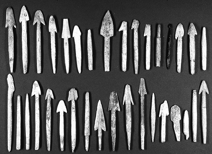
The main occupation of the inhabitants was mainly based on agriculture and livestock farming. They mainly kept cattle and pigs, less frequently goats and sheep, whose wool was processed into textiles. Spinning whorls and bone needles bear witness to textile production. Wild animals, mostly red deer and wild boar, provided around a fifth of the meat required and were obviously hunted intensively. The production of arrowheads from bone and horn in the fortification itself is attested by semi-finished products and waste. Bronze seems to have been such a scarce raw material that substitutes had to be used for tools and weapons.
Michael StrobelImage Source U. Wohmann, Foto ©LfA 1999.
Bronze caster
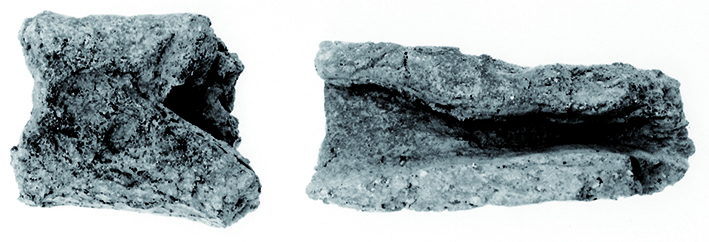
In addition to the production of bone and antler tools, bronze processing played a central role on the Heidenschanze. Three smelting furnaces on the western edge of the plateau probably only formed part of a larger quarter of bronze craftsmen, in which at least tin-rich bronze was remelted or even tin and copper were alloyed. Fragments of crucibles and clay nozzles were part of the basic metallurgical equipment of these specialists.
Michael StrobelImage Source K. Jünger 2020, 124, Abb. 97.
A center of bronze craftsmanship?
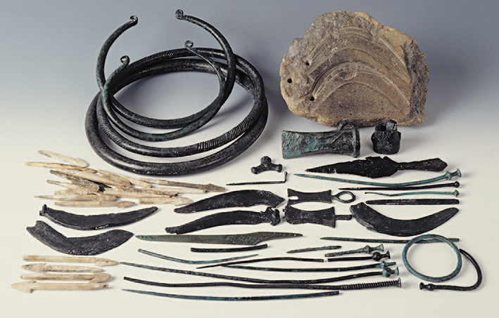
A wide range of weapons (including arrowheads and spearheads), implements (e.g. axes and sickles) and jewelry and costume items (e.g. pendants, pins and neck rings) were produced in stone moulds. A total of four deposits have been found that can be associated with bronze production or were deposited as "building offerings".
Michael StrobelImage Source U. Wohmann, Foto ©LfA 1999.
Wheel and carriage
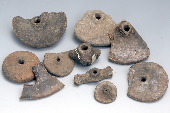
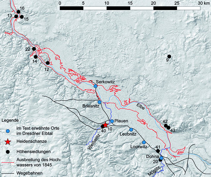
Although the Coschützer Heidenschanze is located away from the Dresden Elbe valley, it is presumably on an important historical transport route that led through the Ore Mountains to Bohemia. At least indirectly, fragments of disk and spoke wheels from clay wagon models refer to transport and trade. Like so many other castles, the Heidenschanze was abandoned in the course of the early pre-Roman Iron Age by 500 BC at the latest.
Michael StrobelImage Source U. Wohmann Diatheknr. 20110810_uwoh_0017 ©LfA 1999.
Transport favorability as a location factor
It was not until centuries later, around 1000 AD, that the plateau was settled again in the early Middle Ages, perhaps even fortified. Typical "Slavic" shards date from this period. The favorable traffic topographical location may also have been a decisive factor this time. Today, the plateau is permanently protected as part of the FFH area "Hoher Stein und Heidenschanze" as permanent grassland. Only a few other monuments in the Free State of Saxony enjoy comparable protection.
Michael StrobelImage Source K. Jünger 2020, 129, Abb. 99.
Literature
Werner Coblenz, Die Heidenschanze von Dresden-Coschütz. In: Heinz-Joachim Vogt (Hrsg.), Archäologische Feldforschungen in Sachsen. Arbeits- und Forschungsberichte zur sächsischen Bodendenkmalpflege Beiheft 18 (Berlin 1988) 117–121.
Konstanze Jünger, Die vorgeschichtliche Besiedlung der Heidenschanze von Dresden-Coschütz. Veröffentlichungen des Landesamtes für Archäologie Sachsen 70 (Dresden 2020).
Konstanze Jünger/Judith Schachtmann, „Eine 3000 Jahre alte Stadt“: die Ausgrabungen auf der Heidenschanze von Dresden-Coschütz und ihre Darstellung in der Öffentlichkeit. In: Regina Smolnik (Hrsg.), Ausgrabungen in Sachsen 2. Arbeits- und Forschungsberichte zur sächsischen Bodendenkmalpflege Beiheft 21 (Dresden 2010) 27–35.
Judith Schachtmann/Thomas Widera, Wissenschaftler und Nationalsozialist: Der Vorgeschichtler Walter Kersten (1907–1944) in Sachsen. Archaeo 10, 2013, 30–36.
Note on monument protection
Archaeological monuments are protected by the Saxon Monument Protection Act. A permit under monument law is required for ground interventions or construction measures.
Permalink
https://archaeo-sn.de/en/ort/heidenschanze-coschutz/
Citation
Michael Strobel, Heidenschanze Coschütz. In: Landesamt für Archäologie Sachsen, Website archaeo | SN (05.09.2024). https://archaeo-sn.de/en/ort/heidenschanze-coschutz/ (Stand: 29.09.2026)
