

Biehla swamp jump
| Place: | Biehla (Kamenz, Bautzen) |
|---|---|
| Type: | Weirs/fortifications |
| Dating: | older Pre-Roman Iron Age | Billendorf culture | 620 - 570 BC. |
Description
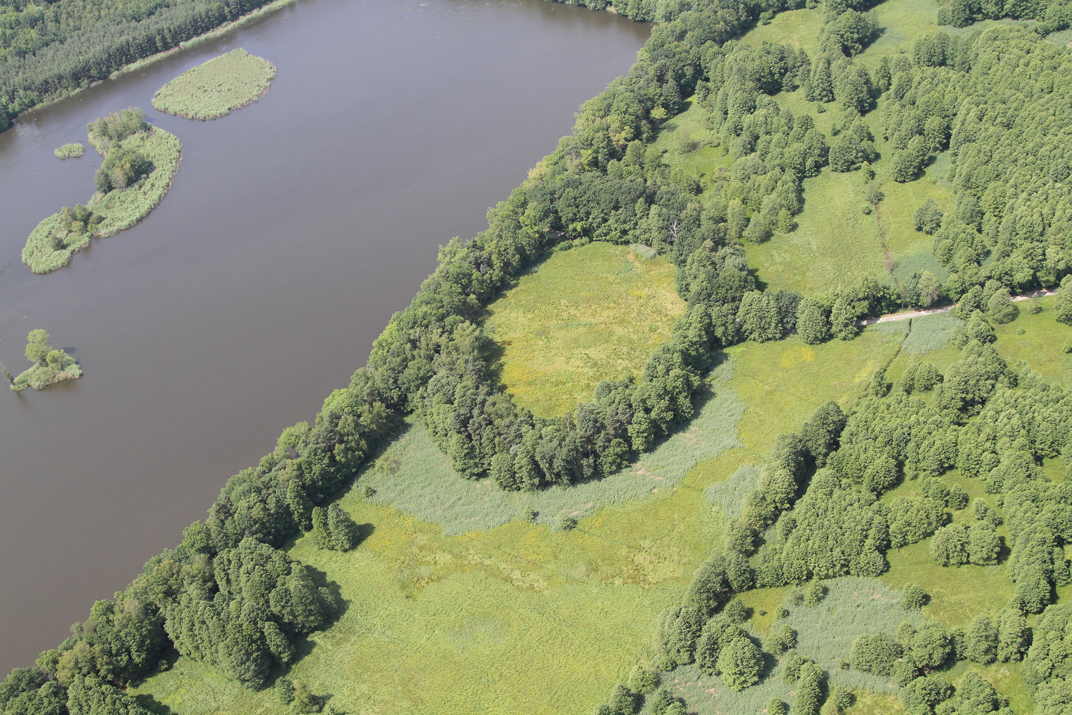
The Biehla swamp hill (Běła), Kamenz (Kamjenc), is located in the middle of the Lusatian heath and pond landscape. It covers an area of 100 m x 120 m and was built by the people of the Billendorf culture in the early Iron Age. It once had a rampart fortified with a wooden earth wall and was densely built up with half-timbered houses in its interior. In the first half of the 6th century. Century v. Chr. the plant was destroyed by fire. Today, a section of the rampart fortification is used as a dam for a modern fish pond, while the rest of the rampart is heavily eroded.
Annemarie ReckFastenings in protective layers
In the late Bronze Age and early Iron Age, fortifications were often built in protective locations. Where appropriate, they were built on hilltops, in spur locations or on hillside terraces above river valleys. In the flat landscape of Upper Lusatia, surrounded by heathland, lakes and swamp forests, lowland castles were built, such as the Biehla swamp fortification. Originally, it was located on a small promontory that rose slightly above the surrounding terrain of the former alluvial forest. It only had a narrow earth bridge for access. Even over 2500 years after it was built, it served as a refuge for the people of Biehla: As the Red Army troops approached at the end of the Second World War, the village community and their livestock sought shelter in the old marshy redoubt.
Annemarie ReckImage Source P. de Vries, Foto ©LfA 2013.
Discovery of the plant
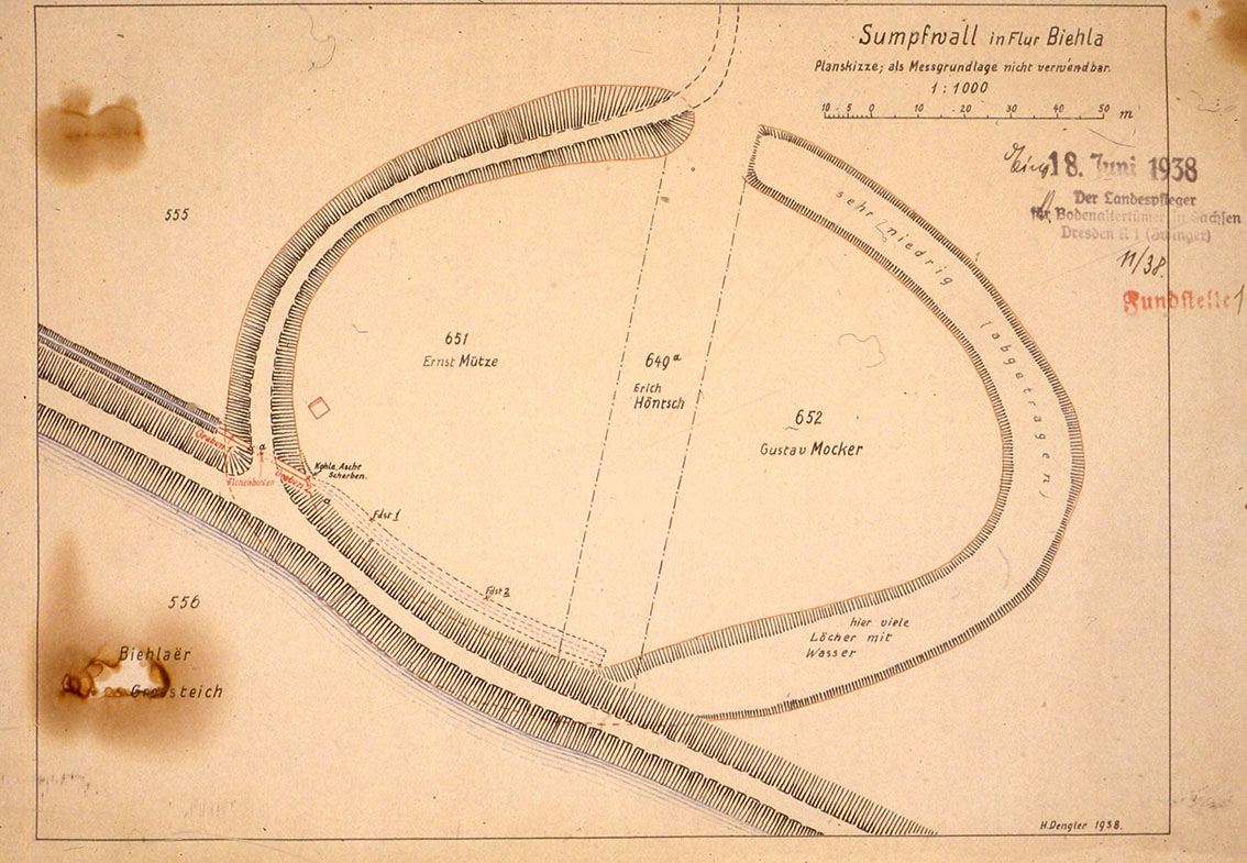
Although the eye-catching rampart is already recorded on old mileage sheets from the 19th century, the Iron Age monument remained undiscovered and unprotected for a long time. Around 1910, local farmers used the good, charcoal-rich soil to spread it on their fields, almost completely eroding large parts of the former rampart. It was not until 1934 that the swamp redoubt was recognized as a prehistoric fortification and placed under protection by Dr. Georg Bierbaum, who was the state curator for archaeological sites at the time.
Annemarie ReckImage Source H. Dengler, Plan ©LfA 1938.
First rescue excavation in 1938
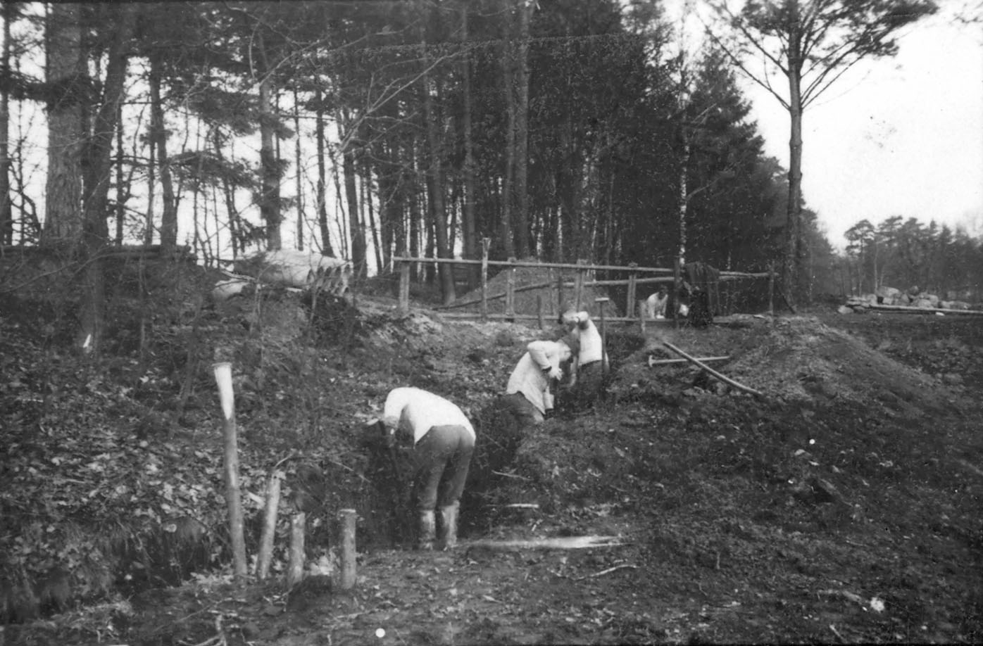
Despite being a protected site, a drainage ditch was dug through the rampart of the swamp redoubt in 1938. In the course of a small rescue excavation, led by Hermann Dengler, it became possible to take a first look at the structure of the rampart. Numerous pieces of wood and pottery shards from the early Iron Age were recovered, which were very well preserved due to the high groundwater level, allowing the site to be roughly dated for the first time.
Annemarie ReckImage Source H. Dengler, Foto ©LfA 1938.
Excavation 2000
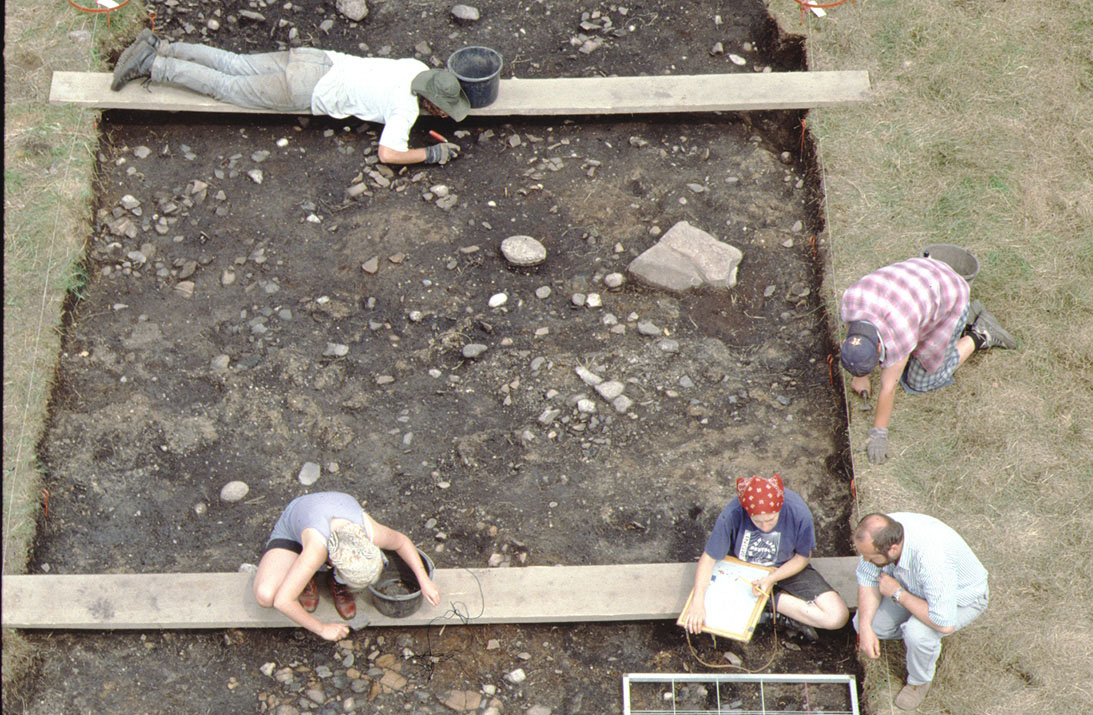
In the following decades, the Biehla swamp redoubt continued to be subject to destruction despite monument and nature protection, for example due to unauthorized drainage work in the 1970s, as well as heavy mowing machines, which were intended to prevent the area from becoming overgrown. In 2000, the State Office of Archaeology of Saxony, in cooperation with the Polish Academy of Sciences of the Cardinal Stefan Wyszyńsky University of Warsaw, carried out an archaeological excavation to examine and secure the condition of the endangered monument. Three excavation sections were created for this purpose.
Annemarie ReckImage Source J. Lipták, Foto ©LfA 2000.
The whale structure
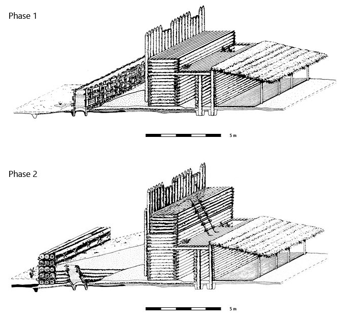
The north-western excavation section measured 4.00 m x 45.00 m and was located in the area of the excavated rampart. The remains of the fortification were only 0.70 m high. However, a two-phase construction could still be recognized, which Louis Nebelsick reconstructed as follows: In phase 1, there was initially an approach obstacle consisting of two wattle and daub walls, with a clay packing in between. Behind this was an initially narrow berm. On the outside of the 4 m wide rampart was a row of closely set vertical beams that served as a screen wall. The actual rampart wall consisted of a wooden box structure filled with earth, to which a loose construction in the form of a battlement was attached on the inside. Its structure is thus very similar to the fortification in Biskupin, Poland. In the 2nd construction phase, the berm in front of the rampart was enlarged to a width of 7 meters. The wall in front, made of clay and wattle and daub, was covered over and a new wall made of transverse beams was placed in front of it. It can be assumed that the rampart wall was also raised in the course of this. The entire rampart was destroyed by a major fire, possibly in connection with warfare.
Annemarie ReckImage Source L. Nebelsick, Rekonstruktion ©LfA 2000.
Further building finds
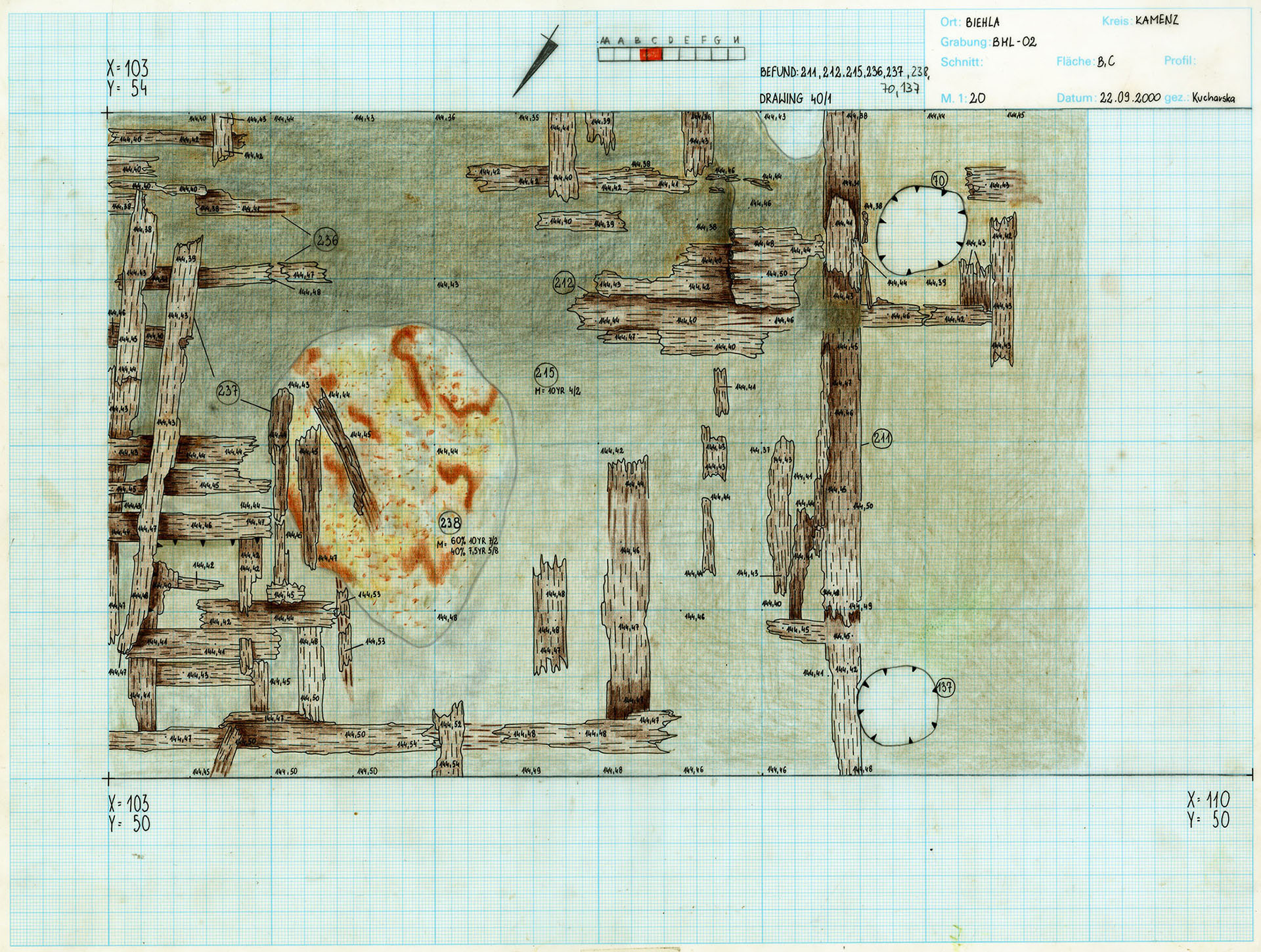
In a 200 m² area inside the redoubt, a regular building structure was found, interspersed with narrow alleyways running east-west. An 8 m wide and 11 m long building in the same orientation was completely excavated. The posts of the timber-framed building were wedged together with stones and the damp marshy ground even preserved wooden planks of a floor. In places, dense ceramic packs were found on top. The sherds can be classified as coarse storage pottery, but in many cases also as fine pottery. Adaptations are rarely found in the area of the sherd paving, which is why it must be assumed that they did not come from vessels that were smashed on site, but were laid out at a later date, perhaps as floor underlayment.
Annemarie ReckImage Source A. Kucharska, Zeichnung ©LfA 2000. Landesamt für Archäologie Sachsen/Kuchavska 2000.
Found objects
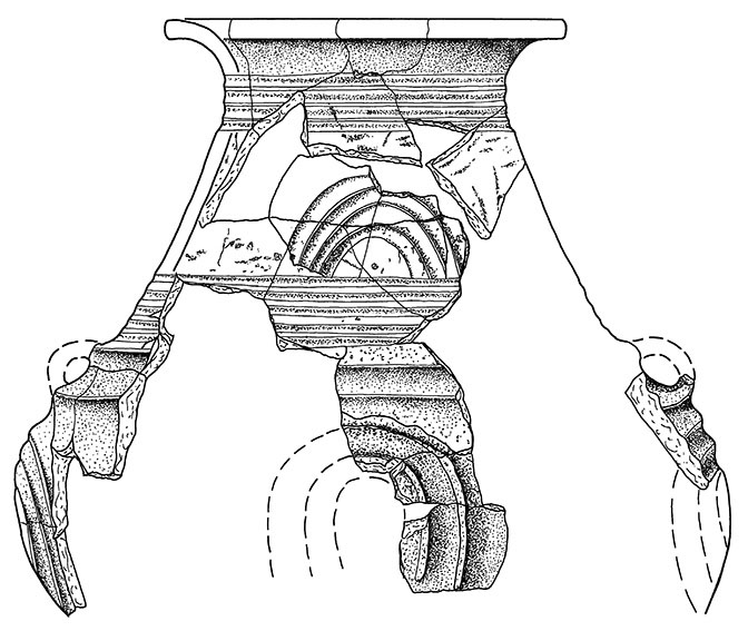
In addition to cooking and storage vessels, there are also tall conical-necked vessels, decorated bowls, cups and small pointed vessels typical of the Iron Age Billendorf culture. Furthermore, two stone axes, a bronze egg and two glass beads were found during the excavations. Clay fragments from casting molds and metal drops also indicate bronze processing.
Annemarie ReckImage Source Zeichnung ©LfA 2015.
Wood preservation and dating
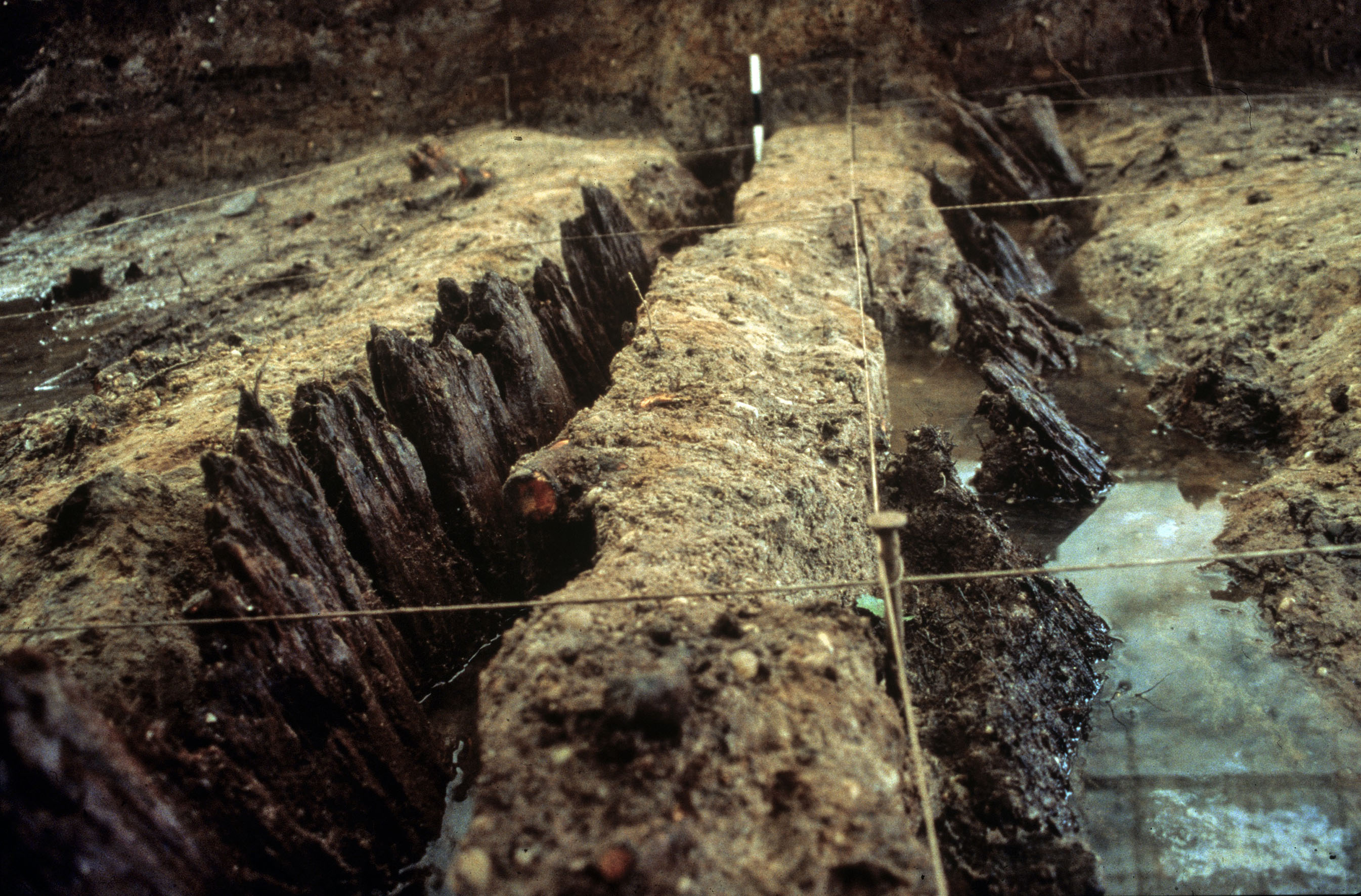
Thanks to the high groundwater level, Biehla has very good wood preservation, which allowed dendrochronological dating of the timbers from the rampart and the buildings in the interior. The growth rings of the timbers were counted and compared with other timbers of the same type. This made it possible to date the construction of the first phase of the rampart and the inner building very precisely to around 620 BC. Only a few decades later, before the middle of the 6th century, the mound burned down and was abandoned. Remarkably, all other known marshland redoubts in Upper Lusatia were also destroyed by fire. However, it is not yet clear whether they succeeded each other in time or were destroyed at the same time in a whole series of military conflicts.
Annemarie ReckImage Source D. Wach, Foto ©LfA 2000.
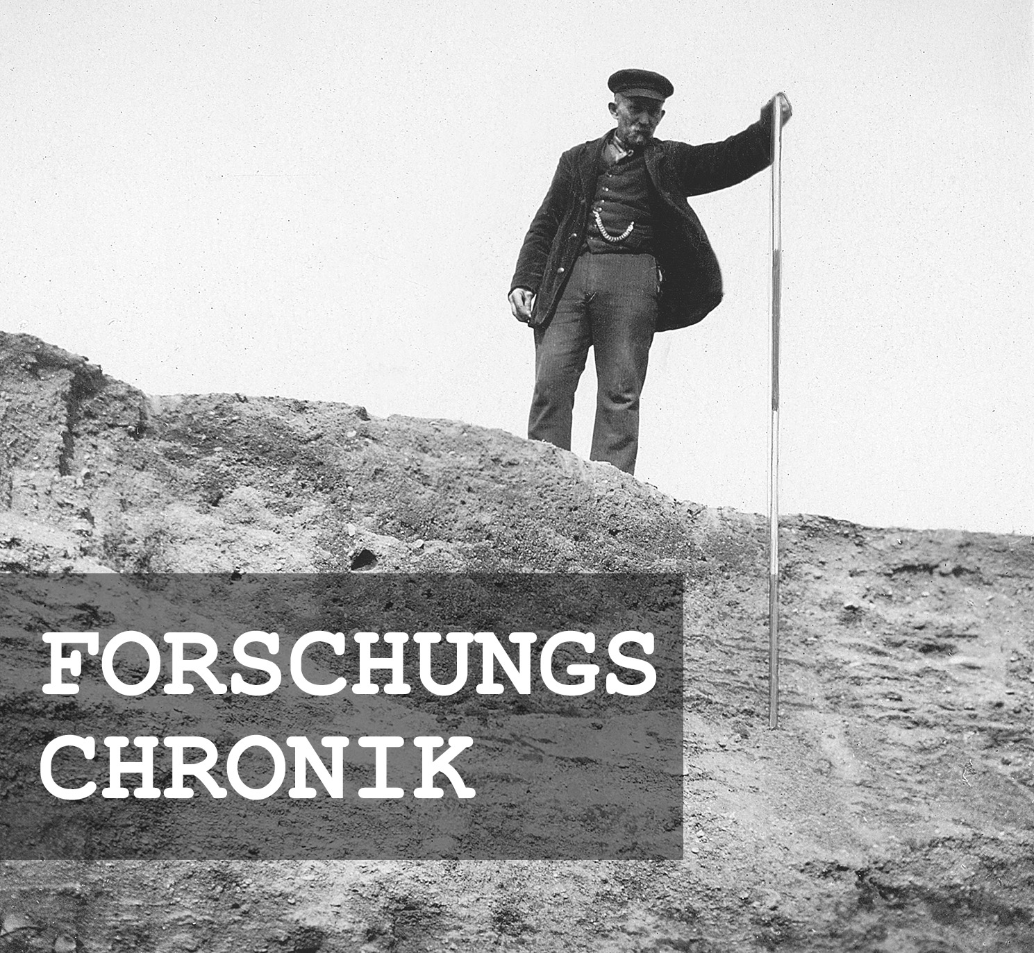
Research chronicle
Image Source Foto ©LfA 2024.
Literature
Grit Bräuer/Wolfgang Ender/Anja Kaltofen/Zbigniew Kobyliński/Frank Meltzer/Winfried Nachtigall/Louis D. Nebelsick/Rebecca Wegener/Olaf Zinke, Biehla: Teich – Sumpf – Schanze. Archaeonaut 12 (Dresden 2015).
Wolfgang Ender, Biehla (Běła): Die Sumpfschanze. In: Regina Smolnik/Jasper von Richthofen (Hrsg.), Oberlausitz, Ausflugsziele zwischen Neiße und Pulsnitz. Ausflüge zu Archäologie, Geschichte und Kultur in Deutschland, Bd. 51 (Stuttgart 2010) 100–103.
Ingo Kraft, Biehla (Lkr. Kamenz) und die eisenzeitlichen Burgen zwischen Elbe und Weichsel. Archäologisches Nachrichtenblatt 13, 2008,2, 202–204.
Louis D. Nebelsick/Znigniew Kobyliński/Anna Swieder/Katarzyna Zeman-Wiśniewska, „Sumpfschanzen“ – Burgen im Sumpf, Archäologie in Deutschland 2017, 6, 38–41.
Note on monument protection
Archaeological monuments are protected by the Saxon Monument Protection Act. A permit under monument law is required for ground interventions or construction measures.
Permalink
https://archaeo-sn.de/en/ort/biehla-swamp-jump/
Citation
Annemarie Reck, Biehla swamp jump. In: Landesamt für Archäologie Sachsen, Website archaeo | SN (01.02.2024). https://archaeo-sn.de/en/ort/biehla-swamp-jump/ (Stand: 01.10.2026)
