

Boiler near Mehderitzsch
| Place: | Mehderitzsch (Torgau, North Saxony) |
|---|---|
| Type: | Fortified system |
| Dating: | Billendorf Group | 700 - 550 BC. |
Description
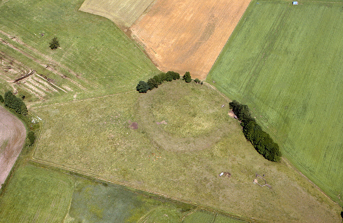
In the lowland area southwest of the village of Mehderitzsch, on the left bank of the Elbe, there is a basin-shaped rampart in the middle of wet meadows. Due to its shape and location, it was long thought to be a Slavic castle rampart. However, the finds unearthed during excavations in the late 1960s indicate that the site belongs to the early Iron Age, to the Billendorf group. The oval structure measures up to 125 m in diameter at its widest point. A 15 cm thick cultural layer indicates that the inner surface of the "cauldron" was settled over a large area“ towards. The once closed rampart is now partially eroded and flattened in the east.
Ronald Heynowski/Annemarie ReckShape of the ring wall
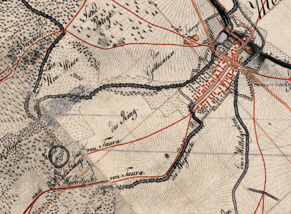
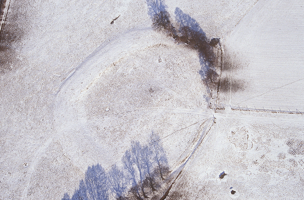
The "Kessel" near Mehderitzsch is already recorded on the Saxon mileage sheet from 1783. Its name apparently refers to its oval shape, which stands out in the North Saxon lowlands. At its widest point, the enclosed inner surface measures up to 125 m in diameter. The surrounding, broadly ploughed and shallowly sloped rampart still has a width of up to 20 m and is still clearly recognizable as a structure about 0.6 to m high. In the south of the complex, it still reaches a maximum height of up to 1.30 m.
Ronald Heynowski/Annemarie ReckImage Source Berliner Meilenblatt 1783, M. 1:500 ©LfA/GeoSN 2024.
The area around the boiler
As the mileage sheet still shows the cauldron as a complete circle, it must be assumed that the eastern rampart was removed during the 19th century. In addition, this part of the site was heavily leveled due to progressive agriculture. Today it is merely a flat bump in the ground. The terrain to the south, west and north of the "Kessel" is dominated by wetland soils, which also characterize the inner surface of the rampart. It was only possible to reach the castle on dry ground from the south-east. Today, the monument is crossed from south to north by a ditch that drains into the Elbe 2 km away.
Ronald Heynowski/Annemarie ReckImage Source O. Braasch, Foto ©LfA 1993.
Archaeological investigations
In 1968, several small-scale archaeological investigations were carried out inside the castle rampart during improvement work. During the work, the entire inner surface was interspersed with numerous trenches. The then Dresden State Office for Prehistory was able to document the trench profiles. This revealed that in the inner surface of the "cauldron" there was an approximately 15 cm thick cultural layer above a peat layer. A wealth of finds, such as pottery, animal bones, burnt clay and charcoal remains, were recovered from the overburden.
Ronald Heynowski/Annemarie ReckImage Source H. Kaufmann, Foto ©LfA 1972.
Ceramics and dating
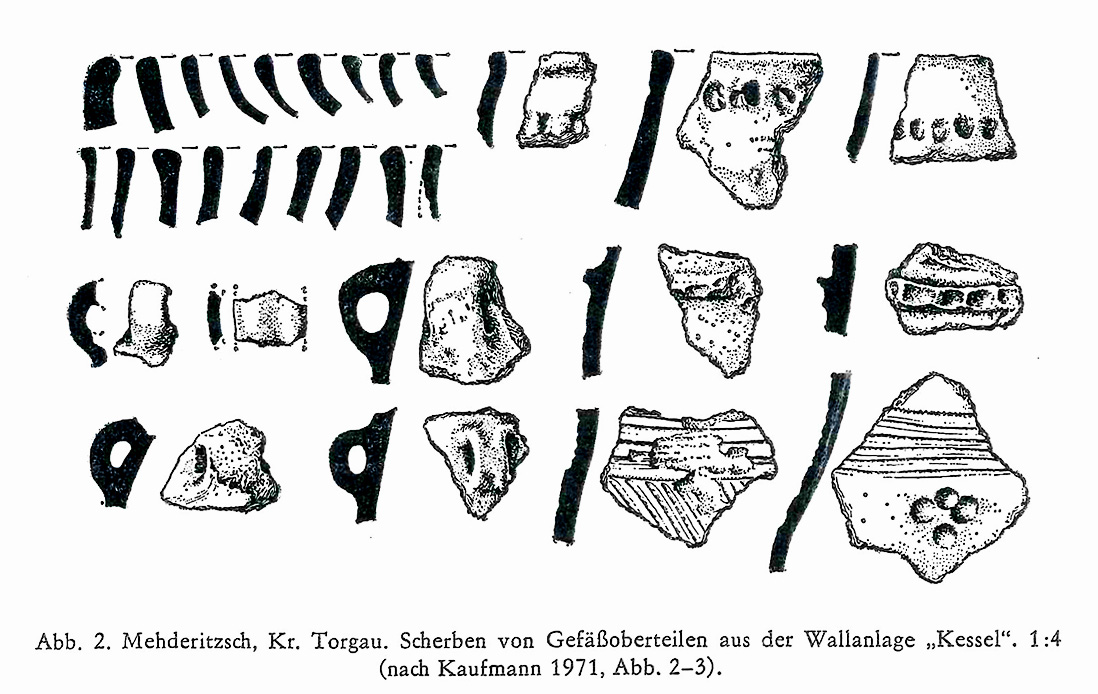
Among the pottery finds were pieces with a row of finger dabs under the rim of the mouth, with a simple ridge as well as with a finger dab ridge in the shoulder area and pieces with horizontal as well as diagonal grooves in the neck-shoulder area. Furthermore, some sherds were decorated with horizontal grooves in the lower neck area and band-shaped handles. The ware was predominantly red to gray-brown, in rare cases also light to dark brown or almost black, partly mixed with mica and rather hard-fired. Based on the formal characteristics of the pottery, the castle complex can be assigned to the early pre-Roman Iron Age, around 700-550 BC. At this time, the region was inhabited by the so-called Billendorf culture, which represents the most recent stage of development of the preceding Lusatian culture. There were no finds of early medieval Slavic pottery.
Ronald Heynowski/Annemarie ReckImage Source H. Kaufmann, Foto ©LfA 1972.
The Wall
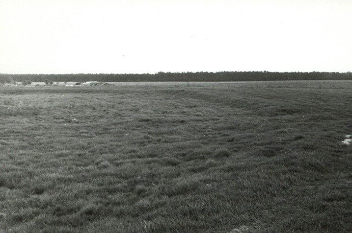
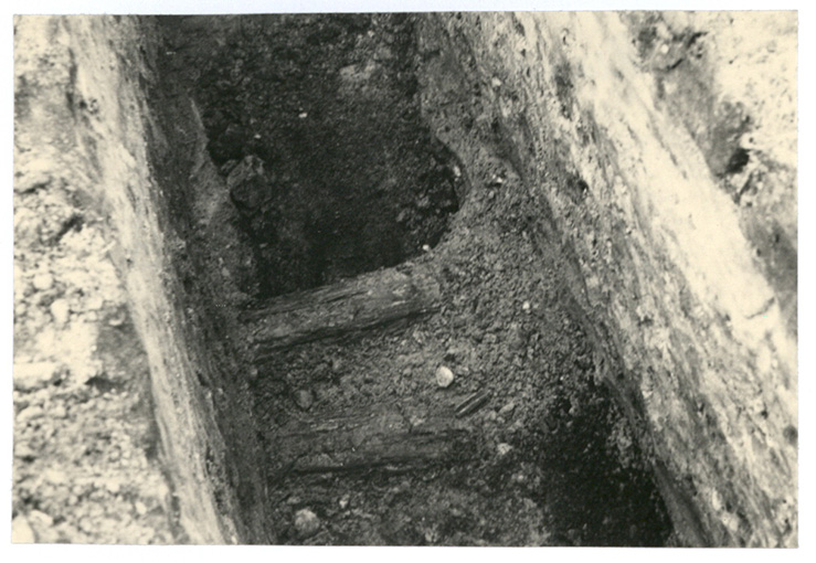
During the drainage work, a small excavation cut measuring 0.6 x 1.60 m was made in the northern section of the rampart. The rampart was made of dark gray sand. Three logs, arranged parallel to the course of the rampart, supported the base of the rampart. Their diameters varied greatly, namely between 0.12 and 1.20 m. However, this finding fits in with a local tradition which states that a "priest in Mehderitzsch used to dig and is said to have uncovered oak trunks under the rampart". Charcoal particles were found at all depths. However, there was no evidence of a faced front wall, as is known from other redoubts. There was also no evidence of a ditch surrounding the rampart.
Ronald Heynowski/Annemarie ReckImage Source K.-H. Schlegel, Foto ©LfA 1968.
Interpretation of the settlement
From the thickness of the cultural layer in the interior and the density of the finds, it can be concluded that the "cauldron" was settled intensively and over a longer period of time. In comparable sites, such as the extensively excavated Biehla marshland entrenchment, a dense settlement of the enclosed area could be proven. The narrow spatial boundaries of the area suggest a settlement of traders or craftsmen rather than a farming way of life. The location of the "Kessel" in the immediate vicinity of the Elbe and, as it were, protected from flooding, perhaps speaks for an interpretation as a transshipment point for long-distance trade.
Ronald Heynowski/Annemarie ReckImage Source R. Heynowski, Foto ©LfA 2006.
Literature
Ronald Heynowski, Ein Kessel auf weiter Flur. In: Regina Smolnik/Ronny Zienert (Hrsg.), Höhenflüge. Luftbilder und Archäologie in Sachsen (Dresden 2024) 130–131.
Hans Kaufmann, Der früheisenzeitliche Ringwall „Kessel“ bei Mehderitzsch, Kr. Torgau In: Heinz-Joachim Vogt (Hrsg.), Archäologische Feldforschungen in Sachsen. Arbeits- und Forschungsberichte zur sächsischen Bodendenkmalpflege, Beih. 18 (Berlin 1988) 160–163.
Note on monument protection
Archaeological monuments are protected by the Saxon Monument Protection Act. A permit under monument law is required for ground interventions or construction measures.
Permalink
https://archaeo-sn.de/en/ort/boiler-near-mehderitzsch/
Citation
Ronald Heynowski/Annemarie Reck, Boiler near Mehderitzsch. In: Landesamt für Archäologie Sachsen, Website archaeo | SN (25.09.2024). https://archaeo-sn.de/en/ort/boiler-near-mehderitzsch/ (Stand: 29.09.2026)
