

Brohna swamp jump
| Place: | Brohna (Radibor, Bautzen) |
|---|---|
| Type: | Weirs/fortifications |
| Dating: | Billendorf Group | Middle Slavic Group | around 700 BC | 800 - 900 AD |
Description
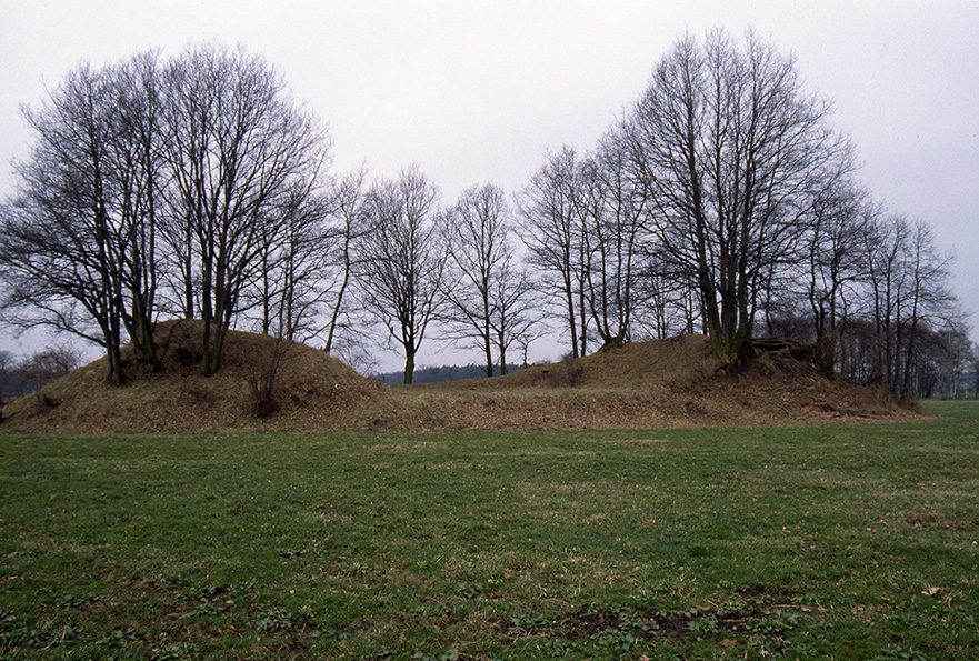
The Brohna swamp hill is located about 300 m north of the roundabout village of Brohna in a small field grove next to a small wood. Only a small part of the Slavic castle complex from the early Middle Ages remains today. Most of the marshland entrenchment was destroyed by material removal and repeated excavations during the 20th century. Destroyed at the end of the 19th century. Originally, the site was protected by a ditch up to 6 m wide and 1 m deep and a rampart at least 45 m high. Three block buildings were found inside. A boardwalk led through the lowlands into the castle grounds. It is probably connected to a three-part well construction that was excavated about 70 m to the southeast. However, no evidence of an associated open settlement from that time has yet been found. The pottery finds recovered during the excavations suggest that the marshland entrenchment was built and used in the 9th century. Century. In addition, prehistoric shards indicate that the site was first fortified during the Pre-Roman Iron Age before being revisited in the Early Middle Ages.
Annemarie ReckLocation
Around 300 m north of the center of Brohna, on a sandy hilltop, lies the swamp redoubt known as the "Alter Wall" or "Hrodźišćo". Together with the fortifications of Loga (Łahow), Luga (Łuh) and Radibor (Radwor), all of which are located within a radius of just 5 km, it is part of a system of early medieval marshland castles. They are also all connected by their location within a channel running from west to east, a few hundred meters wide and filled with alluvial loam, which forms a geographical border between the fertile loess area of the Upper Lusatian region and the heath and pond area to the north.
Annemarie ReckImage Source E. Schmitt, Foto ©LfA 1999.
Natural conditions
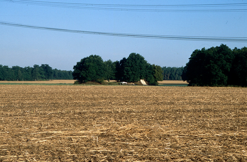
There are hardly any stray finds in the vicinity of the Brohna marshland entrenchment that could indicate a settlement belonging to the castle complex. The reason for this may be that the area around the site was unsuitable for agricultural use in the early Middle Ages. As a result, from the 13th century onwards, numerous fish ponds were created in the area between the Kleiner Spree and Schwarzwasser rivers and other regions unsuitable for agriculture. They are connected by a dense network of weirs and ditches, which still define the landscape of the region today. The situation was different during the early pre-Roman Iron Age: pollen analyses from the nearby wetlands around the castle indicate much more favorable conditions for agriculture at the end of the Sub-Boreal period. Today, the fields around the marshland entrenchment are largely drained and used for agriculture.
Annemarie ReckImage Source G. Seifert/R. Hoffmann, Foto ©LfA 2001.
Early research
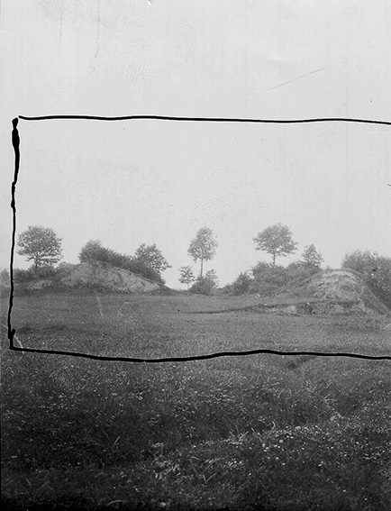
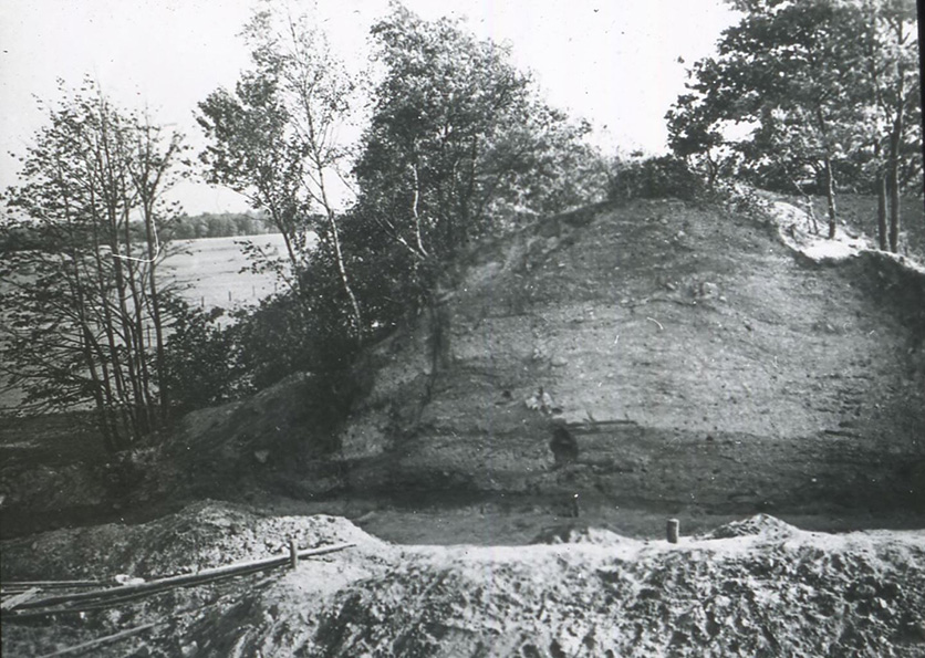
The swamp redoubt was first mentioned in the Lausitzer Monatsschrift of 1805 and in Karl Benjamin Preusker's "Verzeichnis Oberlausitzer Alterthümer aus vorchristlicher Zeit" of 1827 and his "Blicken in die vaterländische Vorzeit" of 1843. At this time, the complete ring rampart of the Brohna lowland castle was still preserved. In the second half of the 19th century until the site was entered in the list of monuments in 1935, the rampart was increasingly removed by the landowner for material extraction. As a result, the first archaeological excavations were carried out in Brohna in 1902 and 1907 by the Dresden Prehistory Museum under the direction of Johannes Deichmüller and the Bautzen branch of the Society for Anthropology and Prehistory of Upper Lusatia.
Annemarie ReckImage Source H. Schmidt, Foto ©LfA 1907.
Excavations 1949-1953 and 2001
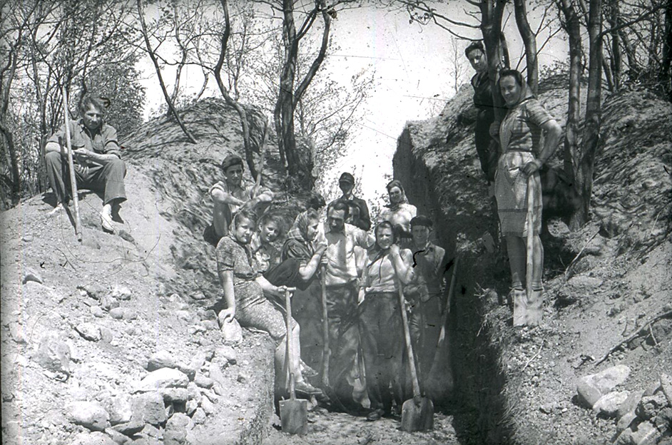
Between 1949 and 1953, the site was re-examined by the Dresden State Museum of Prehistory. During this second, more detailed excavation, not only was a cut made through the surviving rampart as before, but parts of the inner surface were also uncovered. Furthermore, seven exploratory trenches were dug in the vicinity of the lowland castle. In 2001, on behalf of the State Office for Archaeology, a further small cut was made through the rampart to confirm the findings of the early 1950s. At this time, only one sixth of the original rampart had been preserved.
Annemarie ReckImage Source W. Coblenz, Foto Grabungsteam ©LfA 1949.
The findings
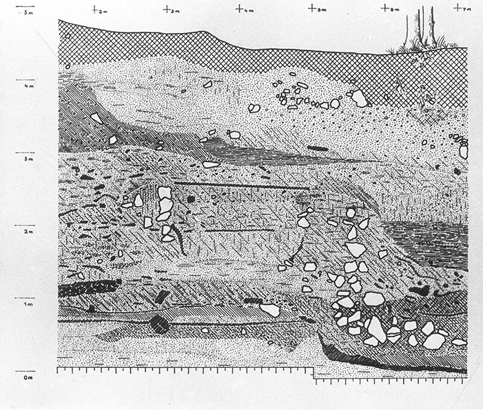
Today, only a small, maximum 4.5 m high remnant in the north and south bears witness to the fortification. The inner surface is still slightly raised. Based on the excavation documentation, the former state of the rampart can nevertheless be reconstructed. This shows that Brohna has always been remarkably small compared to other Upper Lusatian ramparts. The fortification consisted of a ditch about 6 m wide and 1 m deep, which surrounded an inner area 60 m in diameter. On the inner side, a 2 m wide berm was heaped up from the ditch excavation. Behind this was the irregularly shaped, up to 9 m wide rampart wall made of wood, stones and earth.
Annemarie ReckImage Source W. Coblenz, Foto Wallschnitt 1951.
The finds
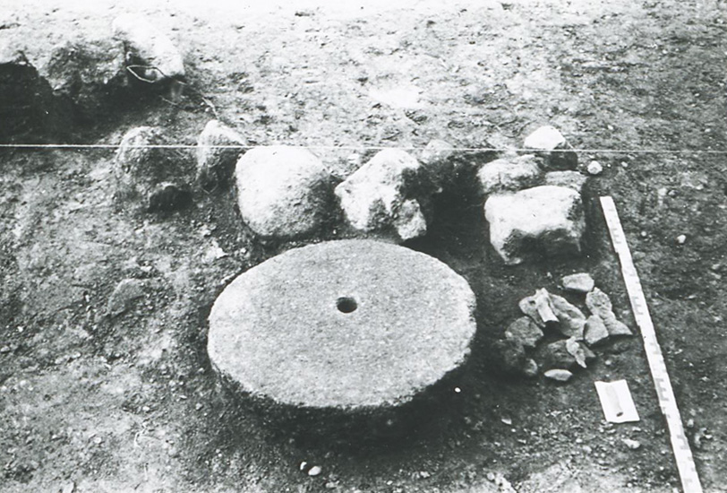
Only a small area with a diameter of 30 m remained inside the castle. An investigation of this area revealed evidence of three rectangular buildings, 3.5 m long and 2 m wide, which were built in block construction. A large round grinding stone was found in the corner of one of these buildings, as well as pottery shards, whetstones, spindle whorls and the remains of a few iron knives. Among the animal bone remains, cattle bones predominated with almost 75%. Overall, 90% were domestic animals, while only 10% of the bone finds came from wild animals.
Annemarie ReckImage Source W. Coblenz, Foto ©LfA 1951.
The tunnel gate
Access to the castle complex was from the north, where a gravel ramp had been heaped up. From there, access to the castle was probably via a small bridge and a tunnel gate about 2.5 m high. The access road was paved with planks, which were supported by logs laid out in the direction of travel and stabilized by stones. Coming out of the castle, the path turned to the right past the castle and through the damp lowlands to the south.
Annemarie ReckImage Source W. Coblenz, Tunneltorprofil M. 1:50 ©LfA 1969.
The fountain construction
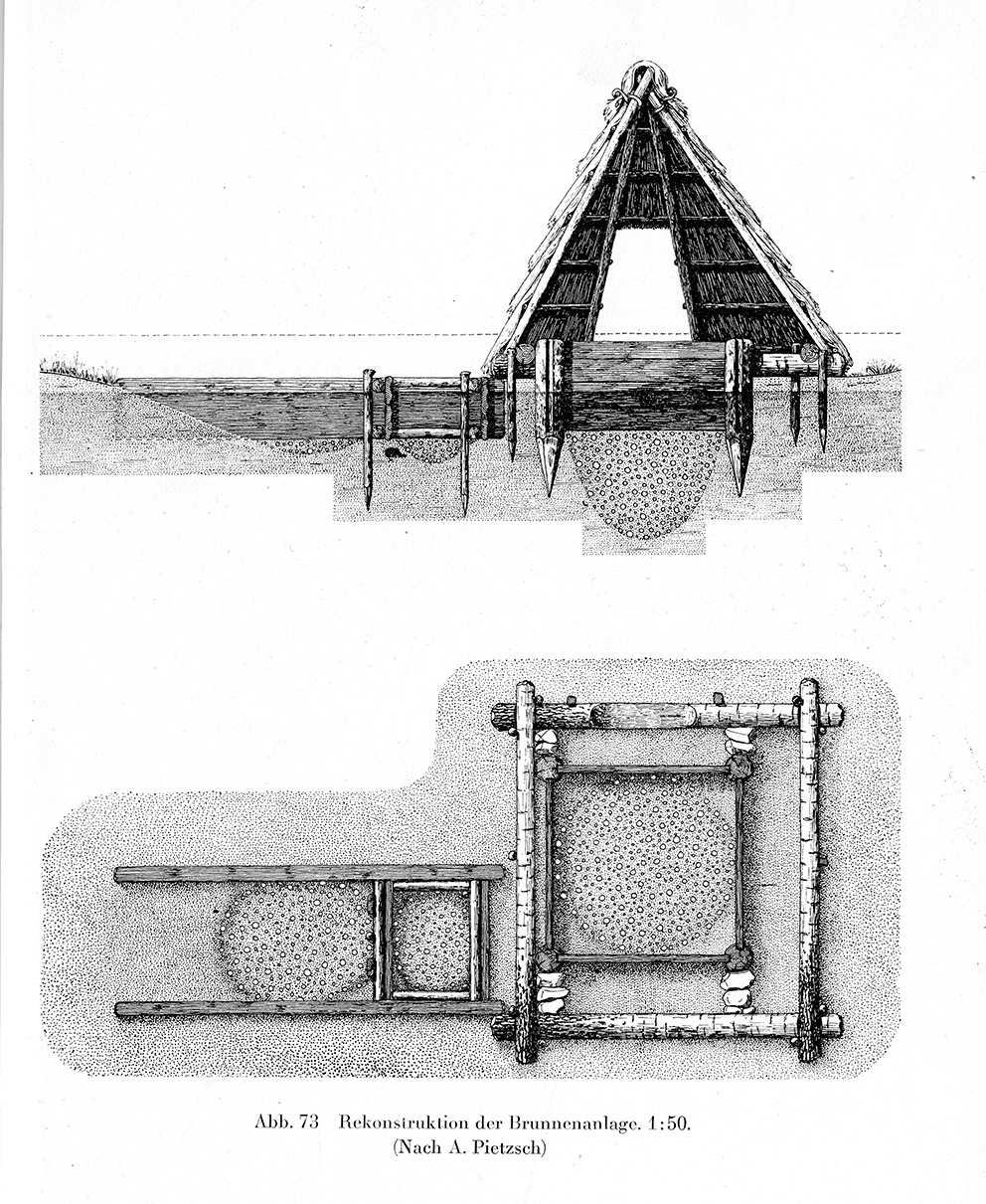
During the excavations from 1949-1953, a well construction was uncovered just 70 m south-east of the rampart. It was located only 15 m away from the plank path and consisted of three parts: a main well for drinking water, a well for farm water and a well presumably used as a cattle trough. The main well consisted of a square box structure, each side of which was 1.25 m long and had a roof. The service well also consisted of a box structure, albeit of a slightly rectangular shape, which was fitted with a lid. The cattle trough was closely adjacent to the farm well, but was only enclosed by timbers on three sides. One special find from this area is a preserved wooden ladle.
Annemarie ReckImage Source W. Coblenz (nach A. Pietzsch) 1988, Abb. 3.
Dating
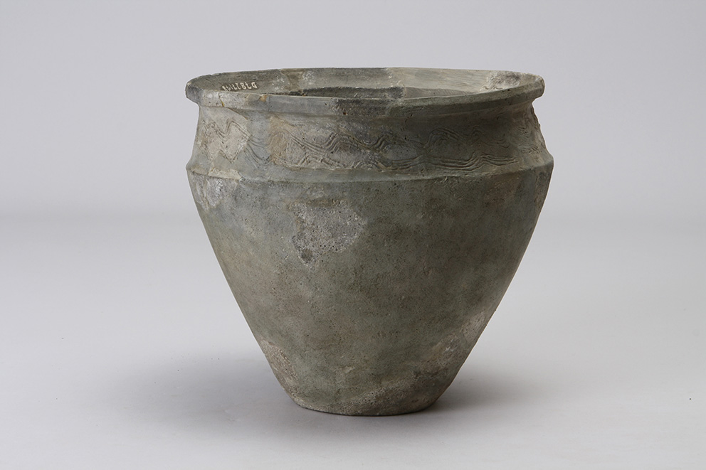
The wooden remains recovered during the various excavation campaigns were heavily decayed and no longer suitable for dendrochronological dating, which is why the mound can be dated solely on the basis of the material found. Unfortunately, there were only a few meaningful ceramic remains among the finds, so that the ringfort can only be roughly dated to the 9th century. It is assumed that it was used up to 100 years before it was abandoned. The fortified nature of the complex indicates that it was the residence of a person of high social standing. A second, heavily disturbed settlement horizon was also recorded under the Slavic cultural layer inside the castle, which can be dated to the early Iron Age (around 700 BC).
Annemarie ReckImage Source U. Wohmann, Foto slawischer Topf 9. Jh. ©LfA 2010.
Literature
Werner Coblenz, Die Sumpfschanze von Brohna bei Bautzen. In: Heinz-Joachim Vogt (Hrsg.), Archäologische Feldforschungen in Sachsen. Arbeits- und Forschungsberichte zur sächsischen Bodendenkmalpflege, Beih. 18 (Berlin 1988) 360–365.
Jürgen Vollbrecht, Brohna (Bronjo): Die Sumpfschanze. In: Regina Smolnik/Jasper von Richthofen (Hrsg.), Die Oberlausitz. Ausflugsziele zwischen Neiße und Pulsnitz. Ausflüge zu Archäologie, Geschichte und Kultur in Deutschland 51 (Stuttgart 2010) 114–116.
Note on monument protection
Archaeological monuments are protected by the Saxon Monument Protection Act. A permit under monument law is required for ground interventions or construction measures.
Permalink
https://archaeo-sn.de/en/ort/brohna-swamp-jump/
Citation
Annemarie Reck, Brohna swamp jump. In: Landesamt für Archäologie Sachsen, Website archaeo | SN (17.09.2024). https://archaeo-sn.de/en/ort/brohna-swamp-jump/ (Stand: 23.08.2026)
