

Castle Hill Zadel
| Place: | Zadel (Diera-Zehren, Meissen) |
|---|---|
| Type: | Fortified system |
| Dating: | High Middle Ages | 1000 - 1200 AD. |
Description
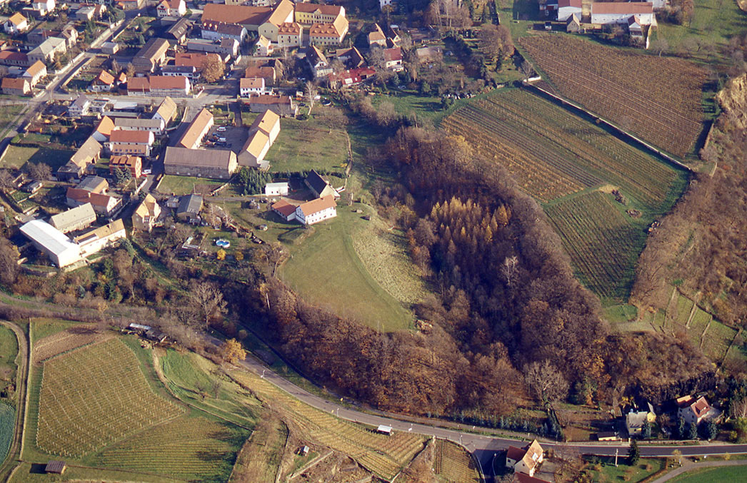
On a rocky spur near Zadel on the east bank of the Elbe are the ruins of an 11th century castle. Century. As early as 1074, historical sources mention a castle ward in Zadel (Zadili) for the first time. Even today, clear traces of the walls can still be seen on what is still known as "Burgberg“ Recognize known spur. The complex was presumably built as a German stronghold in the course of the eastern expansion of the East Frankish Empire. In contrast to the castle mountains in Zehren and Meißen, the spur in Zadel offers less natural protection. It is therefore assumed that the rampart was erected at a time when the empire already had bases in the hinterland far to the right of the Elbe and greater security already prevailed. According to this theory, Zadel Castle replaced Zehren Castle Hill as the seat of the Burgward and was only built after the latter was abandoned in the 2nd half of the 19th century. Half of the 11. Built at the end of the 19th century.
Annemarie ReckWall tracks on the spur
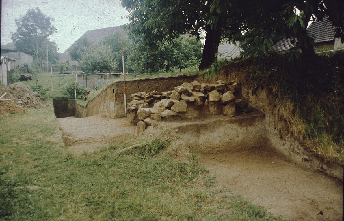
The spur in Zadel was protected by a rampart and sealed off with a transverse rampart. An additional rampart is barely visible due to overbuilding. The transverse rampart was breached in 1952 in favor of a property entrance. In 1982, an archaeological excavation was carried out on a section of the main rampart. This revealed that a double-shell, timber-reinforced wall construction with a ditch in front was concealed beneath the earth rampart that is still visible today.
Annemarie ReckImage Source R. Heynowski, Foto ©LfA 2006.
Wall and ditch
The wood-earth wall was around 2.5 m thick and faced on both sides with a dry stone wall. The outer front was quite well preserved, while only the lowest layer of the inner front was preserved. This was partially removed and severely damaged when a vineyard was planted in the 19th century. The ditch was up to 1.60 m deep and reached down into the bedrock. Its original width was 15 meters.
Annemarie ReckImage Source T. Gerlach, Foto ©LfA 1982.
Findings and findings
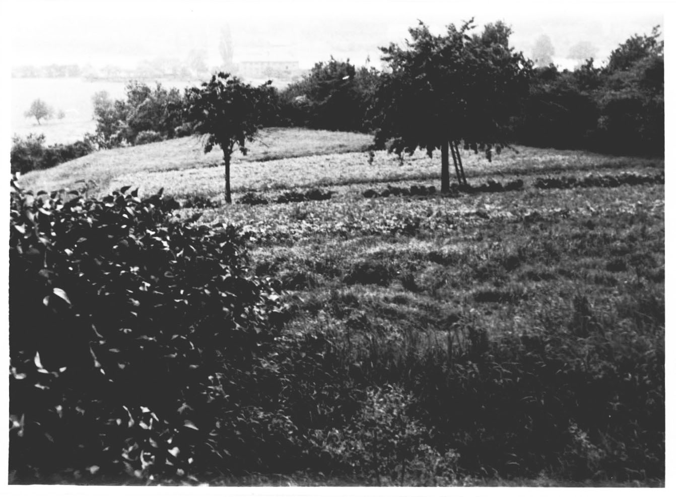
Due to the large-scale removal of the cultural layers when the vineyard was created in the 19th century, it is no longer possible to make any statements about the former inner buildings. The former outer bailey area is heavily built over, which is why nothing is known about its extent. However, some finds have been recovered in this area. The oldest finds date back to the Bronze Age. Some early medieval shards of typical "Slavic" design also indicate that the spur was already inhabited from the 10th century. However, it has not yet been possible to prove whether there was already a fortified settlement in earlier times, which served as a precursor to the high medieval castle complex.
Annemarie ReckImage Source H. Quietzsch, Foto ©LfA 1972.
Literature
Werner Coblenz/Thomas Gerlach, Grabungen am Burgwall Zadel, Kr. Meißen. In: Heinz-Joachim Vogt (Hrsg.), Archäologische Feldforschungen in Sachsen. Arbeits- und Forschungsberichte zur sächsischen Bodendenkmalpflege, Beih. 29 (Berlin 1984) 26 –30.
Werner Coblenz, Burgberg Zadel, der Nachfolgeburgwardsmittelpunkt von Zehren? In: Heinz-Joachim Vogt (Hrsg.), Archäologische Feldforschungen in Sachsen. Arbeits- und Forschungsberichte zur sächsischen Bodendenkmalpflege, Beih. 18 (Berlin 1988) 378–381.
Reinhard Spehr, Gana – Paltzschen – Zehren. Eine archäologisch-historische Wanderung durch das Lommatzscher Land (Dresden 2011) 185.
Note on monument protection
Archaeological monuments are protected by the Saxon Monument Protection Act. A permit under monument law is required for ground interventions or construction measures.
Permalink
https://archaeo-sn.de/en/ort/castle-hill-zadel/
Citation
Annemarie Reck, Castle Hill Zadel. In: Landesamt für Archäologie Sachsen, Website archaeo | SN (01.02.2024). https://archaeo-sn.de/en/ort/castle-hill-zadel/ (Stand: 13.10.2026)
