

Deserted village of Batwitz
| Place: | Falkenberg (Trossin, North Saxony) |
|---|---|
| Type: | Village desolation |
| Dating: | 1100 - 1400 AD. |
Description
In the forest between Kossa and Dahlenberg in the Falkenberg district, a roughly rectangular structure was discovered in 2015 during a review of the digital terrain model (DTM). These were the remains of a village that was abandoned in the Middle Ages, the deserted village of Batwitz. The few finds that came to light were mainly gray and light-colored pottery shards, which suggest that the site was used from the 12th century onwards. up to 14. Century speak. It is not known why the village was abandoned and deserted.
Ronald Heynowski/Annemarie ReckLocation of the deserted site
The village desert is located in an area of the "Halbmondweg", which is now a forest path, but dates back to an old road connection between Bad Düben and Dommitzsch. It is located approximately at the intersection of this path with the "Spathen", a historic route from Eilenburg via Pressel to Bad Schmiedeberg and on towards Wittenberg. In an entry on Johannes Humelius' map of the Torgau Heath from 1557-1562, this place is called "Badnitzer dorfsted". Other records refer to the place as Bathwicz or Batwitz. Another historical source mentions the name "Patenicz". However, the village, which still belonged to the castrum Torgau at this time, was already referred to as "villa deserta" in 1378.
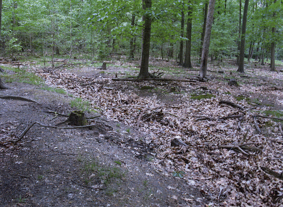
Ronald Heynowski/Annemarie ReckImage Source OA 8150, 308, Foto vom Wall und Dorfgraben ©LfA 2015.
Structure of the place
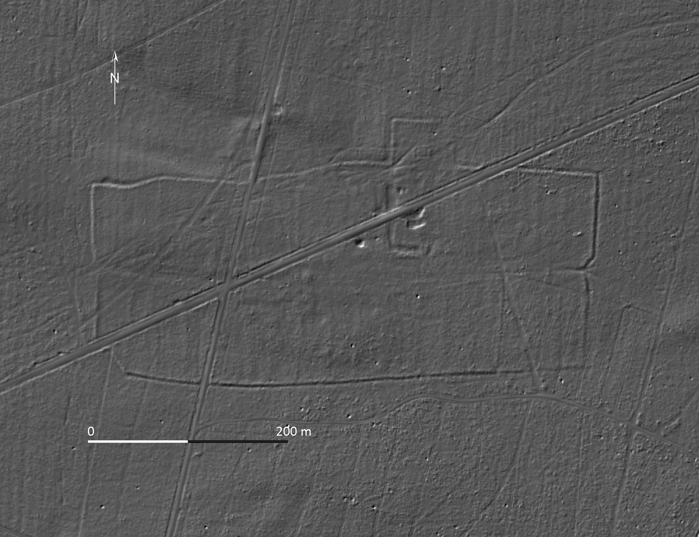
In the DTM, the deserted settlement appears as a rectangular, west-east aligned ditch structure. It has a maximum length of around 500 m with an average width of 220 m. Northeast of the center, the enclosed area was extended by a 65 m wide and 46 m deep, right-angled extension. The width of the ditch is largely constant at around 4 m. Its excavated material was heaped up on the inside to form a small rampart. There are gates roughly in the middle of the west and east sides of the village. At these points, the ditch recedes slightly and the lanes are conspicuously bundled together. The path between the two gates forms the central axis of the village. However, some of the lanes deviate significantly from this path from the western gate and lead parallel to today's half-moon path to the northeast in the direction of Dahlenberg.
Ronald Heynowski/Annemarie ReckImage Source R. Heynowski 2024, 145.
A manor house?
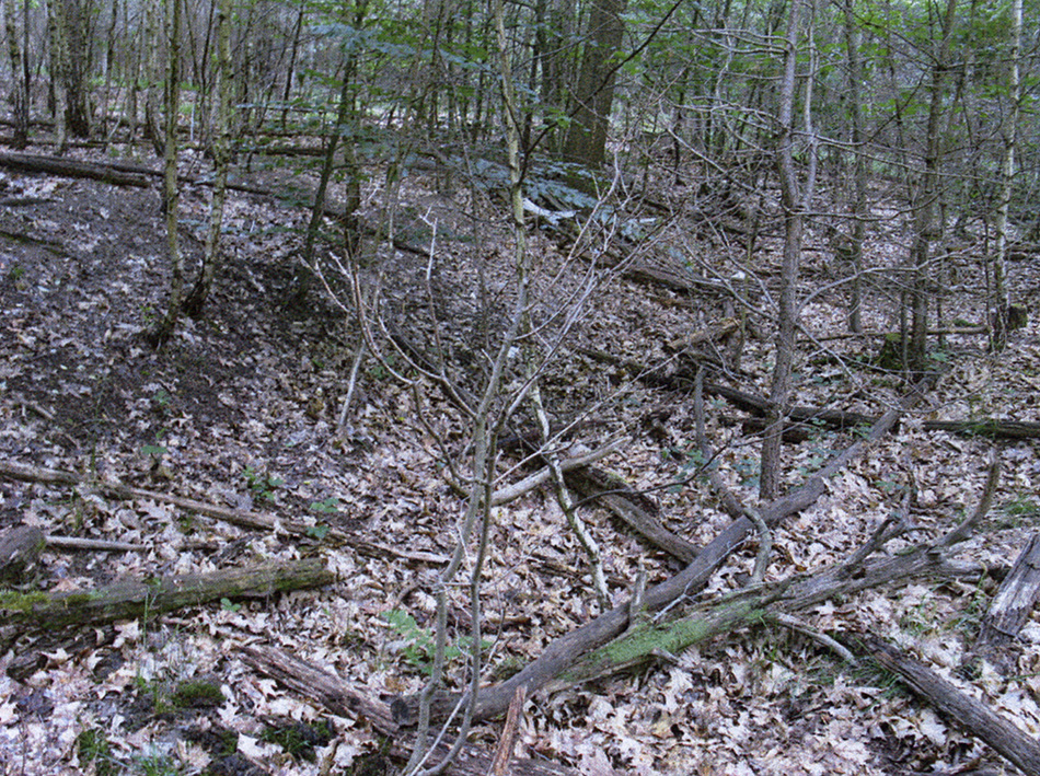
In the northern half of the village, just east of the center, there is another L-shaped ditch structure 7-9 m wide, of which only the western and southern parts remain. It can be assumed that there was originally also a section of ditch in the eastern part, which is now buried. In the north, the section connects directly to the extension outside the village moat, which makes it appear as a single unit. The size and extent of the L-shaped moat are reminiscent of the outer enclosures of moated castles, which were common in the late Middle Ages. There may have been a manor house on this site, which is no longer recognizable today due to modern disturbances.
Ronald Heynowski/Annemarie ReckImage Source OA 8150, 309, Foto vom Wall ©LfA 2015.
The church location
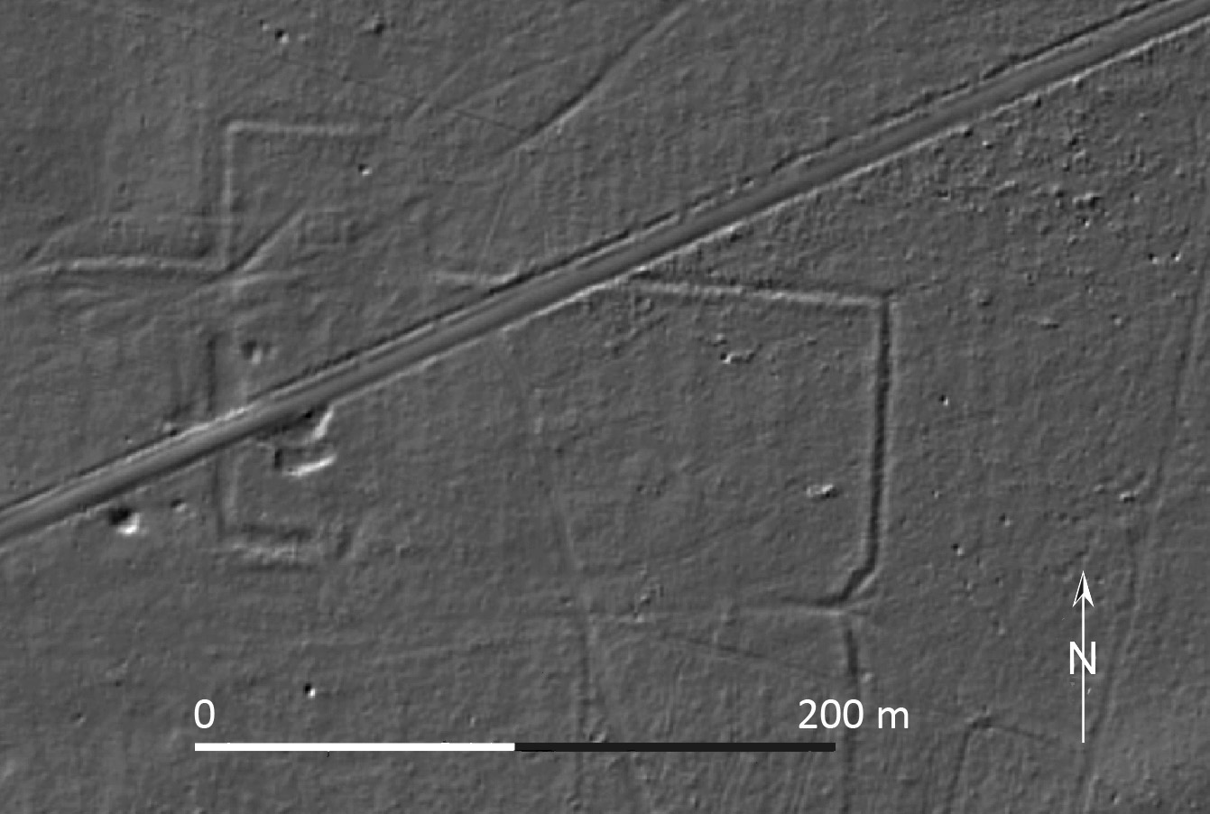
Within the rectangular extension to the north of the village area, there is a 7 x 11 m west-east aligned ditch structure in the middle. Both its size and orientation suggest that it is the excavation trenches of the foundations of a small church. The enclosed area around the building may have served as a village cemetery. The proximity of the manor house to the church and the slightly offset position of the church and farm area in relation to the rest of the village would support this interpretation. Surface finds of gray and light-toned ware from the area of the deserted site date from the 12th-14th centuries.
Ronald Heynowski/Annemarie ReckImage Source R. Heynowski 2024, 145, Detailansicht Nordosten.
Literature
Ronald Heynowski, Batwitz – Wüstung am Halbmondweg. In: Regina Smolnik/Ronny Zienert (Hrsg.), Höhenflüge. Luftbilder und Archäologie in Sachsen (Dresden 2024) 144–145.
Note on monument protection
Archaeological monuments are protected by the Saxon Monument Protection Act. A permit under monument law is required for ground interventions or construction measures.
Permalink
https://archaeo-sn.de/en/ort/deserted-village-of-batwitz/
Citation
Ronald Heynowski/Annemarie Reck, Deserted village of Batwitz. In: Landesamt für Archäologie Sachsen, Website archaeo | SN (05.09.2024). https://archaeo-sn.de/en/ort/deserted-village-of-batwitz/ (Stand: 29.09.2026)
