

A Bronze Age burial mound field in the southwest of the Thümmlitzwald
| Place: | Seidewitz-FR Thümmlitzwald (Grimma, Leipzig) |
|---|---|
| Type: | Burial Mound/Burial Mound Field |
| Dating: | Lusatian Culture | 1350–750 B.C. |
Description
The Bronze Age burial ground (1350–750 BC. Chr.) With about 50 mounds, it is one of the largest necropolises in the Free State and is located on the southwestern edge of the Thümmlitzwald on a plateau above the Freiberger Mulde. The cemetery has been known since the early 19th. Jh.
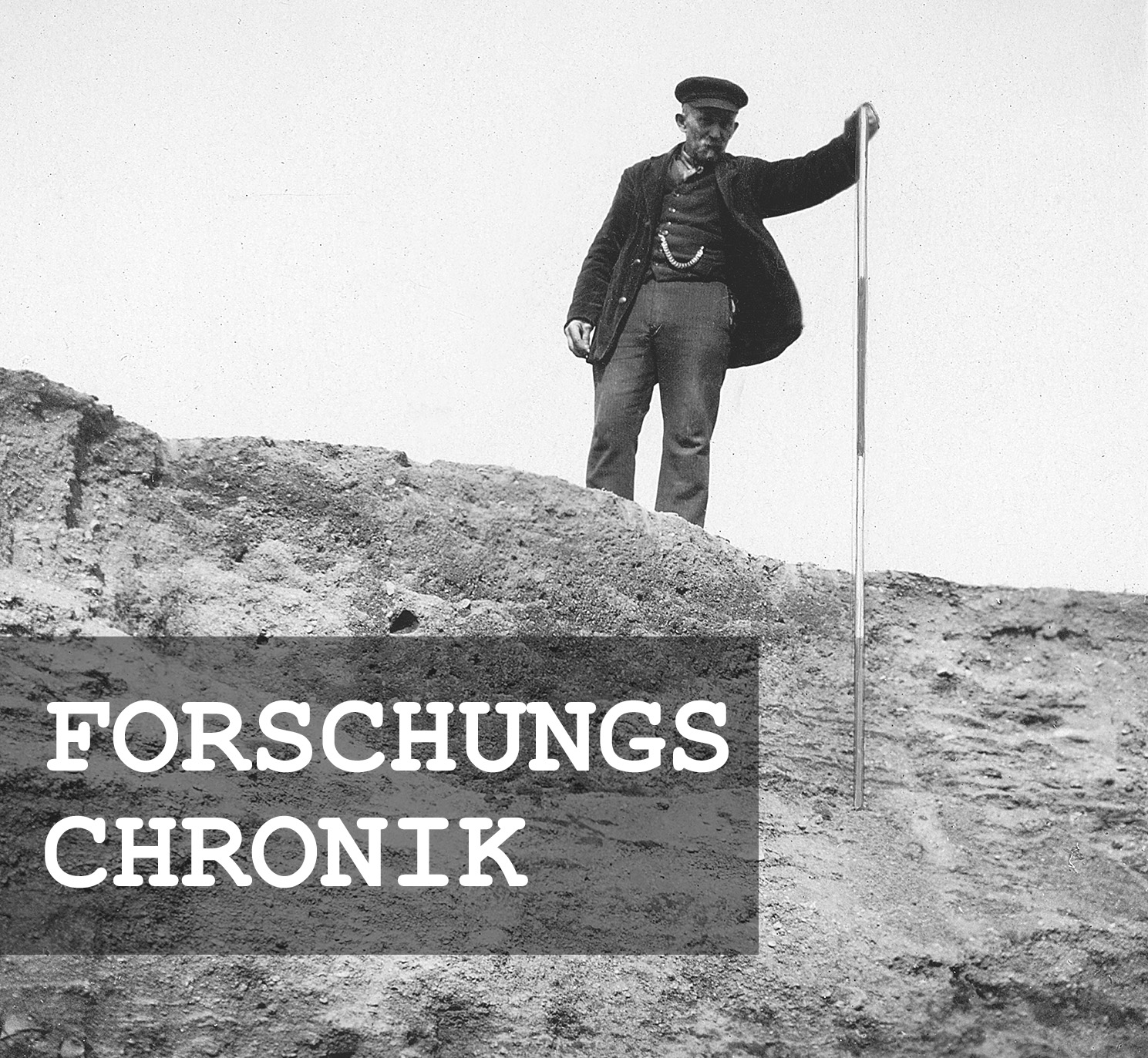
Michael StrobelResearch Chronicle
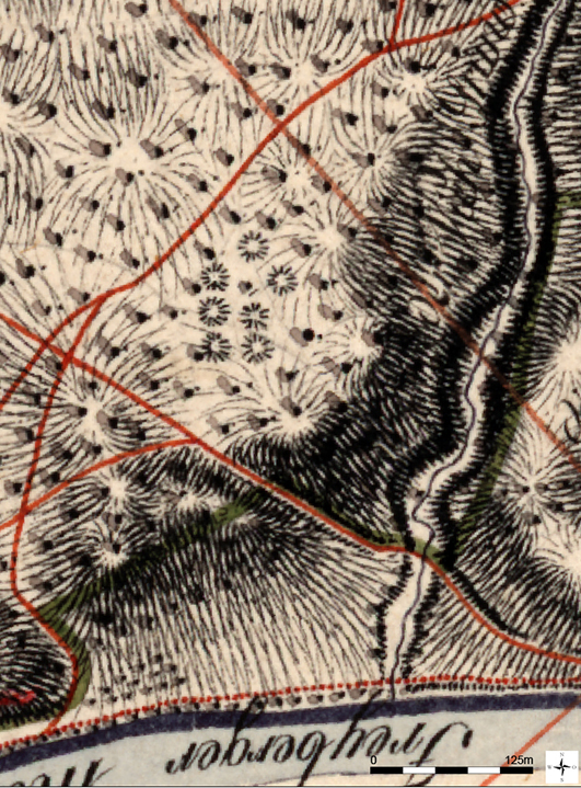
Around 1800 | Mapping in the Saxon Mile Map.
1820 | Investigation of a mound at the initiative of Count von Ronow, the Colditz forest ranger.
1885 | Further excavations by the Leisnig Historical and Archaeological Society.
1890 | Excavations led by Johannes Deichmüller.
1910 | Thinning operations in the area of the burial mounds.
1935 | Forest management by mutual agreement.
1943 | Large-scale clear-cutting in the area of the cemetery.
2018 | Storm damage caused by Hurricane Friedrike and subsequent removal of damaged timber.
Image Source Foto ©LfA 1929.
Detected early – mapped early
As early as 1844, Karl Benjamin Preusker (1786–1871), the tax collector of Großenhain, mentioned the mounds. This was likely aided by the fact that, although the Saxon survey map does not show the cemetery’s full extent, it does at least map the seven largest mounds.
Michael StrobelImage Source Berliner Meilenblatt ©Staatsbibliothek Berlin/SLUB/LfA Sachsen
Gaps in “cartographic memory”
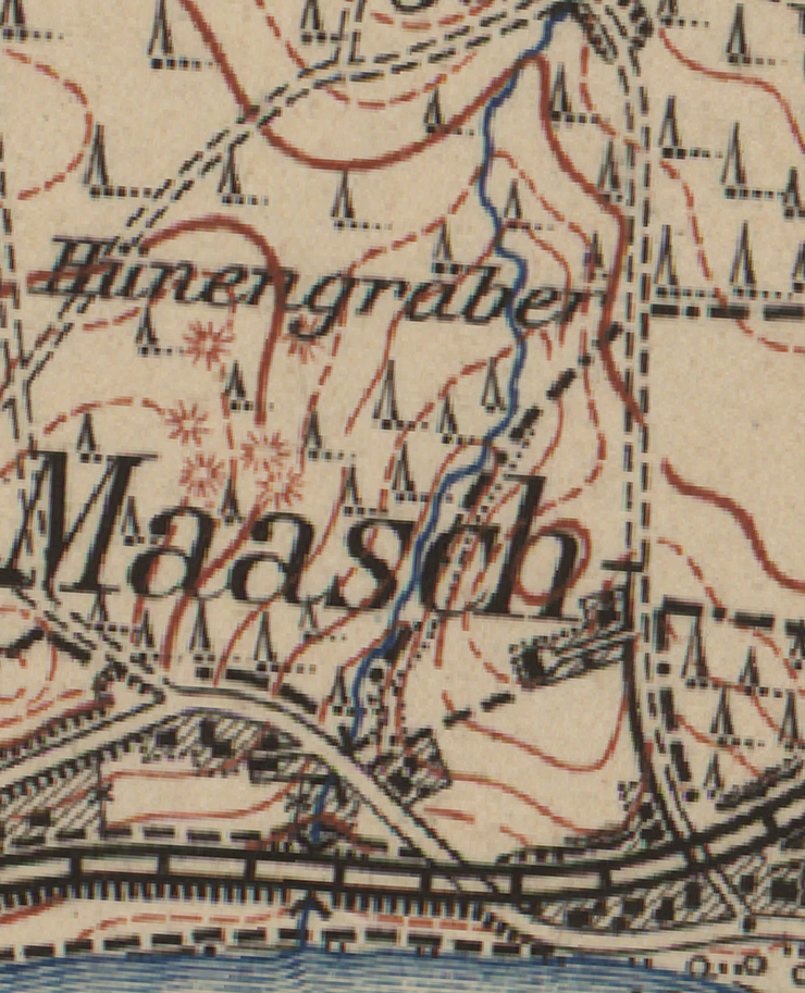
Although the 1876 equidistant map contains no reference to the necropolis, the burial mounds reappear in the 1907 topographic map as megalithic tombs. Since a general plan from 1890 has apparently been lost and the local file contains only a rough sketch of the site, the responsible foresters likely knew best just how large the necropolis actually is.
Michael StrobelImage Source Meßtischblatt Colditz 1907 ©SLUB
The Cemetery in the Digital Terrain Model (DTM)
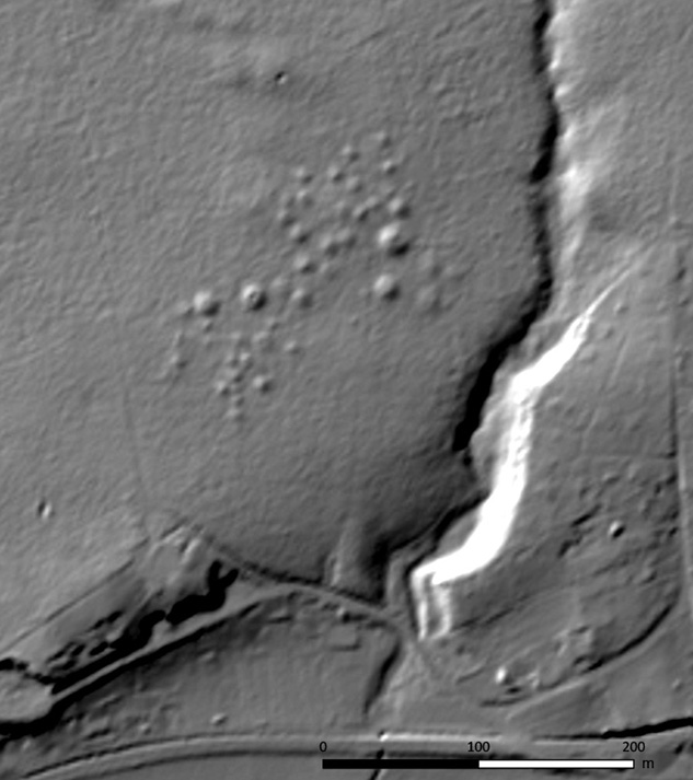
In fact, estimates of the number of mounds vary considerably. The exact extent of the necropolis and the size of the mounds therefore only became apparent decades later through the digital terrain model (DTM). Two spatially distinct groups are clearly visible in the northeast and southwest, respectively, each of which appears to be centered around two particularly large mounds. In total, the cemetery comprises 50 mounds, whose heights and diameters vary considerably.
Michael StrobelImage Source DGM ©GeoSN
Clear-cutting
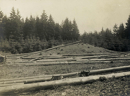
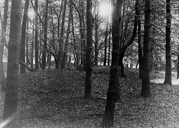
While the mounds in the open agricultural landscape would likely have been removed and leveled long ago, centuries of forest management have also left their mark on this archaeological site: Storm damage, clear-cutting, and reforestation efforts have repeatedly caused minor or major damage to the mound fill. Many disturbances can be attributed to 19th-century excavations, when members of regional antiquarian societies, among others, attempted to penetrate the center of the mounds from above or from the side using funnel-shaped trenches in order to reach a central burial site presumed to be richly furnished with grave goods. In 1820, Count von Ronow, the forest ranger of Colditz, had the largest burial mound excavated. This was followed in 1885 by another excavation led by Dr. von Lindenau in collaboration with the Leisnig Historical and Antiquities Society.
Michael StrobelImage Source Foto Ortsakte 4210a, 980 ©LfA 1910
A First “Scheduled” Excavation
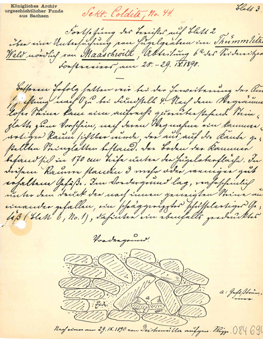
In the fall of 1890, Johannes Deichmüller, the Dresden curator of the prehistoric collection at the Royal Mineralogical and Geological Museum (1854–1944), the curator of the prehistoric collection at the Royal Mineralogical and Geological Museum in Dresden, finally felt compelled to conduct an excavation on a large mound that had already been “funneled.” The documentation meets the standards of the late 19th century and is extremely detailed.
Michael StrobelImage Source Ortsakte 4210a, 998 ©LfA 1890
A Hill in Profile
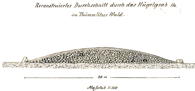
However, the depiction of the mound’s cross-section is highly idealized. According to this depiction, the fill consisted primarily of stone. In cavities protected by stone slabs stood urns filled with cremated remains. The top was covered with stone paving, which was in turn covered with soil. The base of the mound was bordered by a stone ring.
Michael StrobelImage Source Ortsakte 4210a, 995 ©LfA 1890
Full containers
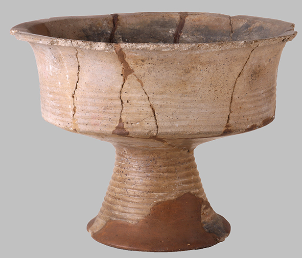
During the Bronze Age, it was customary to cremate the bodies of the deceased and to place the cremated remains or ashes in urns, which were often covered with a bowl. Other vessels, which could comprise entire sets of tableware, contained food or liquid offerings. Deichmüller succeeded not only in recovering individual shards but also in reconstructing nearly complete vessels. Earthenware pots, biconical vessels, fluted bowls, cups, and dishes are typical of the period around 1200 B.C. A high-quality, goblet-like vessel with a foot deserves special attention.
Michael StrobelImage Source Foto A. Kaltofen ©LfA 2023
Closeness to One's Ancestors
It is unclear for how long people were buried in the cemetery. The nearest Bronze Age settlements are only a few hundred meters away. However, based on current research, these settlements likely consisted of small hamlets or farmsteads that were relatively unstable and were relocated every few generations. The more mobile and scattered the population was, the greater their longing for permanence in death seems to have been. Over the decades, the continuous use of the cemetery led to the creation of ever-new mounds and thus to a steady expansion of the necropolis, which was likely accompanied by an intense cult of the ancestors.
Michael StrobelImage Source Foto J. Deichmüller, Ortsakte 4210a, 976 ©LfA 1908
Forestry and Historic Preservation
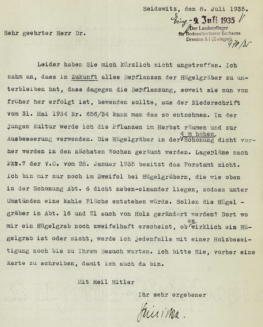
Officials at the state forestry administration were always aware of the significance of the burial mound field. However, just as it was impossible to forgo forestry operations, it was equally impossible to prevent storm damage and pest infestations. The use of forestry plows prior to replanting caused particularly severe damage. At least the responsible foresters were willing to coordinate their actions with Georg Bierbaum (1889–1953), the state curator for archaeological sites. Since the mounds are located not in private but in state-owned forest, the State Curator for Archaeological Monuments was not required to initiate their inclusion on the list of protected monuments under the Saxon Heritage Protection Act of 1934.
Michael StrobelImage Source Ortsakte 4210a, 1035 ©LfA 1935
New Challenges
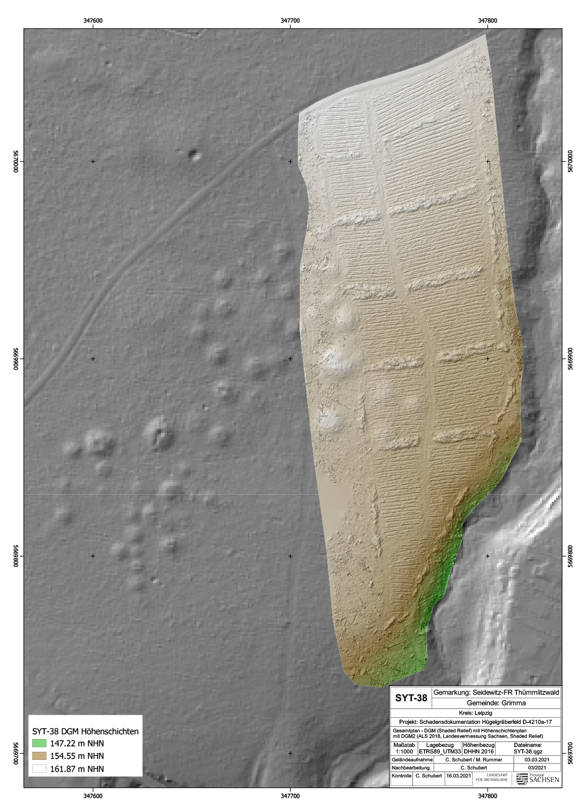
Climate change and bark beetle infestations are putting increasing pressure on forests. To prevent the pests from spreading further, areas affected by natural disasters must therefore be cleared within six weeks. In 2018, Hurricane Friederike caused devastating damage to the forests of Saxony, which had to be cleared as quickly as possible. During the subsequent clearing and replanting efforts, several mounds on the eastern edge of the cemetery were also affected. To prevent damage to the mounds in the future, plowing should therefore be avoided during reforestation.
Michael StrobelImage Source Karte C. Schubert ©LfA 2021, Grundlage DGM ©GeoSN
The forest is recovering
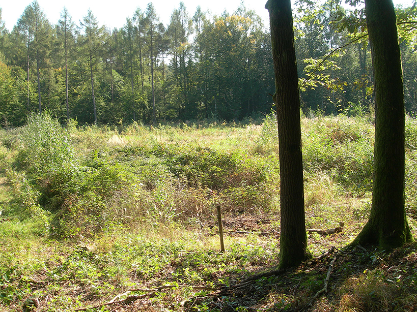
Almost eight years have now passed since the damaging event. In the large clearing, shrubs and trees are gradually beginning to take root through new plantings and natural regeneration. At this stage, it is difficult to make out the mounds beneath the dense vegetation. In a few decades, however, the monuments will once again be clearly visible, just as they are in the Hochwald to the west. Information signs help visitors get a sense of the burial mound field while they’re there.
Michael StrobelImage Source Foto M. Strobel ©LfA 2024
Note on monument protection
Archaeological monuments are protected by the Saxon Monument Protection Act. A permit under monument law is required for ground interventions or construction measures.
Permalink
https://archaeo-sn.de/en/ort/ein-bronzezeitliches-grabhuegelfeld-im-suedwesten-des-thuemmlitzwaldes/
Citation
Michael Strobel, A Bronze Age burial mound field in the southwest of the Thümmlitzwald. In: Landesamt für Archäologie Sachsen, Website archaeo | SN (08.01.2026). https://archaeo-sn.de/en/ort/ein-bronzezeitliches-grabhuegelfeld-im-suedwesten-des-thuemmlitzwaldes/ (Stand: 29.09.2026)
