

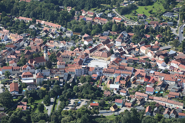
A Tragedy in Several Acts
| Place: | Radeburg (Radeburg, Meissen) |
|---|---|
| Type: | Water Castle |
| Dating: | High Middle Ages | Late Middle Ages | 1200–1500 A.D. |
Description
During the high Middle Ages, lower-ranking nobles played a key role in the development of the region east of the Elbe. In the Großehain region, numerous motte-and-bailey castles and moated castles bear witness to this process, which took place during the late 12th. Jh. began and continued into the 13th. Jh. continued. Many of them can still be seen and experienced above ground today. Of course, this does not apply to the fortification that was located on the northern outskirts of Radeburg, at the foot of the lower terrace in the Röder floodplain. It may be the manor house of a "Hermannus de Radeburch"“, which is first mentioned in a document in 1248. To what extent was the 1289 considered an “oppidum”“ The first documented planned urban layout, dating from around the middle of the 13th. Jh. had achieved must remain open.
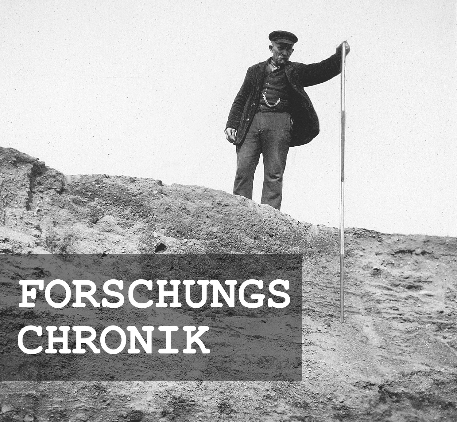
Michael StrobelResearch Chronicle
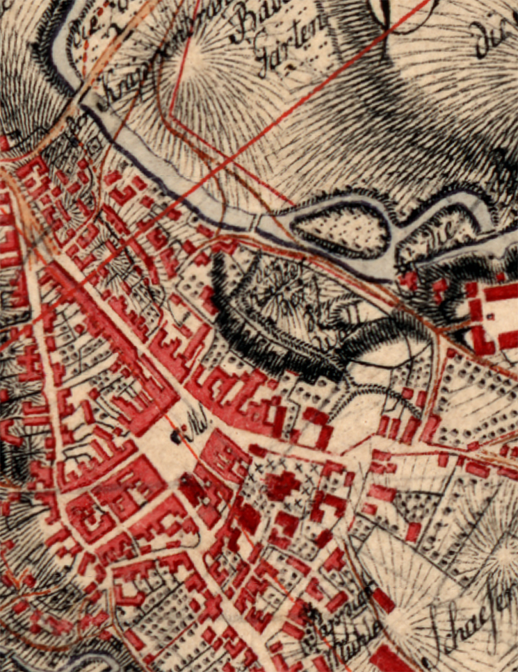
Around 1800 | Mapped as “Der Wall” in the *Berliner Meilenblatt*.
August 1934 | State Conservator Georg Bierbaum learns of the leveling of the former moated castle.
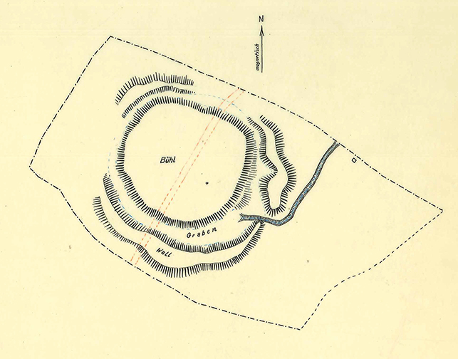
August 28, 1934 | Johannes Schmidt, an employee of the State Conservator, draws up a plan.
August 29, 1934 | Can historic preservation and development coexist?
October 30, 1934 | Bierbaum asks Professor Kurt Tackenberg of Leipzig for help.
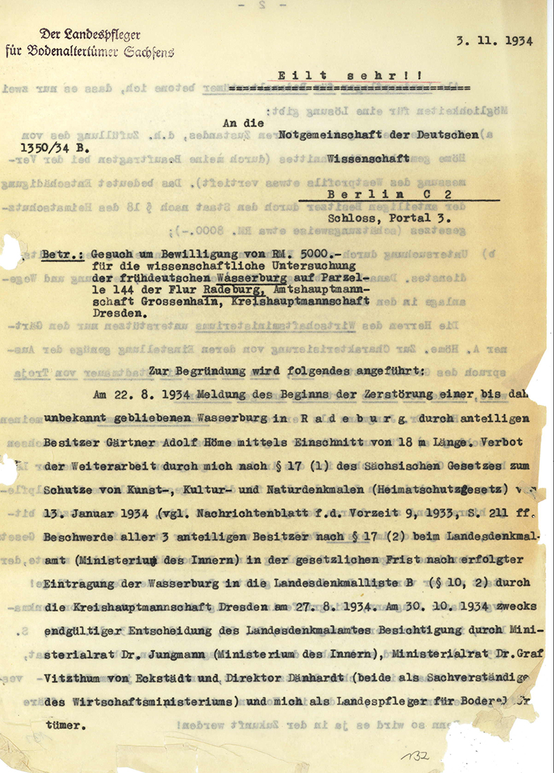
November 3, 1934 | An urgent appeal to the Emergency Association of German Science.
December 6, 1934 | The Dresden District Administrator approves the leveling and development of the site.
December 8, 1934 | The State Conservator files an appeal with the Supreme Authority for the Protection of Historical Monuments.
January 11, 1935 | The Ministry of the Interior rejects the appeal.
1937–1938 | A final review.
September 1938 | The monument is finally permitted to be leveled.
Image Source Foto ©LfA 1929.
Mapped in the Meilenblatt
Even though the depiction of the town and countryside in the *Meilenblatt* should not be retroactively applied to the early modern period or even the Middle Ages, it is nonetheless astonishing how much of the historic site must still have been intact around 1800. The entry “Der Wall” refers to a moated castle that likely consisted of a central, palisade-fortified mound approximately 30 meters in diameter and a moat, which in turn was surrounded by an outer rampart. The total diameter is estimated to have been about 60 m.
Michael StrobelImage Source Berliner Meilenblatt, Auszug ©LfA/SLUB 2025.
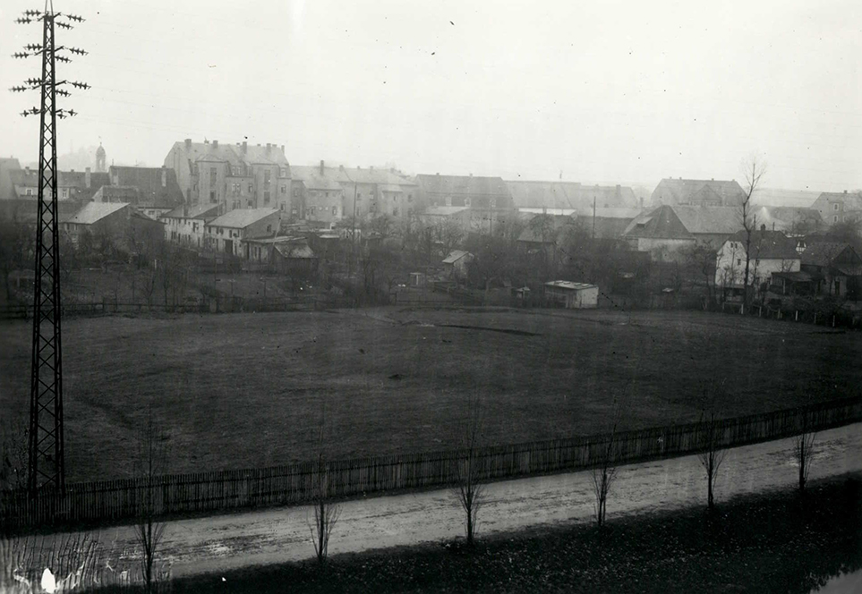
An untouched wetland meadow
Until the early 1930s, the meadowland belonged to the Stolberg-Roßla estate, headquartered at the neighboring manor, which managed 150 ha of farmland, 33 hectares of meadows, and 486 hectares of forest in the Radeburg area. The former “castle garden” south of the Röder River was certainly not a particularly productive area. Even to the untrained eye, the flattened castle complex must have been clearly recognizable in the meadow area in the early 1930s.
Michael StrobelImage Source OA 30660, 87 ©LfA 1934.
An Initial Master Plan
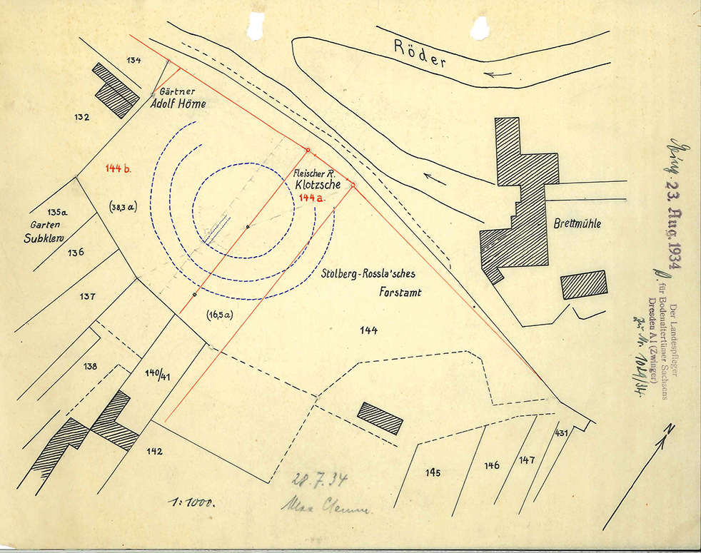
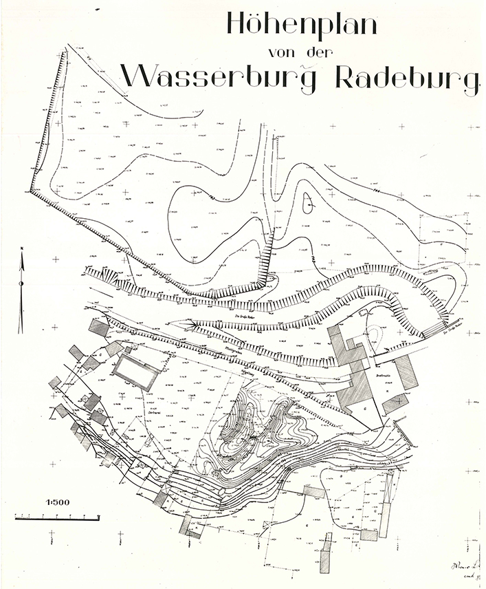
In August 1934, Georg Bierbaum (1889–1953) learned from the former school principal Subklew in Radeburg that the nursery owner Adolf Höme had purchased the northwestern plot of land and had begun leveling the moated castle there. Police Sergeant Johannes Schmidt, who had been seconded to serve as a regional administrator, was dispatched to Radeburg and drew up an informative site plan that depicts the condition of the castle prior to its leveling. Apparently, water from the Röder River could be channeled into the approximately 8-meter-wide moat via a narrow connecting channel on the eastern side.
Michael StrobelImage Source OA 30660, 239 ©LfA 1934.
Fragmented Ownership
On the neighboring property, the construction of an access road planned by master butcher Klotzsche would also have resulted in significant alterations to the complex. Only the estate owners’ intentions regarding the southeastern plot—on which, admittedly, only the smallest portion of the castle stood—remained unclear. In response to the order to halt the earthwork, the gardener threatened to seek damages if he were unable to plant his young seedlings.
Michael StrobelImage Source OA 30660, 91 ©LfA 1934.
Preliminary Agreement
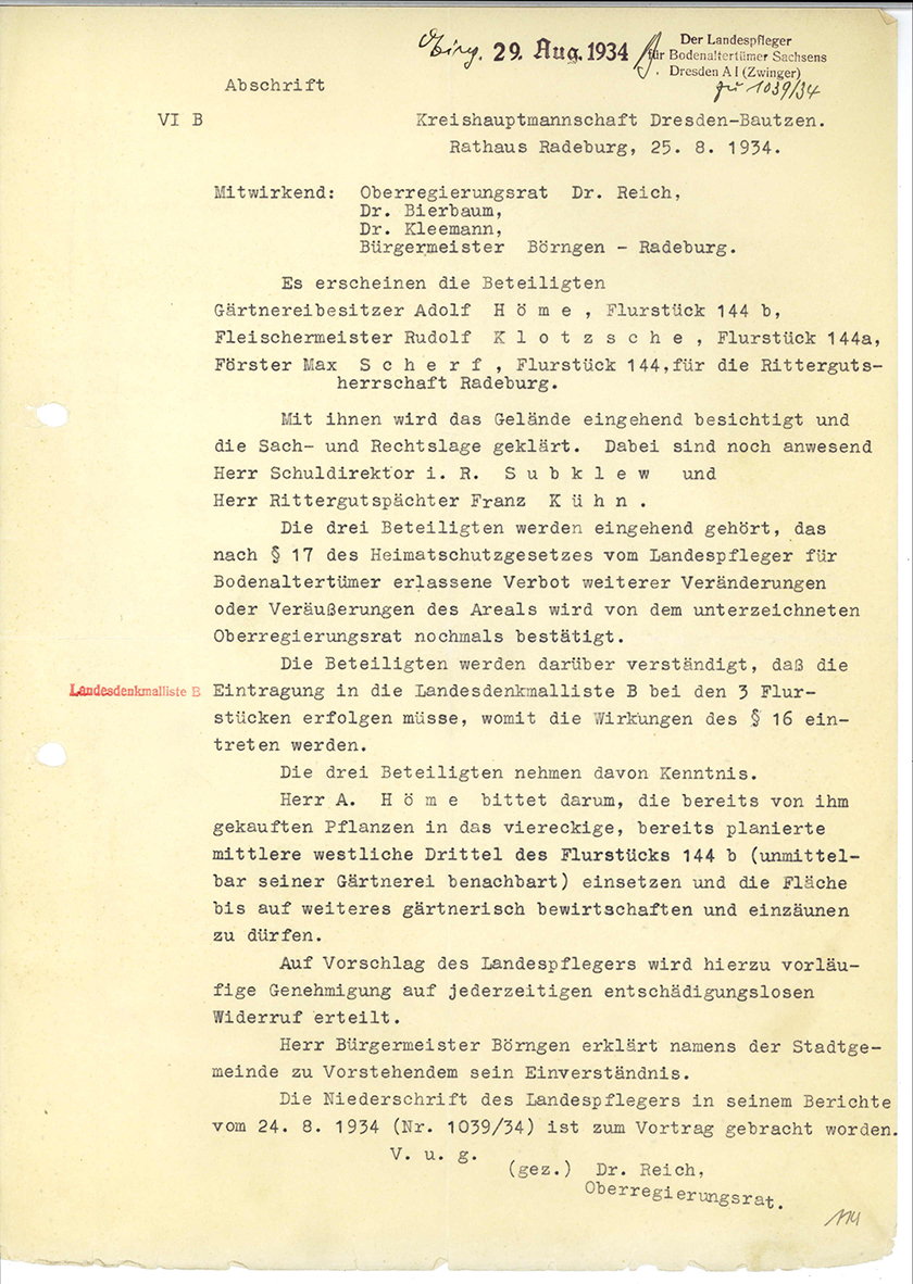
During an on-site meeting that included a hearing at City Hall and a thorough site inspection, the representative of the Dresden-Bautzen District Administration confirmed to the owners, on the one hand, the prohibition on alterations and sales pursuant to Section 17 of the “Historic Preservation Act” enacted in January, and, on the other hand, the nursery owner was granted permission to plant in the already leveled western portion of the property. The surveying and documentation work on the excavated profile continued into the fall. In the trench dug by the gardener, not only High Medieval pottery but also wooden objects—including barrel staves and a club—were uncovered, all of which had been preserved in wet sediments. The dating to the 12th/13th century is thus supported by numerous pieces of evidence and is consistent with the first documented mention in the first half of the 13th century.
Michael StrobelImage Source OA 30660, 114 ©LfA 1934.
A Conflict Between Historic Preservation and Economic Interests
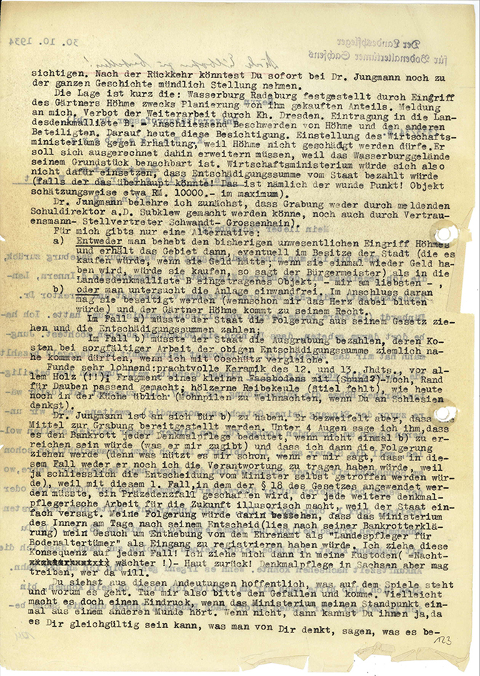
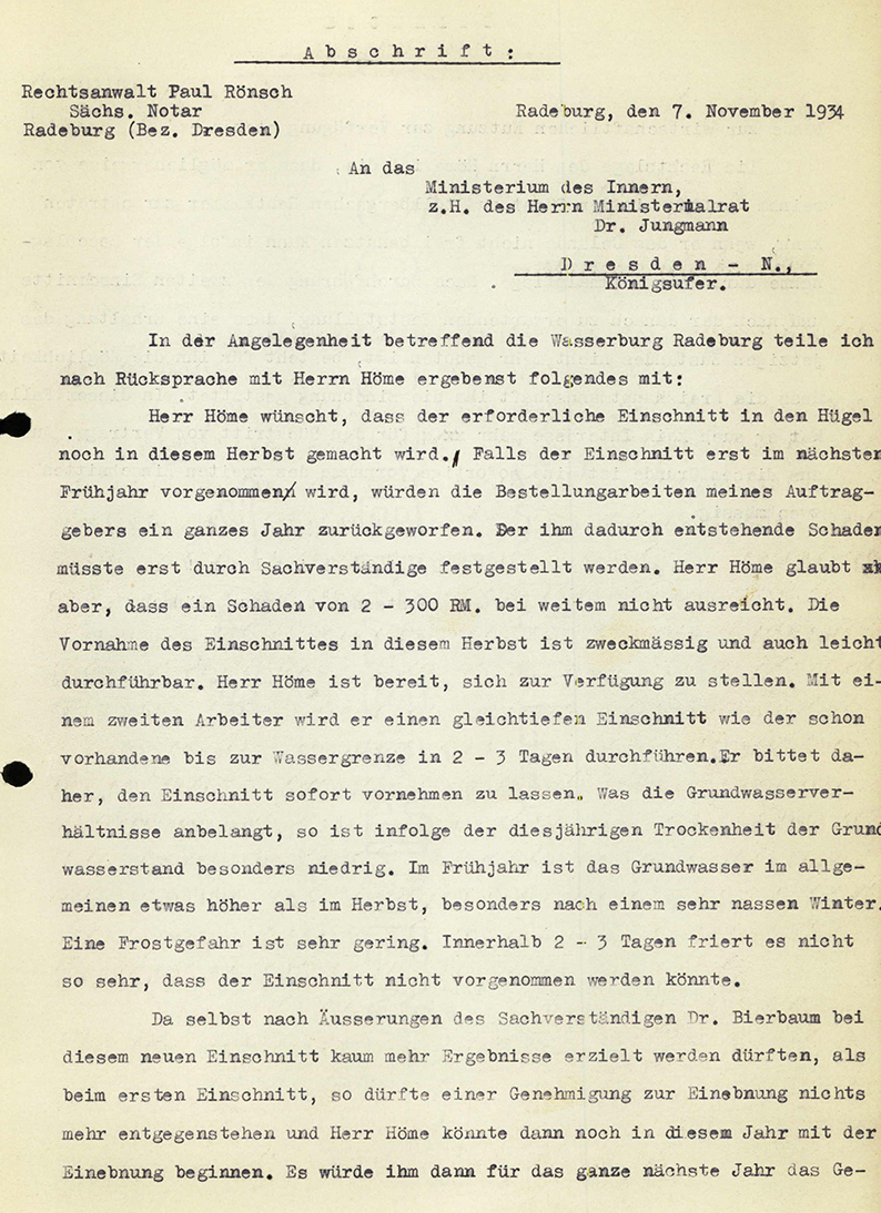
When Höme failed to honor the agreement and planted additional plants on the leveled soil, Bierbaum contacted Kurt Tackenberg (1899–1900), who had been appointed professor of prehistory and early history at the University of Leipzig that spring, requesting an expert opinion and an on-site inspection. Since neither the Ministry of Economic Affairs nor the Ministry of the Interior was willing to advocate for the acquisition of the land—and thus the preservation of the monument—and even an excavation threatened to fail due to a lack of funds, the State Conservator sought allies. After all, in this precedent-setting case, the credibility of the state’s archaeological preservation efforts and the new Heritage Protection Act as a whole was at stake. Bierbaum even threatened to request his dismissal from his new “honorary position” as State Curator.
Michael StrobelImage Source OA 30660, 123 ©LfA 1934.
Futile Efforts to Secure Third-Party Funding
For health reasons, the professor from Leipzig was unable to travel to Radeburg. Bierbaum’s efforts to raise 5,000 RM for an excavation from the Emergency Association for German Science were equally fruitless. Even Theodor Wiegand (1864–1936), president of the German Archaeological Institute, who was recuperating in Württemberg in May 1935, was unable to help him. In this situation, it was only a small consolation that the Supreme Authority for the Protection of Historical Monuments had rejected the three owners’ appeals against the site’s inclusion on the State List of Historical Monuments B (archaeological sites) on formal and substantive grounds.
Michael StrobelImage Source OA 30660, 132 ©LfA 1934.
The dispute continues
As long as the funding for the excavation remained unresolved, Bierbaum refused to comply with the demand made by the lawyer hired by von Höme to begin excavations that winter. For without “a scientific excavation that is flawless in every respect,” the castle could not be leveled as the nursery owner desired. Consequently, in December 1934, he had no choice but to file an appeal with the Supreme Authority for the Protection of Historical Monuments against the permit issued by the district administration—which was limited to two parcels of land—to level the moated castle and build on the site.
Michael StrobelImage Source OA 30660, 148 ©LfA 1934.
The monument may be destroyed
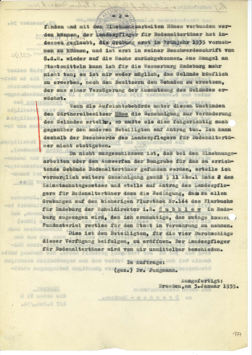
He could hardly have expected that, in January 1935, the Ministry of the Interior would side with the lawyer and the district administration and reject his complaint. The county administrator, however, does not seem to have remembered his announcement that he would request to be relieved of his “honorary position” in this case. In any case, from then on he was forced to stand by helplessly as the nursery owner, year after year, created a fait accompli and gradually destroyed the significant cultural monument. All attempts to acquire the Wasserburg or to raise funds for an excavation had failed.
Michael StrobelImage Source OA 30660, 177 ©LfA 1935
The Last Remnant
When Höme acquired the third plot of land in late 1936, Bierbaum could do nothing more than have these last remaining parcels surveyed once again. The survey was conducted by surveying student Werner Lorenz with the support of the Reich Labor Service (RAD) as part of a thesis under Prof. Werkmeister, the director of the Geodetic Institute at the Dresden University of Technology, with whom the land surveyor had been collaborating for some time.
Michael StrobelImage Source OA 30660, 85 ©LfA 1935
The “Public Benefit of Prehistoric Research”
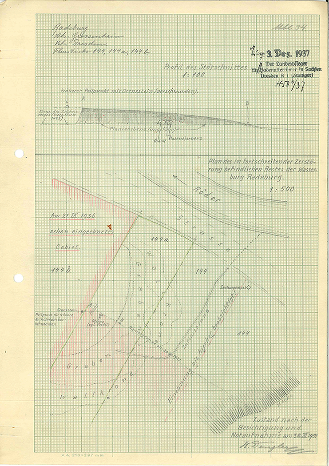
In December 1937, Bierbaum’s technical assistant stood facing nothing but a pile of rubble: Hermann Dengler (1890–1945), who sketched a rough plan showing what remained of the Wasserburg on this property after the gardener’s grading work—work that had been carried out without ever obtaining the necessary approval under historic preservation laws. For a final archaeological survey, which ultimately took place in the summer of 1938, the state heritage officer was even willing to withdraw his criminal complaint against Höme.
Michael StrobelImage Source OA 30660, 219 ©LfA 1937
Just not visible
This resolved the historic preservation concerns regarding the gardener’s final leveling of the site. However, everything that remained in the ground was still protected as a historic site. For this reason, deep tilling continued to be subject to prior approval. Although nothing of the structure is visible on the site today (bottom front), one must still expect to find remnants of the rampart, ditch, and hill even on sealed surfaces, as well as pottery, red clay, or charred wood—and even organic materials, particularly wood, which may have been preserved in water-bearing layers in the absence of oxygen. The historic site has therefore by no means been completely removed.
Michael StrobelImage Source R. Heynowski, Foto ©LfA 2025.
Note on monument protection
Archaeological monuments are protected by the Saxon Monument Protection Act. A permit under monument law is required for ground interventions or construction measures.
Permalink
https://archaeo-sn.de/en/ort/ein-trauerspiel-in-mehreren-akten/
Citation
Michael Strobel, A Tragedy in Several Acts. In: Landesamt für Archäologie Sachsen, Website archaeo | SN (05.12.2025). https://archaeo-sn.de/en/ort/ein-trauerspiel-in-mehreren-akten/ (Stand: 29.09.2026)
