

Goldkuppe with Heinrichsburg Castle
| Place: | Seußlitz (Nünchritz, Meißen) |
|---|---|
| Type: | Fortified system |
| Dating: | Later Bronze Age | Lusatian culture | High Middle Ages | 1350 - 800 B.C. | 1170 - 1300 A.D. |
Description
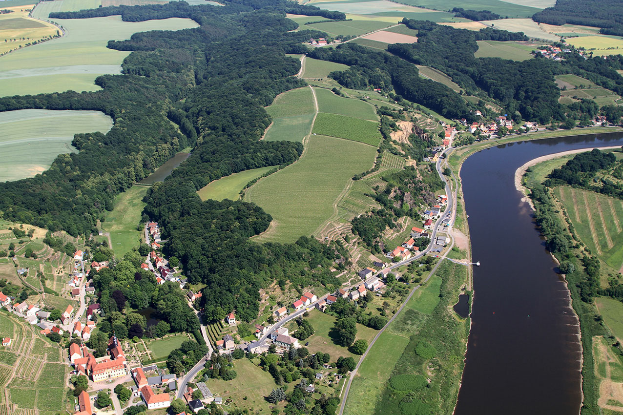
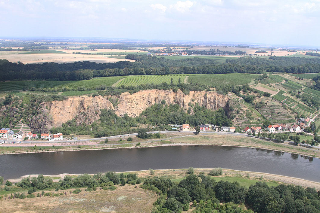
The flat, elongated mountain plateau rises approx. 65 m above the Elbe between Diesbar and Seußlitz. The Goldkuppe still covers an area of 18 hectares today. This makes it the largest prehistoric castle complex in Saxony. Before the damage caused by quarry work in the 19th century. and 20. In the 19th century it may even have been up to 20 hectares. It is protected on three sides by natural steep slopes. The complex is also surrounded by a 2 km long ring wall. The fortifications date back to the Bronze Age Lusatian culture. In the far north-west, literally cut out of the prehistoric ring wall, is the high medieval tower mound castle "Heinrichsburg“.
Annemarie ReckAccess and fastening
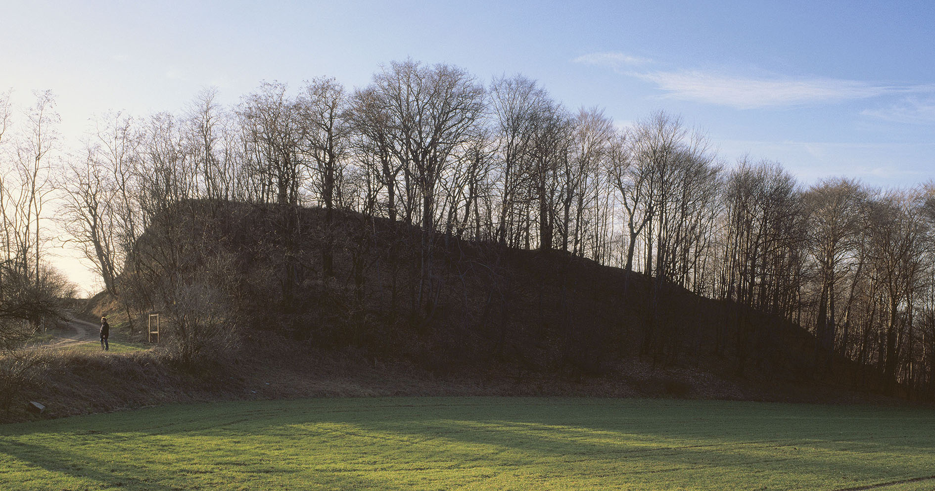
The original access to the plateau was probably in the south-east, above the "Brummochsenloch". In the east, where the plateau was connected to the hinterland by a ridge, was the most vulnerable point for the castle. Here, a section of rampart was piled up to 50 m wide and up to 18 m high. Originally, only this imposing rampart bore the name "Goldkuppe".
Annemarie ReckImage Source R. Heynowski, Foto ©LfA 2010.
Link smac 360°
Main wall
The rampart in the east was probably built in several phases. This is indicated by its stepped appearance. Inside it is a wood-earth wall consisting of wooden boxes filled with clay and stones. Red clay and numerous charred beams indicate a violent fire. After the Second World War, the local population dug cavities in the rampart in the area of the modern path in order to extract charcoal for heating.
Annemarie ReckImage Source J. Lipták, Foto ©LfA 2000.
Cavities in the wall
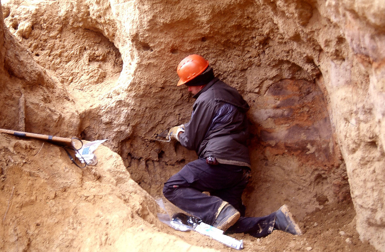
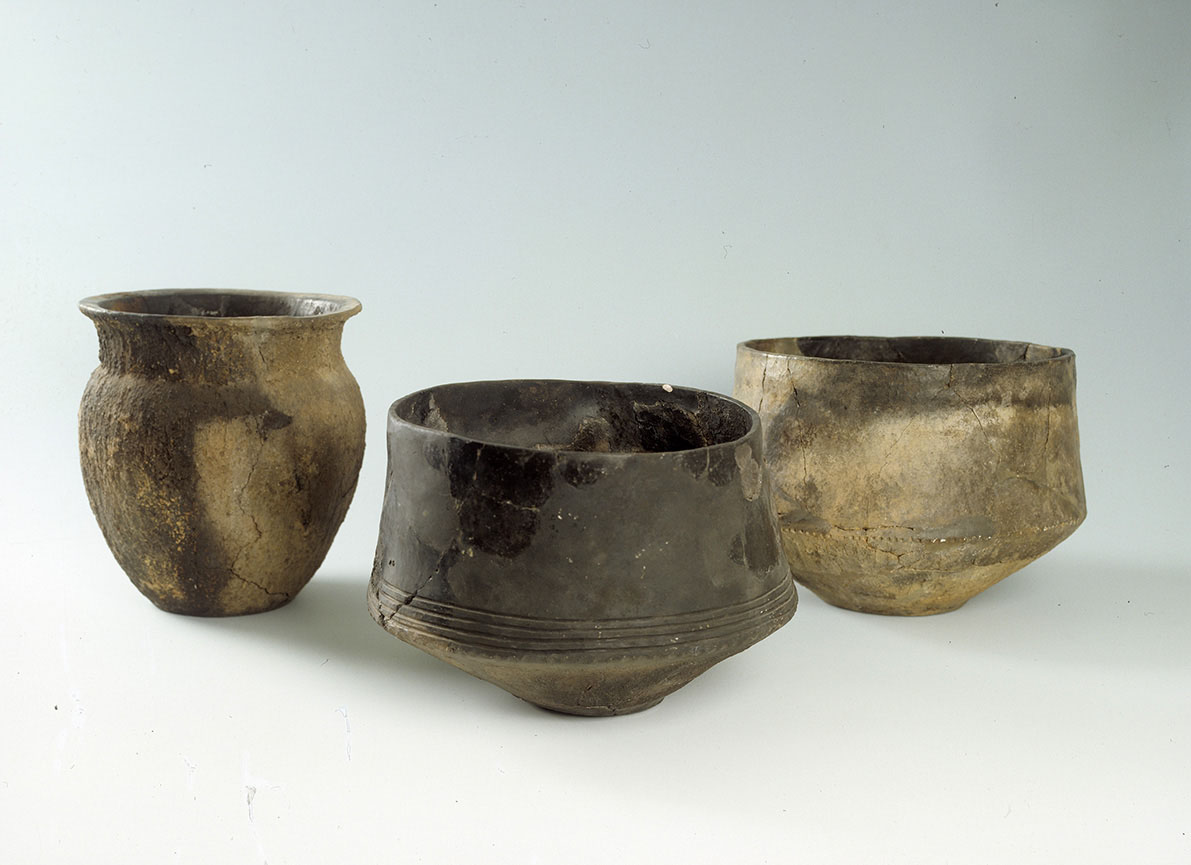
In 1971, children playing about 3 m below the top of the rampart discovered what was probably a prehistoric cavity. Several almost completely preserved vessels were found in it, which still contained charred food, presumably barley porridge. The vessels are typical forms of the Lusatian culture. It is unclear whether the small cavity is a kind of guardhouse or a deposited building sacrifice. The modern cavities allow the experts a glimpse into the structure of the rampart.
Annemarie ReckImage Source E. Lorenz, Foto ©LfA 2004.
Water supply to the castle
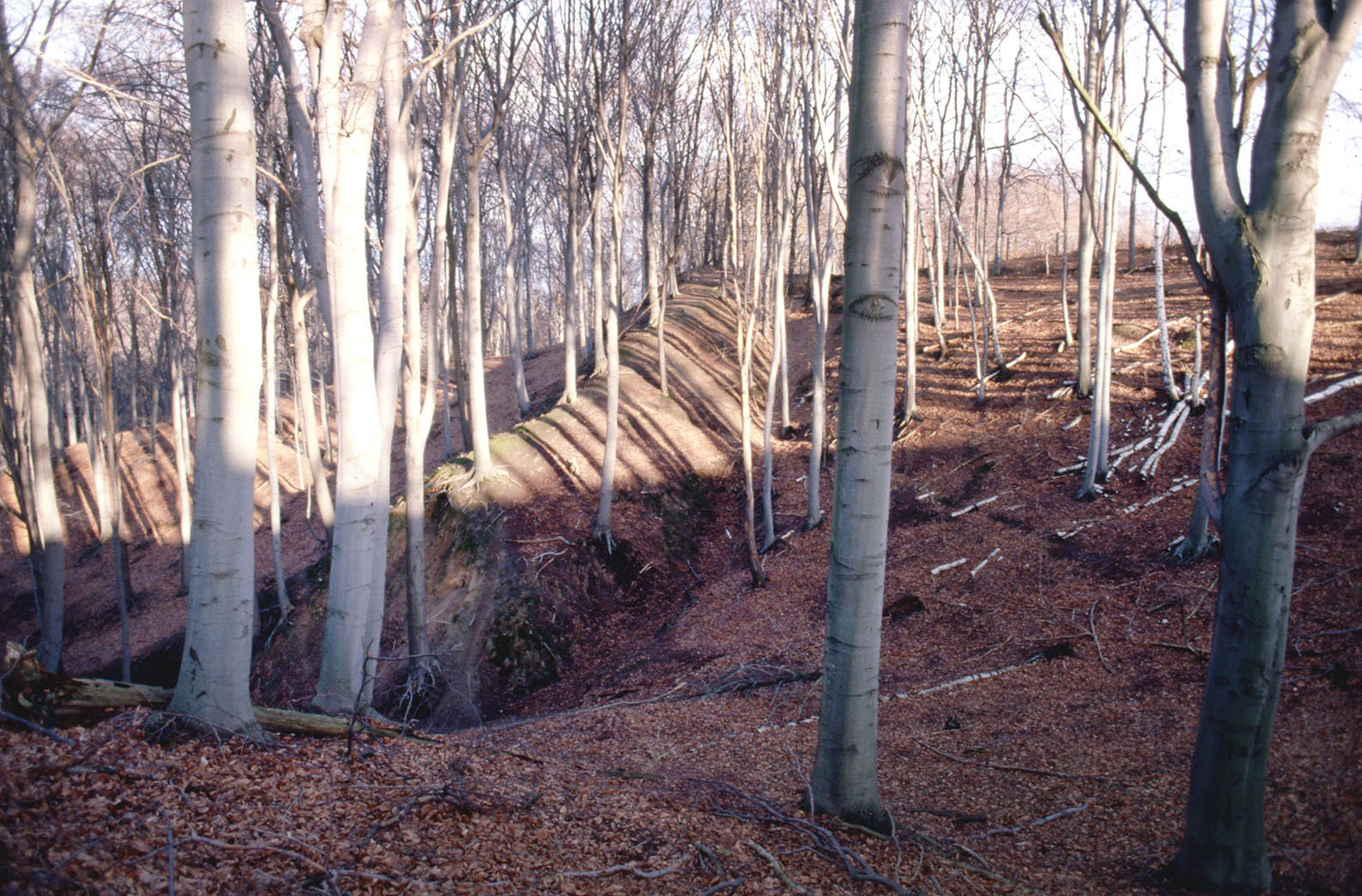
A second rampart is located approx. 50 m from the main rampart. Due to the agricultural use of the area, this is now heavily eroded and only faintly recognizable in the adjacent forest area towards Seußlitzer Grund. The fortification also includes a spring in the so-called Eckholz on the northern flank. The rampart reached a height of 11 m here and dammed up the water in the spring hollow to form a water reservoir for the inhabitants of the castle complex.
Annemarie ReckImage Source J. Lipták, Foto ©LfA 2000.
Stone mill depot
In the south, in the area of the "Böser Bruder" quarry, a deposit of three stone mills came to light in 1935. They showed no signs of use and lay in a deep pit on a bed of pottery shards. It can therefore be assumed that they had been deposited for ritual purposes rather than simply as a warehouse. The finds date from between 1000-700 BC. The stone from the mills came from a nearby Bronze Age quarry on the Kleiner Göhrisch. The "Böser Bruder" quarry has no longer been in operation since the mid-1960s, but the edges of the plateau are still at risk of erosion.
Annemarie ReckImage Source R. Heynowski, Foto ©LfA 2010.
The colonization
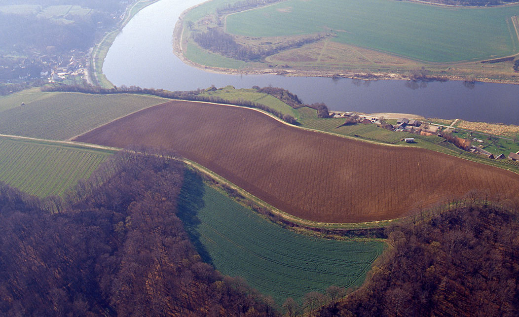
For a long time, only a few Late Bronze Age finds were known from the huge inner area. As early as 1966, the loess plateau, which had previously been used as arable land, was converted into a vineyard. After forty years, in the winter of 2006/2007, the vineyard was to be rejuvenated. For this purpose, a 6 ha area was extensively cleared and plowed up. This gave the researchers the opportunity to walk over the freshly plowed area for the first time. Concentrations of finds and, due to the changing coloration and type of soil, also settlement focuses could be determined. In between, however, there were always large, almost empty areas, which speak against a dense settlement on the plateau.
Annemarie ReckImage Source R. Heynowski, Foto ©LfA 2007.
Finds and use
In 1933, a fragment of a bracelet from the Lusatian culture was discovered during fieldwork and a two-bladed arrowhead is known from the area of the main rampart. The pottery remains found indicate that the site was mainly used between 1200-800 BC. It is possible that the fortification was only used on special occasions or as a refuge for the surrounding settlements. This is because numerous burial grounds and settlements are known from the area around the Goldkuppe. It is therefore quite conceivable that the mountain plateau could have played a role as a central location.
Annemarie ReckImage Source U. Wohmann, Foto ©LfA 1998.
Link archaeo | 3D
Tower hill castle Heinrichsburg
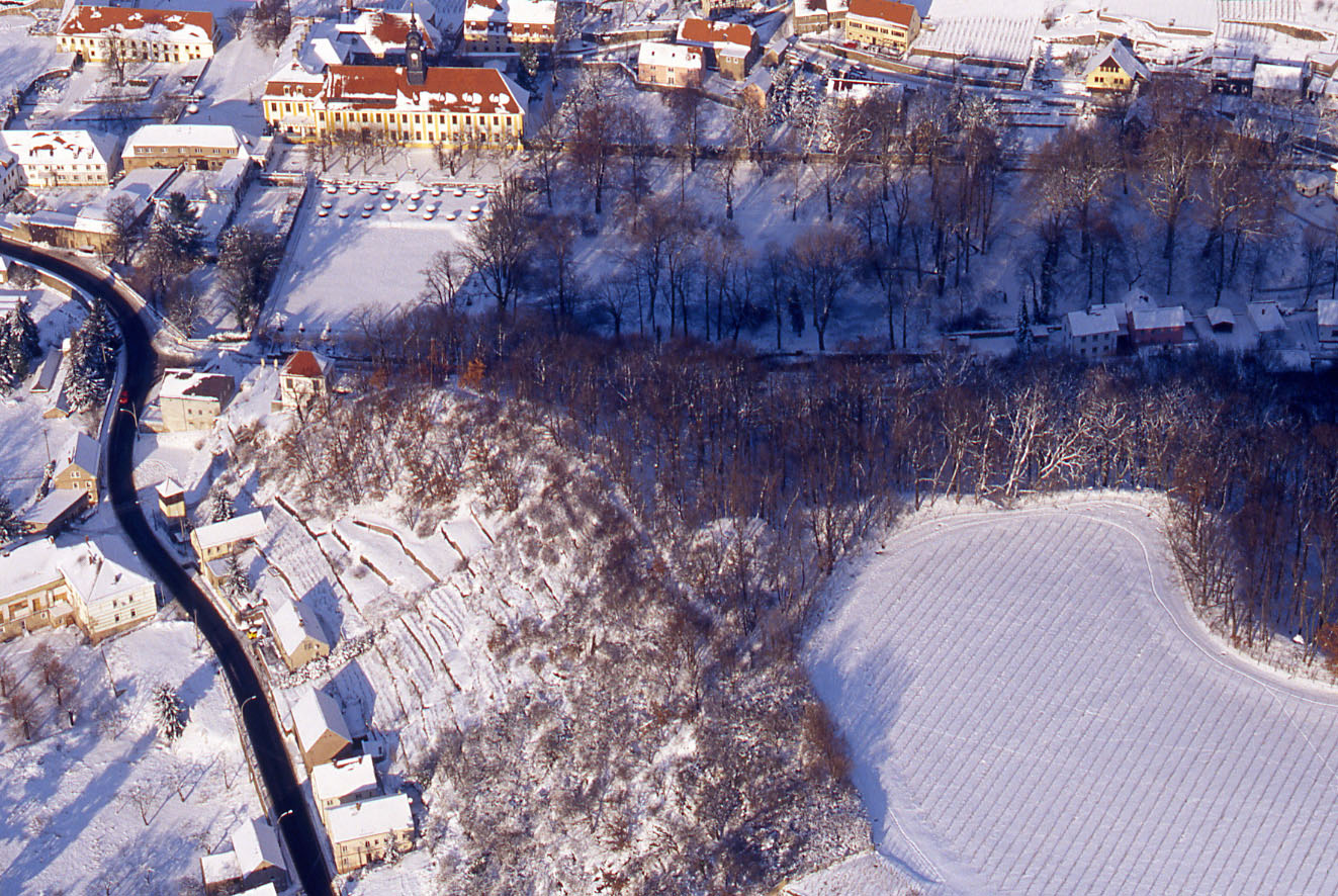
Otto von Suselitz built Heinrichsburg Castle at the end of the 12th century. This was a typical structure for the time, known as a motte or tower mound castle. On an artificial hill surrounded by palisades and a circular moat, a mostly wooden tower structure was erected, which served as the residence of the mostly lower-ranking noble family. In the case of Heinrichsburg, a section to the north-west of the existing rampart was cut off and transformed into a tower mound castle. Today, the small garden house on the hillside also bears the name Heinrichsburg.
Annemarie ReckImage Source R. Heynowski, Foto ©LfA 2008.
Literature
Werner Coblenz, Die Burgen an der Rauhen Furt und ihre Vermessung. Arbeits- und Forschungsberichte zur sächsischen Bodendenkmalpflege 6, 1957, 367–416.
Werner Coblenz, Die Wehranlage Goldkuppe – Heinrichsburg bei Diesbar-Seußlitz. In: Heinz-Joachim Vogt (Hrsg.), Archäologische Feldforschungen in Sachsen. Arbeits- und Forschungsberichte zur sächsischen Bodendenkmalpflege, Beih. 18 (Berlin 1988) 137–138.
Reinhard Spehr, Gana – Paltzschen – Zehren. Eine archäologisch-historische Wanderung durch das Lommatzscher Land (Dresden 2011) 163–175.
Rebecca Wegener, Diesbar-Seußlitz und die Goldkuppe. Bei gutem Wein Geschichte entdecken. Archæo 4, 2007, 74–79.
Note on monument protection
Archaeological monuments are protected by the Saxon Monument Protection Act. A permit under monument law is required for ground interventions or construction measures.
Permalink
https://archaeo-sn.de/en/ort/goldkuppe-with-heinrichsburg-castle/
Citation
Annemarie Reck, Goldkuppe with Heinrichsburg Castle. In: Landesamt für Archäologie Sachsen, Website archaeo | SN (01.02.2024). https://archaeo-sn.de/en/ort/goldkuppe-with-heinrichsburg-castle/ (Stand: 02.10.2026)
