


Hilltop settlement on the Pfaffenstein
| Place: | Pfaffendorf (Königstein, Saxon Switzerland-Eastern Ore Mountains) |
|---|---|
| Type: | Fortification | Settlement |
| Dating: | Late Bronze Age | older Lusatian culture | humpback pottery stage | 1350 - 1100 BC. |
Description
The rugged massif of the Pfaffenstein is one of the most impressive sandstone formations in Saxon Switzerland. The so-called Barbarine, at the southern tip of the mountain, is particularly well-known. The freestanding rock tower is over 42 m high and has been a protected natural monument since 1978. As early as the advent of hiking tourism in the 19th century. The Pfaffenstein became a popular excursion destination in the 19th century. As a result of the construction of a restaurant, the first prehistoric finds were finally made on the rocky plateau in 1895. The shape and style of the pottery that came to light indicates a settlement of the Late Bronze Age Lusatian culture.
Ronald Heynowski/Annemarie ReckThe location of the mountain
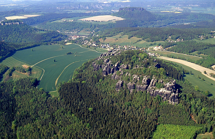
At 434.6 m above sea level, the Pfaffenstein is one of the highest table mountains in Saxon Switzerland and is located around 2 km south of the Elbe. The vertical cliffs and the fact that access to the plateau is only possible through narrow, easily blocked gorges make the Pfaffenstein a safe location for settlement. In addition, there is a spring on the mountain massif, which ensures a fresh water supply.
Ronald Heynowski/Annemarie ReckImage Source M. Trommler, Foto ©LfA 2007.
Finds from the Pfaffenstein
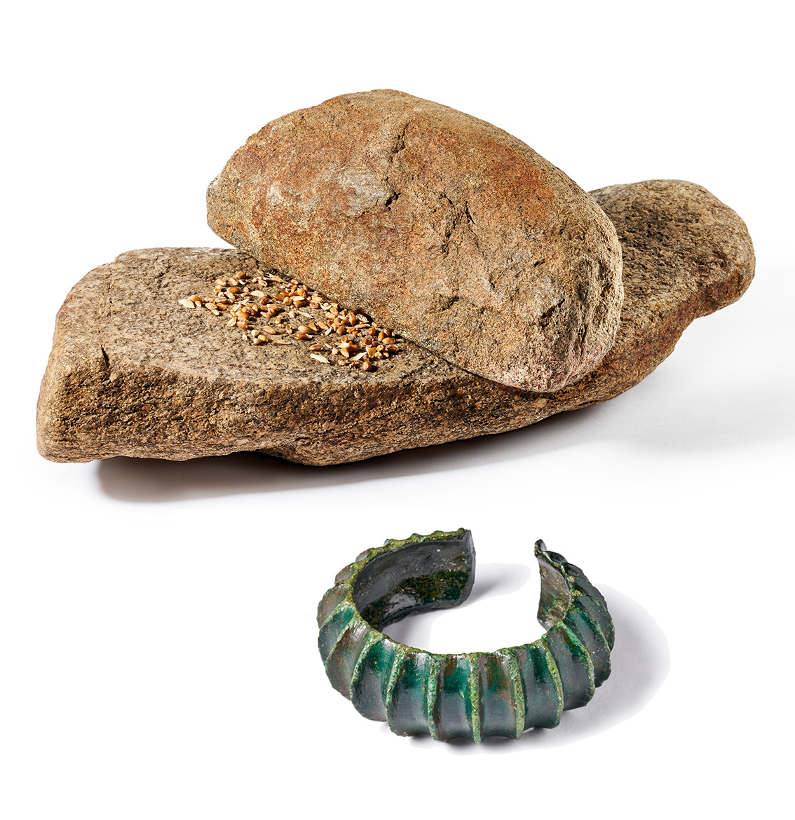
The archaeological finds discovered during the construction of the restaurant include vessel remains with zone hump decoration, egg-shaped pots and double cones with a notched rim. Their form allows them to be assigned to the older Lusatian culture. In addition, numerous quartz sandstone and quartz porphyry grinding stone fragments were excavated, indicating settlement activity. Among the special finds are two heavily ribbed bronze arm rings and a bronze knife blade. The superficial scatter of finds is mainly concentrated in the area north of the restaurant, which is located roughly in the middle of the plateau of the mountain massif. The settlement therefore did not extend over the entire plateau, but was limited to a smaller, delimited area.
Ronald Heynowski/Annemarie ReckImage Source M. Hultsch, Foto ©LfA 2021.
Link archaeo | 3D
Traces of settlement
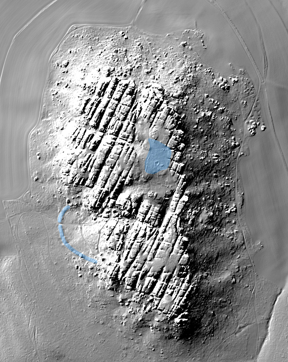
On the west side of the Pfaffenstein, a semi-circular fortification about 4 m high and 200 m long can still be seen. It adjoins the steep rock faces at both ends and was used to secure access to the plateau in the Bronze Age. Today, the rampart is cut through north of the middle by a modern path up the mountain. It is unclear where the prehistoric gateway was located. So far, there has also been no evidence of a burial site in the immediate vicinity, which supports the idea that it was merely a seasonal settlement site.
Ronald Heynowski/Annemarie ReckImage Source R. Heynowski, Bearbeitung/DGM ©LfA/GeoSN 2024.
Excavation 1961
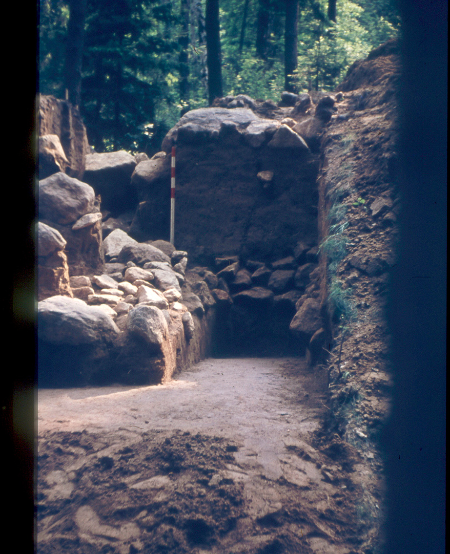
In 1961, under the direction of Werner Coblenz and Alfred Neugebauer, the first archaeological excavations were carried out in the area of the section fortification. A cross-section of the rampart was made, allowing a view of its structure. An approx. 2 m wide and 0.5 m deep ditch was located in front of the 4 m high rampart. Its excavated material was probably used to build the rampart. The original width of 3.2 m and the height of the fortification of 6 m, on which a palisade wall was also placed, can be calculated from the masses of debris.
Ronald Heynowski/Annemarie ReckImage Source A. Neugebauer, Foto ©LfA 1961.
The whale structure
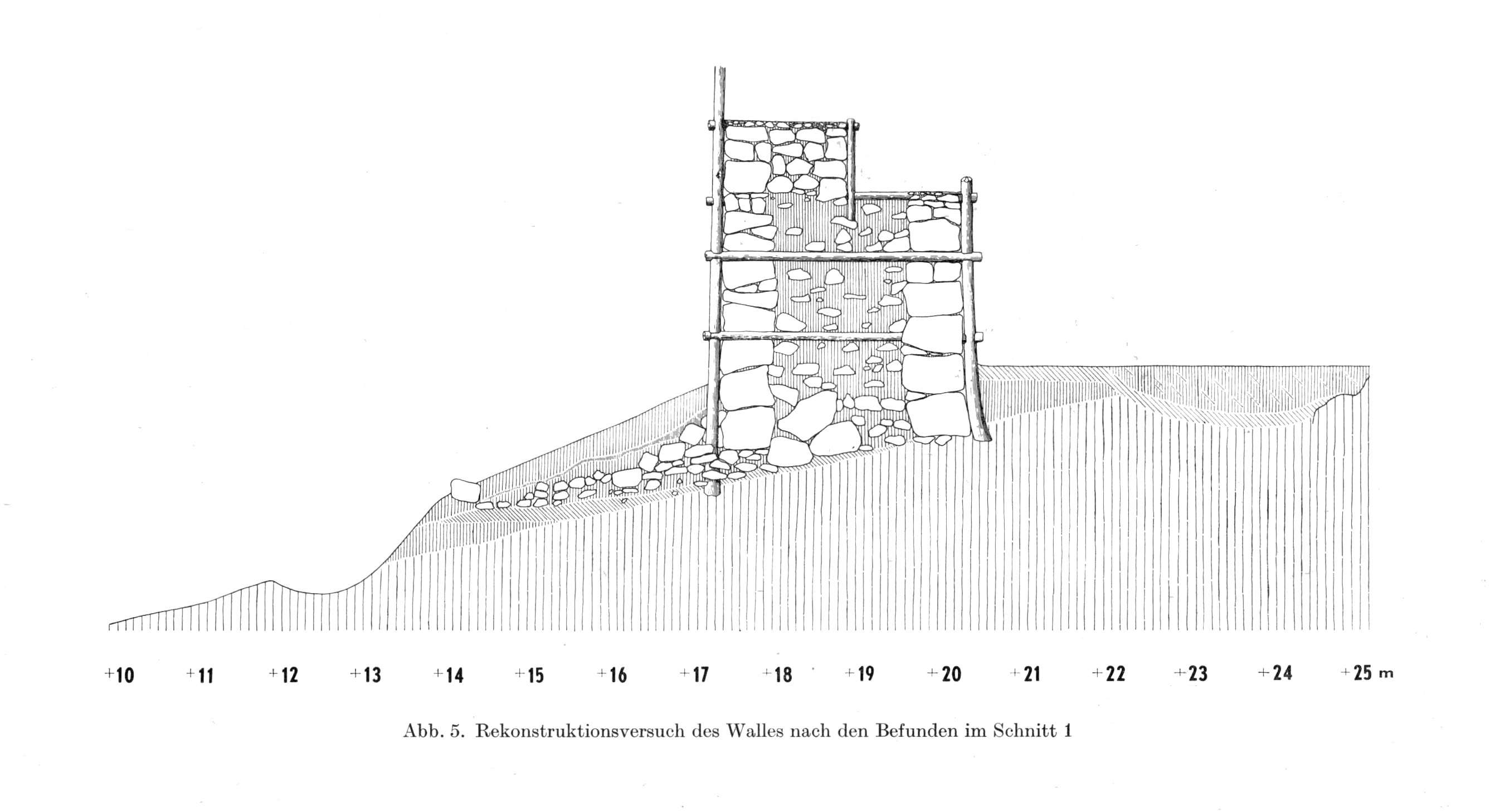
On the inside of the rampart was the 3 m wide berm, the subsoil of which consisted of clay with stone paving and was apparently intended to prevent the fortification from slipping. Both fronts of the rampart were originally clad with large stone blocks. They were originally supported by a wooden structure inside the rampart. This was indicated by the remains of old wood and recesses between the stone blocks.
Ronald Heynowski/Annemarie ReckImage Source W. Coblenz 1964, Abb. 5.
Interpretation
An inner settlement followed closely behind the rampart. The pottery that came to light, most of which was the remains of storage vessels, corresponds to the finds from the mountain plateau. No more recent pottery from the later Lusatian culture is known either from the foot of the rampart or from the plateau. According to Werner Coblenz's interpretation, the area at the western foot of the mountain could have been used to shelter livestock at night or in case of danger. The choice of the Pfaffenstein as a settlement site is surprising in that it is located away from arable land. Accordingly, it was probably primarily the easily protected location of the mountain plateau, which was difficult to access, that played a role in the choice of location.
Ronald Heynowski/Annemarie ReckImage Source R. Heynowski, Foto ©LfA 2007.
The stone barn
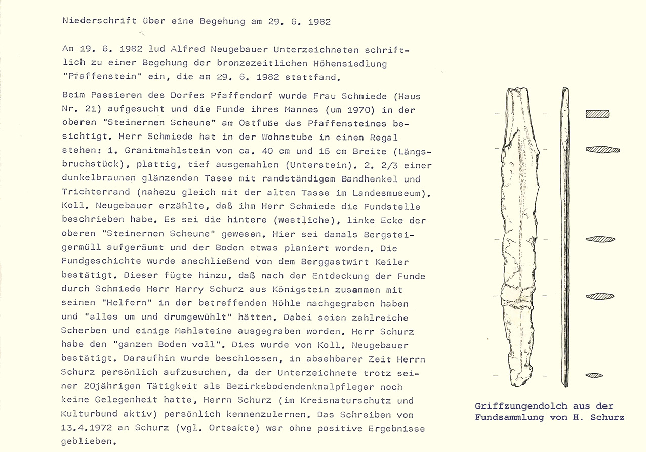
Not far to the north-east of the rock massif is another Lusatian culture site, the "Stone Barn". This consists of two large sandstone slabs set against each other in the shape of a roof and is still used by hikers today as a shelter. Its name is derived from its actual use as a lockable barn, in which several vehicles and agricultural equipment were stored until the middle of the 20th century. Several millstones and fragments of millstones, sherds and handled cups, grooved sherds and a bronze handle-tongue dagger were found here, suggesting a small settlement or farmstead in the immediate vicinity of the hilltop settlement.
Ronald Heynowski/Annemarie ReckImage Source OA_67800-D-302/309, Kollage ©LfA 2024.
Research chronicle
Image Source Foto ©LfA 2024.
Literature
Werner Coblenz, Der Wall am Pfaffenstein in der Sächsischen Schweiz. Varia Archaeologica, Festschrift für Wilhelm Unverzagt. Deutsche Akademie der Wissenschaften Berlin, Schriften der Sektion Vor- und Frühgeschichte 16 (Berlin 1964) 70–76.
Werner Coblenz, Die bronzezeitliche Siedlung auf dem Pfaffenstein in der Sächsischen Schweiz und ihr Sperrwall am Zugang zum Felsplateau. In: Heinz-Joachim Vogt (Hrsg.), Archäologische Feldforschungen in Sachsen. Arbeits- und Forschungsberichte zur sächsischen Bodendenkmalpflege Beih. 18 (Berlin 1988) 123–155.
Ronald Heynowski, Eine Höhensiedlung am Rande der Zivilisation. In: Regina Smolnik/Ronny Zienert (Hrsg.), Höhenflüge. Luftbilder und Archäologie in Sachsen (Dresden 2024) 126–127.
Note on monument protection
Archaeological monuments are protected by the Saxon Monument Protection Act. A permit under monument law is required for ground interventions or construction measures.
Permalink
https://archaeo-sn.de/en/ort/hilltop-settlement-on-the-pfaffenstein/
Citation
Ronald Heynowski/Annemarie Reck, Hilltop settlement on the Pfaffenstein. In: Landesamt für Archäologie Sachsen, Website archaeo | SN (17.03.2024). https://archaeo-sn.de/en/ort/hilltop-settlement-on-the-pfaffenstein/ (Stand: 29.09.2026)
