

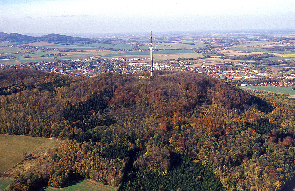
Hilltop settlement on the Schafberg near Löbau
| Place: | Löbau (Löbau, Görlitz) |
|---|---|
| Type: | Weirs/fortifications |
| Dating: | Lusatian culture | ca. 1200 - 900 BC. |
Description
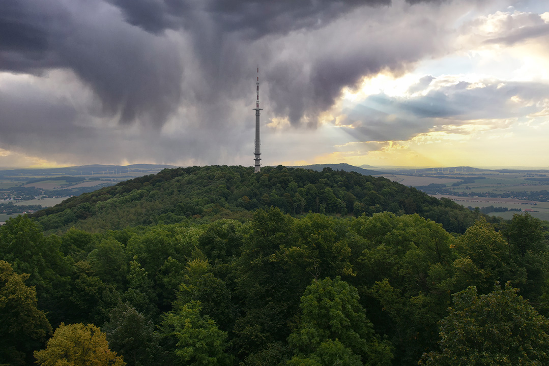
Often only referred to as "Löbauer Berg“ basalt dome, which rises impressively above the town of Löbau, is the erosion remnant of a volcano that was active in the Tertiary period. It comprises the two peaks "Löbauer Berg", which are up to 449 m high and separated by a saddle“ in the southwest and the "Schafberg“ in the northeast, which tower over the hilly Löbau basin by around 150-200 m. The "Schafberg“ has a 55 ha plateau, which is enclosed by an almost pentagonal Bronze Age rampart. The enclosed area roughly corresponds to the size of the town of Löbau in the Middle Ages. The fortifications measure up to 16 km in length and are still around 2 m high in the west and southwest of the hill today. Numerous terraces in the inner area and pottery finds from the Lusatian culture indicate intensive settlement on the mountain during the Late Bronze Age.
Annemarie ReckResearch chronicle
Image Source Foto ©LfA 2024.
First finds from the Schafberg
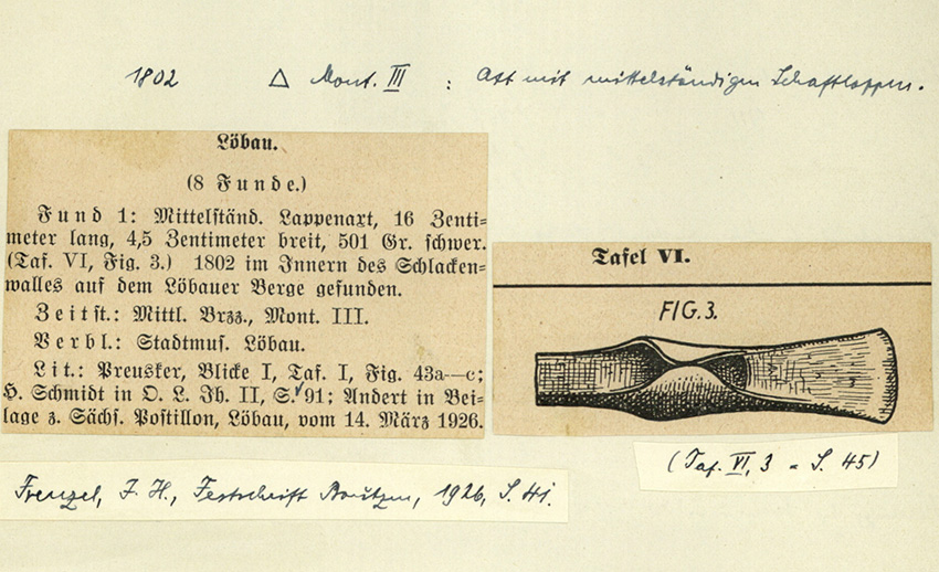
The irregular pentagonal fortification on the Schafberg has been known to researchers since the 18th century. Around 1802, Karl Benjamin Preusker (1786-1871), who was born in Löbau and is still often referred to today as the father of Saxon prehistoric research, discovered a 16 cm long, medium-sized flap axe inside the rampart. He later produced the first description of the fortifications and their "slag ramparts" for his 1841 work "Blicke in die vaterländische Vorzeit".
Annemarie ReckImage Source OA 57400, 59 ©LfA 1926.
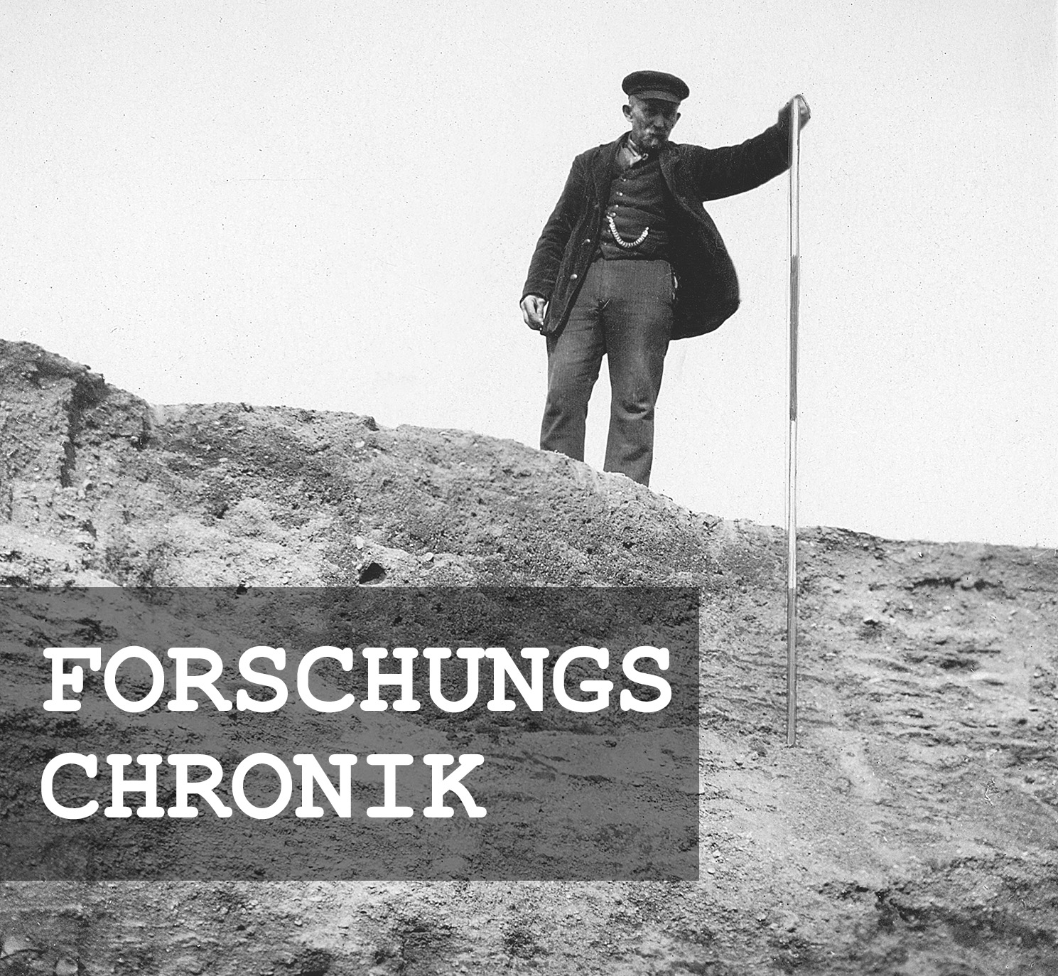
Exploration of the "slag walls"
It was precisely the so-called "slag ramparts", such as those at Strohmberg near Weißenberg, that attracted the attention of 19th century prehistoric researchers. For example, Oscar Schuster in 1869, Robert Behla in 1888 and Ludwig Feyerabend in 1893 also wrote about the ring wall near Löbau. At the time, the "cinder ramparts" were thought to have been created deliberately and were associated with "pagan places of sacrifice and assembly". Since around the beginning of the 20th century, however, their function as fortifications for mostly Bronze Age hilltop settlements has been considered certain. The ramparts, some of which were supported by wooden structures, often fell victim to fires, which may have led to the often observed slagged stones on the inside.
Annemarie ReckImage Source N. Döhlert-Albani, Foto Schafberg ©LfA 2016.
First excavations
During the years 1899 to 1906, the Löbau local historian Hermann Schmidt undertook the first excavation on the hill. He carried out four excavations in the south-western part of the rampart. A further exploratory cut was made in the north-east. His aim was to clarify the structure and age of the rampart. However, these questions could only be answered in 1964 when the Dresden State Museum of Prehistory, under the direction of Werner Coblenz, excavated a further 23 m long section on the north-western flank.
Annemarie ReckImage Source W. Coblenz, Foto ©LfA 1964.
Structure of the wall
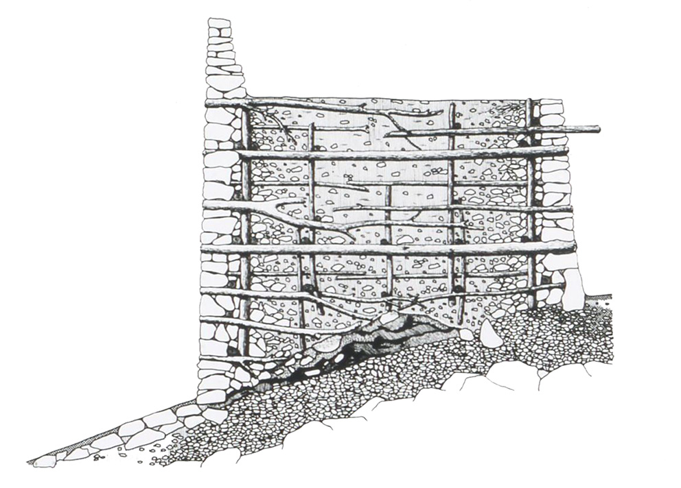
The remains of a wall 6 m wide at the base were uncovered. The rear face consisted of stone blocks and slabs stacked on top of each other. The front of the wall, on the other hand, appeared to have slipped away completely. The rampart was filled with a mixture of earth, clay and stones. Recesses in the construction indicate horizontal and vertical timbers that supported the structure. Slagged rock was found in these areas in particular. The area in front of the wall had been artificially reinforced over a width of 5 m with a layer of clay, stone gravel and a covering of stone slabs. Beneath the wall filling there was a layer of fire up to 0.7 m thick with annealed stones in places, which came from a 2 m wide, two-shell, temporary wooden structure. Presumably after a damaging fire, the ruinous fortification was replaced by a more massive, 7 m wide and also double-shell defensive wall. It was faced with stone on the inside and outside. And reinforced with horizontal wooden beams.
Annemarie ReckImage Source W. Coblenz 1966, 128, Abb. 23 (nach A. Pietzsch), Rekonstruktion des Löbauer Walles.
Access to the hilltop castle
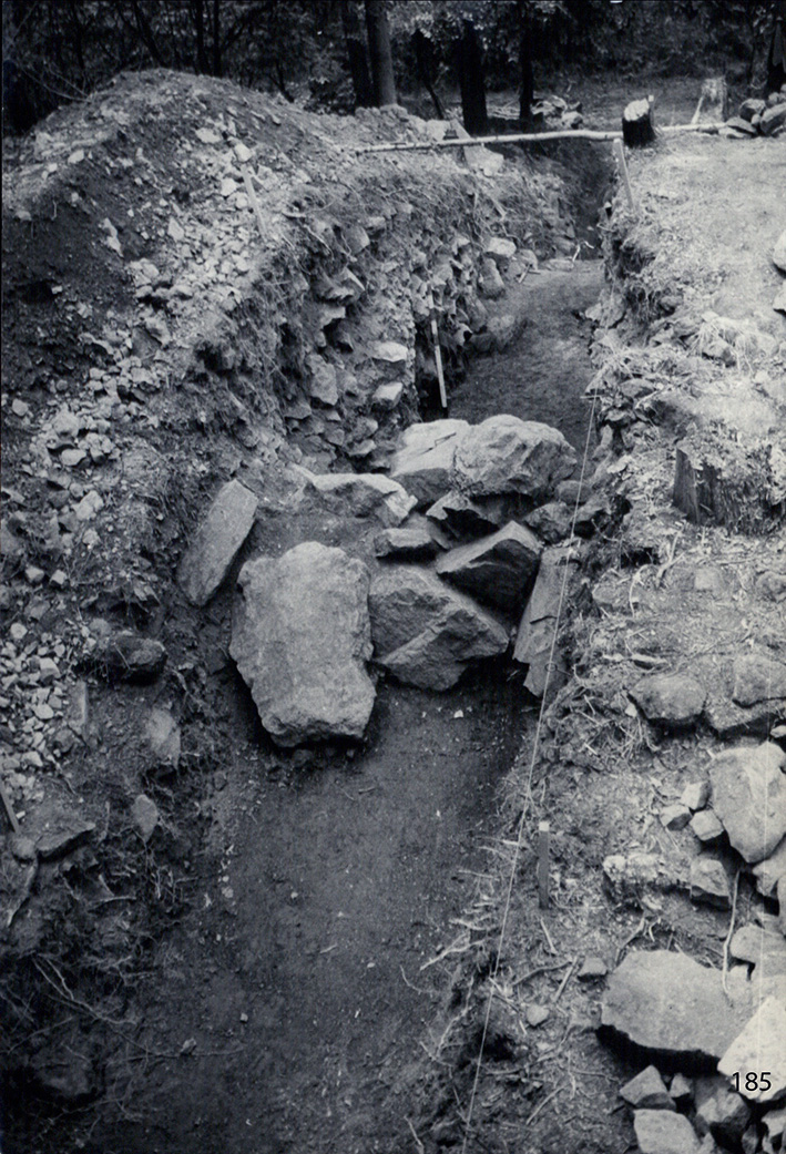
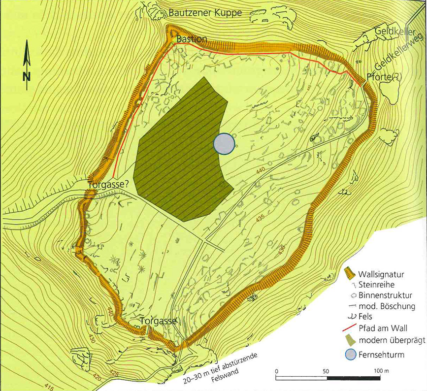
An additional survey of the complex in 1965 showed that the outline of the fortification was strongly adapted to the terrain and also deliberately included bastion-like rock sections and steep slopes, but also deliberately ignored others, such as at the "Geldkeller" in the north-east. A narrow recess in the rampart indicates a gateway here. The actual main gate was probably located in the west of the complex, approximately where a footpath still leads up from the saddle. The remains of the rampart are also highest in this area at 2 m. Another gate may have been located at the southern corner. Apart from the north-western edge, the plateau slopes slightly to the south-east with its highest point at 449 m near the northern section of the rampart.
Annemarie ReckImage Source T. Gerlach 2010, 184.
Destruction by radio operating station
Unfortunately, no attention was paid to the inner area during the first excavation campaign. Just one year later, a radio station with an access road was built there. In the process, around 0.5 ha of the settlement area and, in favor of the access road, the former gate area were destroyed without prior archaeological investigation. It was only when the radio station was extended in 1985 that archaeologists finally had the opportunity to investigate part of the inner area of the "Schafberg" in more detail.
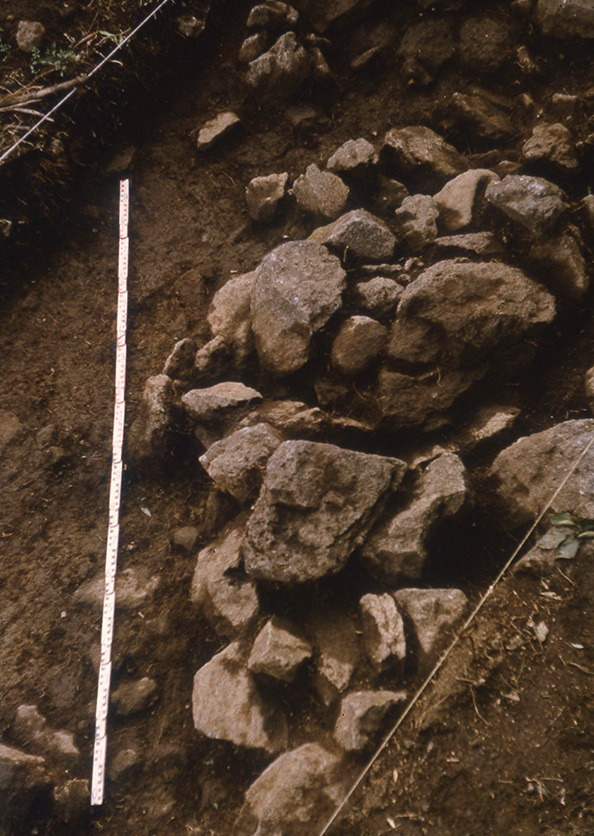
Annemarie ReckImage Source T. Gerlach, Übersichtsfoto Planum 2 ©LfA 1985.
Excavation 1985/1986
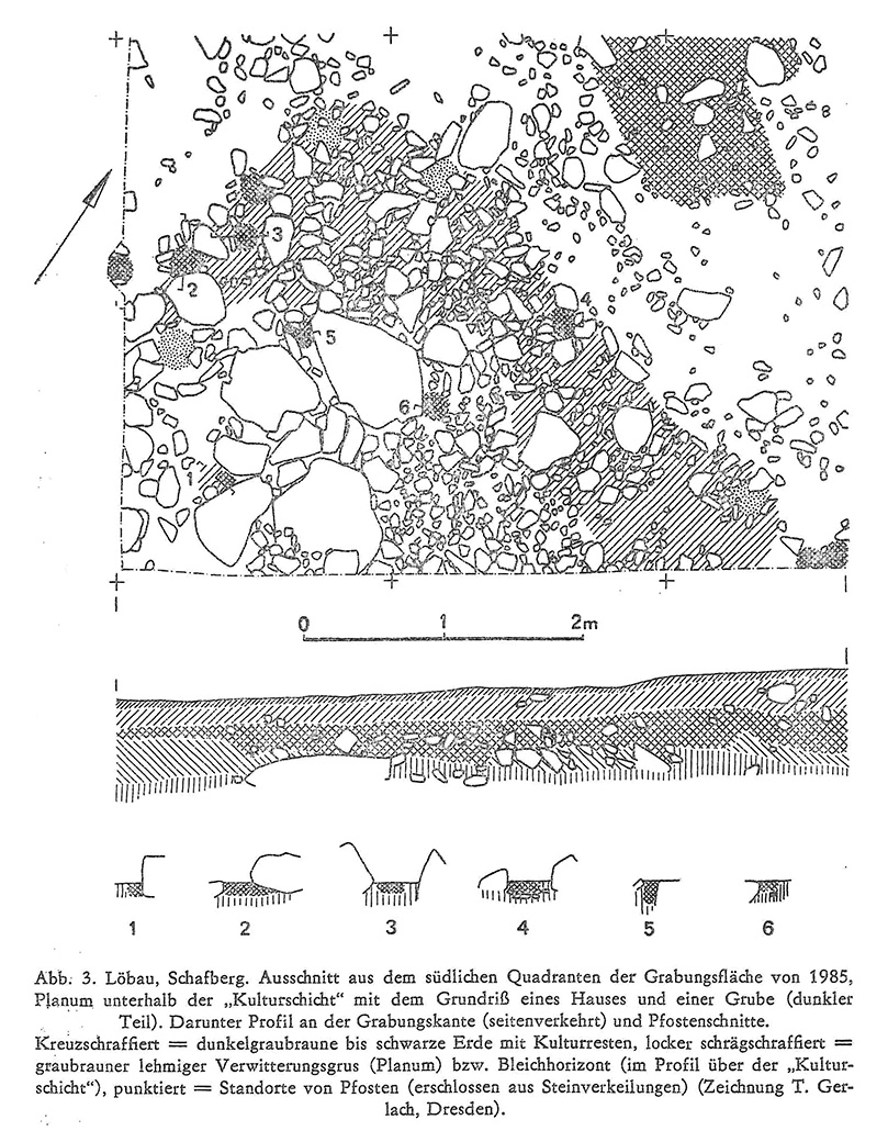
The excavation section from 1985 covered an area of 556 m² in the center of the plateau. The findings initially revealed seemingly disordered scatterings of stones of different sizes. On closer inspection, they were recognizable as row-shaped settlements and stratifications. Interspersed post pits and discolorations indicate house walls and terraced landings of small residential podiums. Inside the buildings, there were densely packed, almost rectangular stone packs, which probably served to underpin the clay floors at ground level. Down the slope, slabs weighing tens of tons were used in places. In between were small, trough-shaped post pits, often with stone wedges. They marked ground plans measuring around 6.5 x 5 meters. In 1986, small soundings were opened in other parts of the inner surface, which showed a similar picture.
Annemarie ReckImage Source K. Simon 1988, 131, Abb. 3.
Finds and dating
The pottery sherds and millstone fragments discovered during the excavations or as finds from the excavations indicate a large-scale settlement and confirm the dating of the site as a hilltop settlement of the Late Bronze Age. Several bronze finds, such as two arm spirals, a sickle or the clay imitation of a bronze cup, mark the "Schafberg" as a probably important center on the southern border of the Bronze Age settlement area between the Lusatian regions and the highlands. It may have served to control an old transportation route that led from the Bautzen loess hills across the Zittau Mountains to Bohemia. However, the economic basis for such a large settlement still seems to be lacking in the surrounding area: The Löbau Basin itself has so far yielded little evidence of settlement in the Bronze Age, despite numerous investigations during construction. A few finds of Slavic pottery probably go back to sporadic use of the hill in the early Middle Ages.
Annemarie ReckImage Source R. Heynowski, Foto ©LfA 2004.
Literature
Werner Coblenz, Die befestigte Siedlung der Lausitzer Kultur auf dem Schafberg bei Löbau. Arbeits- und Forschungsberichte zur sächsischen Bodendenkmalpflege 14/15, 1966, 95–132.
Thomas Gerlach, Löbau: Die Wallanlage auf dem Schafberg. In: Regina Smolnik/Jasper von Richthofen (Hrsg.), Die Oberlausitz. Ausflugsziele zwischen Neiße und Pulsnitz. Ausflüge zu Archäologie, Geschichte und Kultur in Deutschland 51 (Stuttgart 2010) 182–186.
Klaus Simon, Die jungbronzezeitliche Bergsiedlung auf dem Schafberg bei Löbau. In: Heinz-Joachim Vogt (Hrsg.), Archäologische Feldforschungen in Sachsen. Fünfzig Jahre Landesmuseum für Vorgeschichte Dresden. Arbeits- und Forschungsberichte zur sächsischen Bodendenkmalpflege Beiheft 18 (Berlin 1988) 128–133.
Michael Strobel, Die bronzezeitliche Befestigung auf dem Schafberg. In: Regina Smolnik/Ronny Zienert (Hrsg.), Höhenflüge. Luftbilder und Archäologie in Sachsen (Dresden 2024) 166–167.
Note on monument protection
Archaeological monuments are protected by the Saxon Monument Protection Act. A permit under monument law is required for ground interventions or construction measures.
Permalink
https://archaeo-sn.de/en/ort/hilltop-settlement-on-the-schafberg-near-lobau/
Citation
Annemarie Reck, Hilltop settlement on the Schafberg near Löbau. In: Landesamt für Archäologie Sachsen, Website archaeo | SN (03.09.2024). https://archaeo-sn.de/en/ort/hilltop-settlement-on-the-schafberg-near-lobau/ (Stand: 23.08.2026)
