

Höhenburg Zetten
| Place: | Döben (Grimma, Leipzig) |
|---|---|
| Type: | Weirs/fortifications |
| Dating: | Late Bronze Age | Early Middle Ages | ca. 1000 B.C. | 850 - 1050 A.D. |
Description
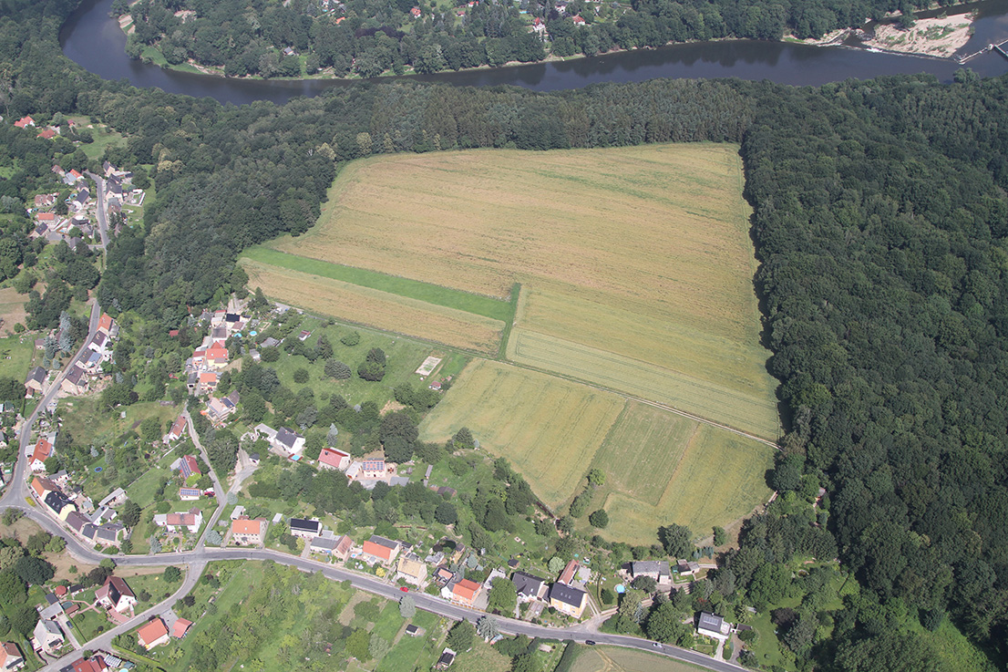
As early as 1935, the "Zetten“ near Döben was one of the first ground monuments in Saxony to be placed under protection. This is because there is a rampart on the hill near Grimma, which was first fortified during the Late Bronze Age. Later in the early Middle Ages, the complex was renovated and used by the Slavic tribe of the Ostchutici as their central castle. Due to its favorable location on a plateau immediately south of the river bend, it probably played an important role in controlling the middle Mulde valley at various times.
Dana Mikschofsky/Ronald Heynowski/Annemarie ReckThe system
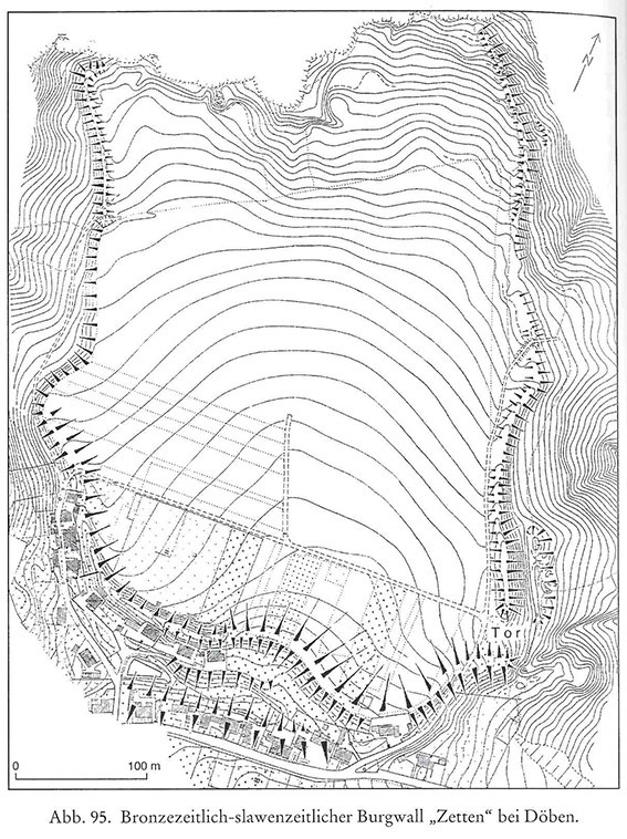
The "Zetten" covers an area of 470 x 530 m and is surrounded on three sides by a rampart construction. Only to the north-west, where the hill slopes down to the hollow as a steep slope, was additional fortification of the terrain dispensed with. The rampart runs irregularly and is based on the local ground relief with its elevations and depressions. Several protruding hilltops were included in the construction instead of straightening the course. This construction method is typical for fortifications of the Lusatian culture of the Late Bronze Age. Only on the north-eastern side of the enclosure, which is now in the high forest, does the rampart run almost in a straight line along the upper edge of the side valley.
Dana Mikschofsky/Ronald Heynowski/Annemarie ReckImage Source K. Kroitzsch 1996, 188.
Walls and gates
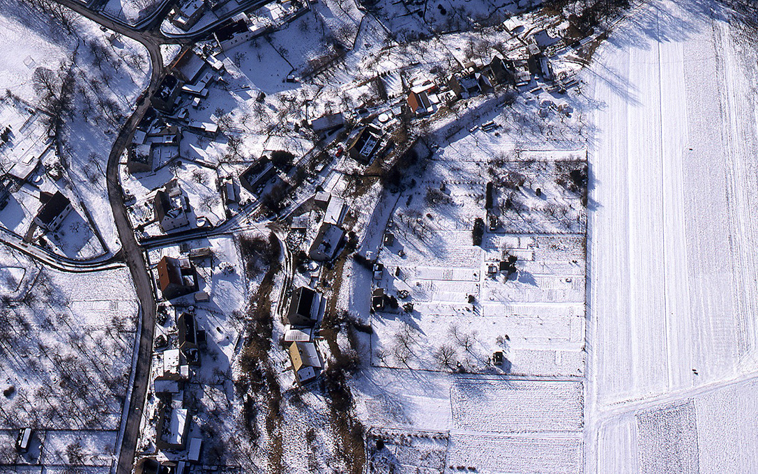
In the west, the rampart is still recognizable as a gentle slope that only slightly protrudes from the terrain. In the area of the access road to the plateau in the southeast, however, the fortification is still up to 3 m high. However, the thickness of the only rampart is most evident on the south side, where there is a headwall up to 6 m high. Its western section is well preserved, while in the east the inner embankment has been leveled like a ramp. In addition, in the 19th century, several houses were built into the rampart by estate workers employed on the nearby manor, interrupting it in places. The former main entrance is thought to have been in the south-east of the complex, where the current access road, a large break in the rampart and terracing on the plateau can still be found. Furthermore, several old paths at this point indicate an entrance. A second one was probably located at the northern tip of the hill, to the right above the hollow, where a bundle of hollow paths, clearly visible in the ground relief, still runs up the "Zetten".
Dana Mikschofsky/Ronald Heynowski/Annemarie ReckImage Source O. Braasch, Foto ©LfA 1996.
Structure of the wall
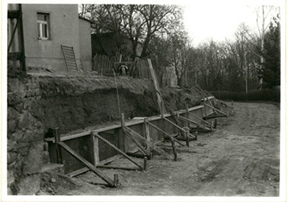
As part of a construction project, part of the rampart was archaeologically investigated in 1989. A layer of clay interspersed with charcoal and hut loam remains came to light inside the rampart, testifying to a wood-earth construction with a dry stone wall in front, as is already known from comparable ramparts. No other excavations have been carried out to date that would indicate a settlement sequence. Only surface finds from the inner surface today provide information about the settlement sequence on the "Zetten".
Dana Mikschofsky/Ronald Heynowski/Annemarie ReckImage Source G. Unteidig, Foto ©LfA 1989.
Dating
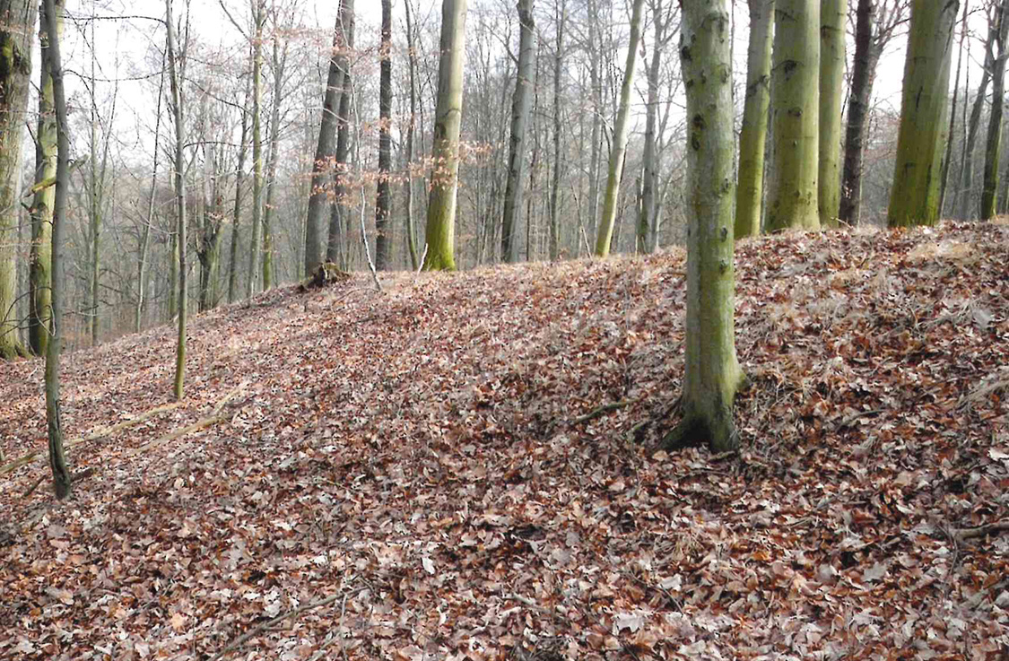
The finds from the inner surface of the plateau provide information about the different phases of its settlement. The oldest objects date from the Late Bronze Age from the Lusatian culture, which was widespread in Saxony at that time. Some Latène period finds are also known, which make it likely that the plateau continued to be used until the Middle Pre-Roman Iron Age. However, the majority of the finds can be attributed to the Slavic settlement of the mountain from the 9th to the 11th century. These include, for example, comb-decorated rim and wall sherds. There are also several fragments of pottery from the late Middle Ages. However, it is unclear whether they are related to a further settlement on the plateau or whether they ended up there as a result of the agricultural cultivation of the area. It is only from the 16th century onwards that the use of the "Zetten" as arable land can be proven with certainty.
Dana Mikschofsky/Ronald Heynowski/Annemarie ReckImage Source A. Rudolph, Foto Wall Ostseite ©LfA 2012.
Historical sources
The site has been known to researchers for a long time. The first written evidence dates back to the year 1013, when a document linked the place to the center of the Gau Ostchitici, which was transferred to the Bishop of Meissen as a compensation from the king. The place name "Golenzica cethla" mentioned in the document can still be recognized in the current name of the "Zetten". The name of the nearby village of "Golzern" can also be found in the name.
Dana Mikschofsky/Ronald Heynowski/Annemarie ReckImage Source R. de Vries, Foto ©LfA 2013.
Literature
Klaus Kroitzsch, Der „Zetten“ und das Schloss Döben. In: Leipzig und sein Umland. Archäologie zwischen Elster und Mulde. Führer archäologischer Denkmäler in Deutschland 32 (Stuttgart 1996) 187–190.
Dana Mikschofsky/Ronald Heynowski, Die Zentralburg der Ostchutici. In: Regina Smolnik/Ronny Zienert (Hrsg.), Höhenflüge. Luftbilder und Archäologie in Sachsen (Dresden 2024) 178–179.
Note on monument protection
Archaeological monuments are protected by the Saxon Monument Protection Act. A permit under monument law is required for ground interventions or construction measures.
Permalink
https://archaeo-sn.de/en/ort/hoehenburg-zetten/
Citation
Dana Mikschofsky/Ronald Heynowski/Annemarie Reck, Höhenburg Zetten. In: Landesamt für Archäologie Sachsen, Website archaeo | SN (07.11.2024). https://archaeo-sn.de/en/ort/hoehenburg-zetten/ (Stand: 30.09.2026)
