

The Kohlenberg near Brandis
| Place: | Brandis (Brandis, Leipzig) |
|---|---|
| Type: | Burial Mound/Burial Mound Field |
| Dating: | Lusatian Culture | 1350–780 B.C. |
Description
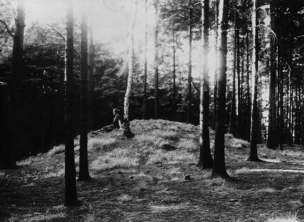
Like a witness hill, a granite and quartz porphyry intrusion of volcanic origin rises about 2 kilometers south of Brandis from the sand loess-covered old moraine slabs. The "Kohlenberg"“ Rises about 40 meters from the eastern Leipzig Lowland Basin as an east-west-oriented ridge visible from afar. Scattered across the gently undulating plateau are three groups of burial mounds, which owe their good state of preservation to centuries of forest cover. This is because the stony, rich brown soils that had formed on top of the periglacial gravel-clay layer were utterly unsuitable for agricultural use. The plow would have leveled the hills long ago.
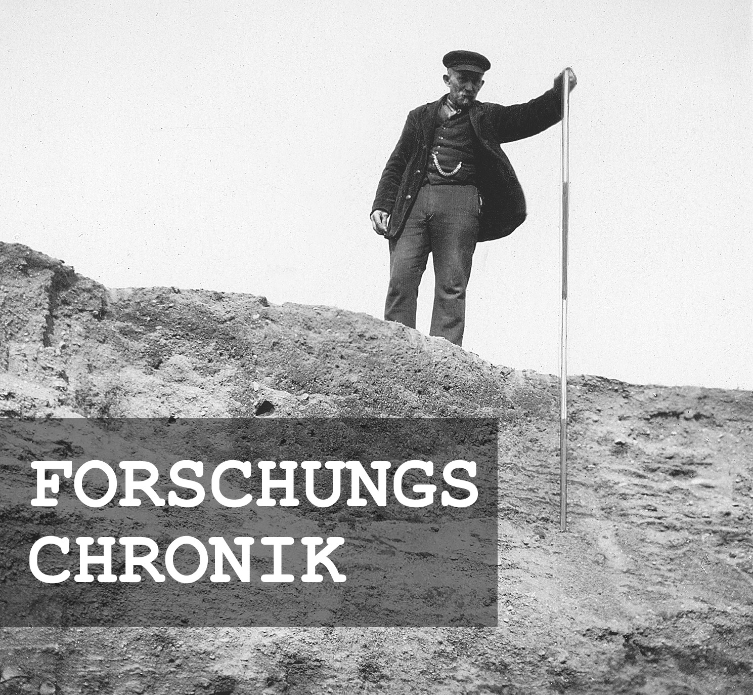
Michael StrobelResearch Chronicle
Since the late 19th century | The burial mounds have been threatened from two sides by quarrying operations.
June 2, 1926 | Rudolf Moschkau documents a burial mound.
Spring 1932 | Tree-felling work exposes the burial mounds.
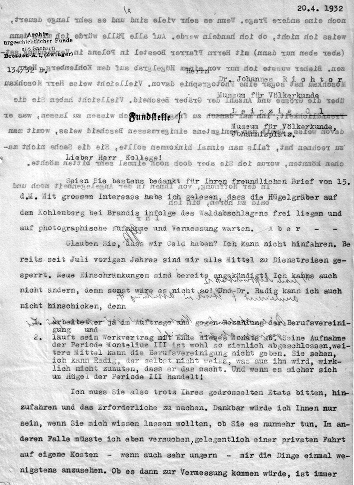
April 20, 1932 | The survey of the cemetery fails due to a lack of financial and personnel resources at the Archive of Prehistoric Finds from Saxony.
June 3, 1932 | Traces of looting are discovered during a site inspection.
January 7, 1935 | Listed on the State Monument List B.
Summer 1935 | Emergency excavation led by Kurt Tackenberg.
Summer 1943 | Emergency excavation led by Werner Jorns.
Fall 1957 | The western quarry is slated to be expanded into a large gravel plant for VEB Granit-Porphyr-Werke Beucha.
1960s | Plans for a local recreation area with a winter sports center.
Image Source Foto ©LfA 1929.
No sign of burial mounds yet…
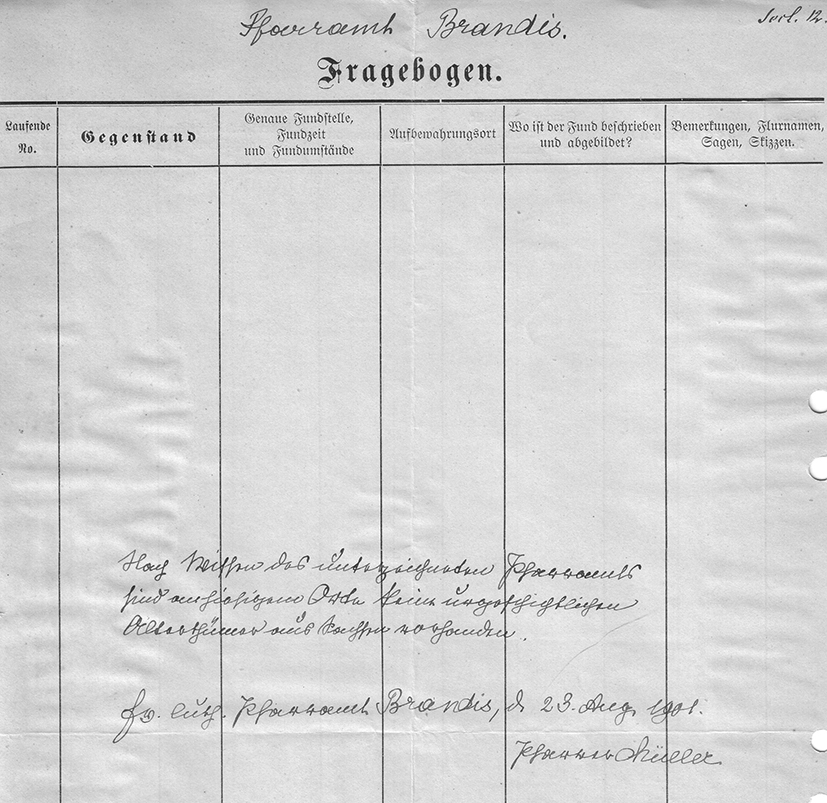
As clearly as the burial mounds can be identified in the digital terrain model and on the ground, it is all the more surprising that they were not already described in the 1909 questionnaire from the Landesverein Sächsischer Heimatschutz, even though new acquisitions are noted in the records of the Leipzig Museum of Ethnology, and several “funnel-shaped features” point to early, undocumented excavations.
Michael StrobelImage Source Ortsakte 86090, 44 ©LfA 1909.
No hills in the mileage log—nowhere
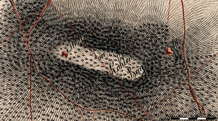
It is equally surprising that the necropolis must also have escaped the attention of the cartographers who created the Saxon Mile Map. Although this atlas from the late 18th and early 19th centuries does show two small quarries—one in the west on the plateau, the other in the northeast at the foot of the slope—it does not include a single one of the mounds, some of which are over 20 meters in diameter.
Michael StrobelImage Source Berliner Meilenblatt ©Staatsbibliothek Berlin/SLUB/LfA Sachsen.
Mapped for the first time
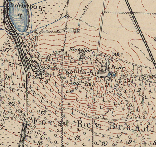
The first “burial mound notation” appears on the 1893 survey map; the much more detailed 1907 version then lists seven burial mounds and indicates that, to the west, two of them had likely already been lost to the expansion of the quarry. A rail spur built before 1893 underscores the industrial scale of the granite quarrying. Meanwhile, the quarry in the northeast was also being driven deeper and deeper into the mountain.
Michael StrobelImage Source Meßtischblatt Brandis-Pehritzsch 1907, 1:25000 ©SLUB.
Alone in the woods?
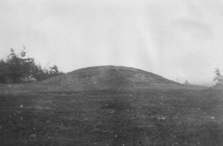
The extent to which the burial mound field was threatened was already evident from the topographic maps both before and after World War I. Sooner or later, the first mounds were bound to fall victim to the quarry operations encroaching from two sides. The director in charge of the archive of prehistoric finds from Saxony, Georg Bierbaum (1889–1953), was, however, only aware of the size and state of preservation of one burial mound following a site inspection conducted by the Leipzig teacher Rudolf Moschkau (1886–1976) in the summer of 1926.
Michael StrobelImage Source Ortsakte 86090, 46 ©LfA 1926.
After Clearing
The extent of the necropolis only gradually became apparent to him in the spring of 1932, after parts of the forest had been cleared. Even though the accuracy of the historical maps leaves something to be desired by today’s standards, the archive director had to expect more than just seven mounds and a serious threat to the above-ground monuments.
Michael StrobelImage Source Ortsakte 86090, 63 ©LfA 1932.
In the Valley of Tears
Since Bierbaum’s financial leeway had shrunk to a minimum at the height of the Great Depression, and since he could neither undertake business trips himself nor immediately commission a survey, he decided to wait until his future “research assistant” Walter Kersten (1907–1944) to begin his duties.
Michael StrobelImage Source Ortsakte 86090, 56 ©LfA 1932.
Volunteer Work
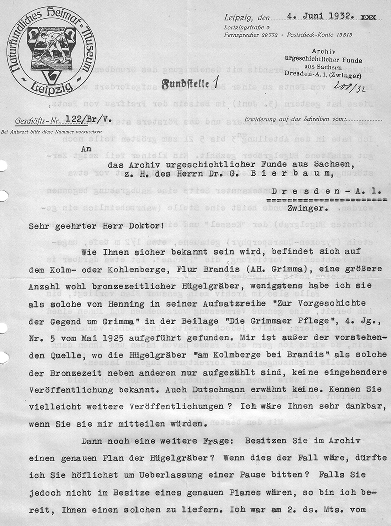
When Kurt Braune, a teacher and director of the Leipzig Local History and Natural History Museum, reported signs of looting following a site inspection in June 1932 and indicated his willingness to conduct a survey, the head of the archives chose to wait rather than accept this offer immediately. However, Kersten, who was slated to survey the mounds, was still indispensable at an excavation near Kassel that summer and could not take up his position as a research assistant in Dresden until early 1933. Bierbaum, therefore, should not have been surprised that his stalling, procrastination, and putting people off aroused the displeasure of the West Saxon volunteers.
Michael StrobelImage Source Ortsakte 86090, 67 ©LfA 1932.
Inclusion on the List of Historic Landmarks
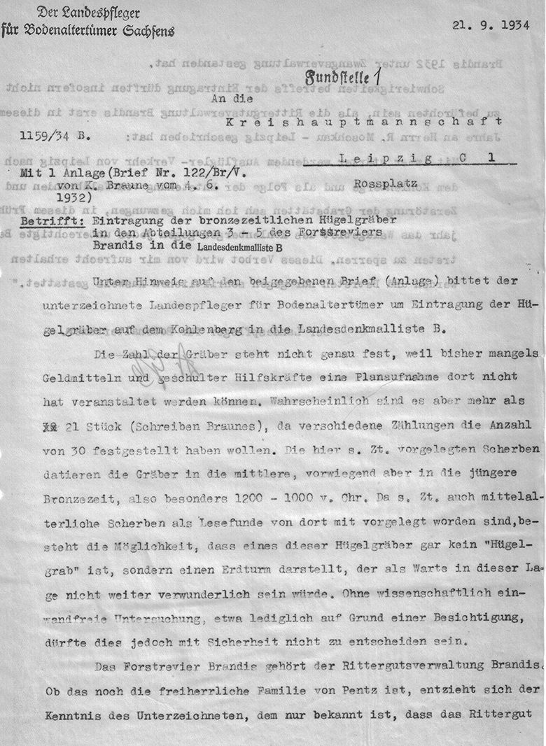
This made it all the more embarrassing that, at the end of 1934, the state conservator was unable to include a site plan with his application for inclusion on State Monument List B, but could only provide a rough estimate of the number of burial mounds. Although this shortcoming did not prevent the site from being designated a historic monument in January 1935, it did complicate further negotiations with the quarry operator, Otto Busse, the owner of the Brandis manor, whose appeal against the designation was rejected by the Saxon State Ministry of the Interior in March 1935.
Michael StrobelImage Source Ortsakte 86090, 90 ©LfA 1934.
On the Value of the "Historic Preservation Act"
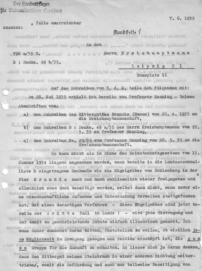
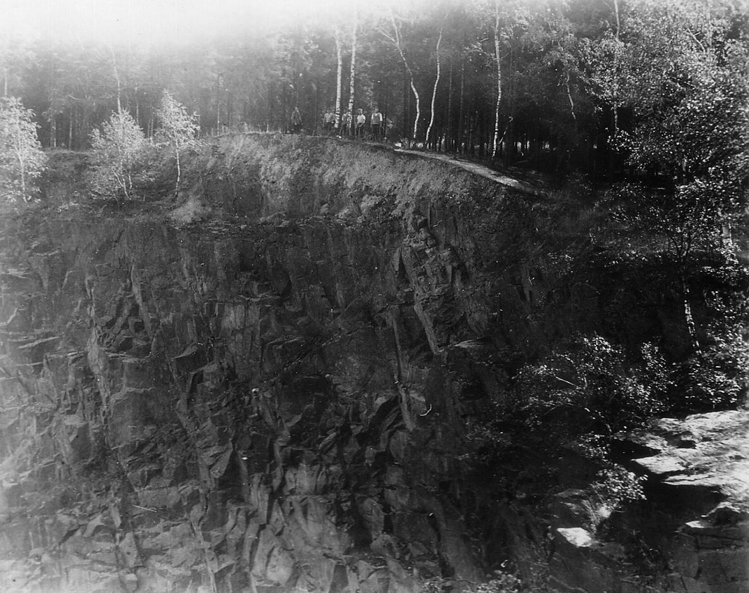
Busse, however, had no intention of shutting down his granite quarry in the northeast. The burial mounds on the southern edge of the quarry face were therefore under immediate threat. Nevertheless, following his initial negative experiences since the enactment of the “Heimatschutzgesetz,” Bierbaum wanted in January 1934, he wanted to exhaust all possibilities to “preserve the entire group for the future” and only then—and “only after a comprehensive plan had been drawn up” and a scientific investigation conducted—would he allow the threatened burial mounds to be excavated. Had he already had a plan drawn up by then, he would have noticed that while the majority of the mounds lay outside the quarry boundaries to the west and southwest of the plateau, the second quarrying area encroaching from the west was no less threatening to the “Kohlenberg.” The fact that Bierbaum himself had never been on site and had never seen the situation at the edge of the northeastern quarry with his own eyes likely did not make assessing the situation any easier.
Michael StrobelImage Source Ortsakte 86090, 106 ©LfA 1935.
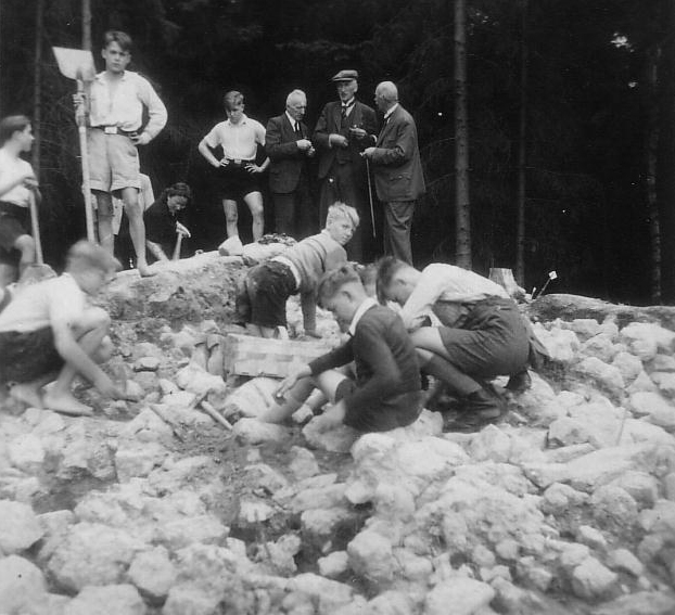
An Initial Rescue Excavation
He was therefore fortunate that Kurt Tackenberg (1899–1992)—who had been appointed in 1934 to the newly established chair of Prehistory at the University of Leipzig— conducted an emergency excavation in the summer of 1935 and, with the help of students, investigated the mound at the southern edge of the quarry, which had evidently already been partially excavated and was in acute danger. A separate issue is the tardiness of the professor from Leipzig—and, since 1938, Bonn—who, apart from a brief note in the journal *Die Fundpflege*, has always failed to provide his Dresden colleague with an excavation report—as has been the case in so many other instances. The emergency excavation is documented by only a few black-and-white photographs.
Michael StrobelImage Source Ortsakte 86090, 125 ©LfA 1935.
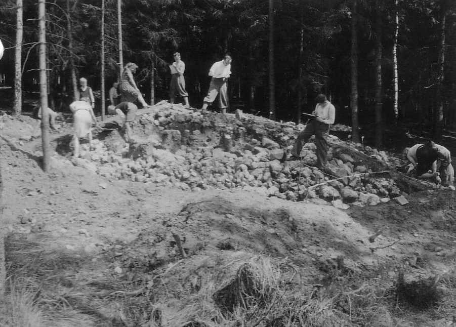
An excavation site without a phone line
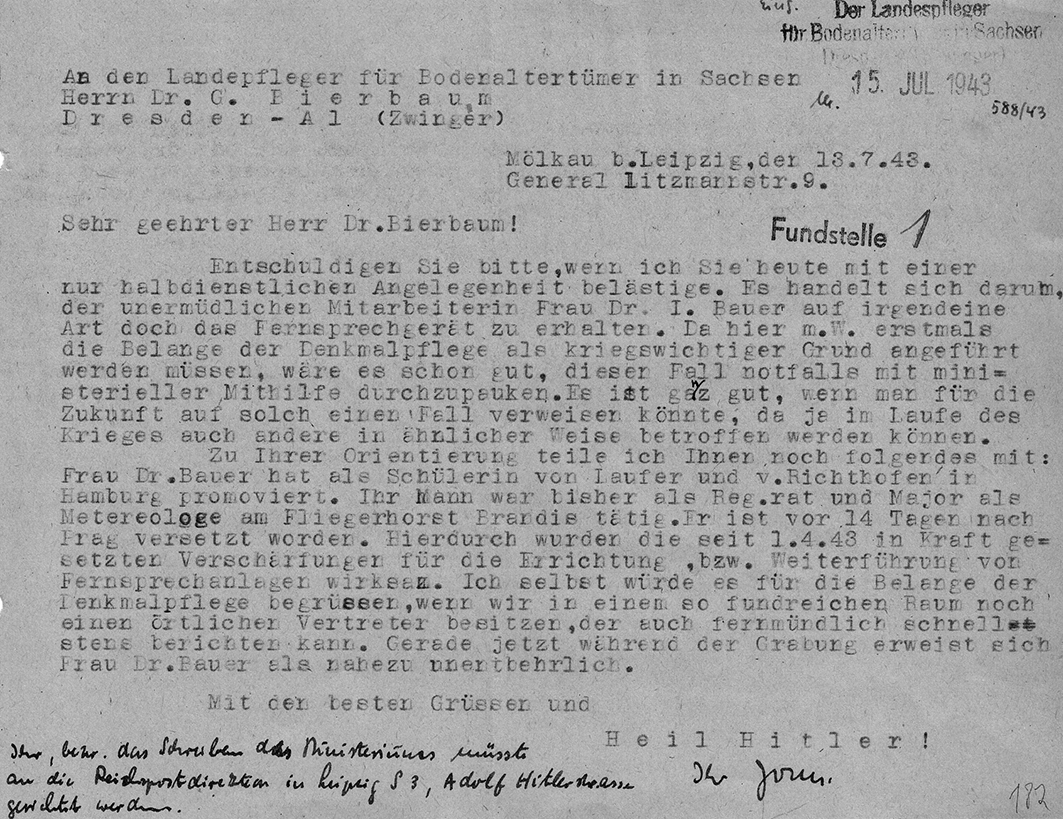
Nearly ten years later, in the summer of 1943, the excavation of a second, better-preserved mound was evidently just as inevitable. This time, Werner Jorns (1909–1990), curator at the Municipal Museum of Ethnology and deputy union representative, oversaw an exemplary excavation and documentation. He did not lack the generous support of the county administrator, who even provided ration coupons for hardware—that is, excavation tools. However, Jorns was unable to claim that the telephone line of a woman with a doctorate in archaeology—who was an excavation assistant and the wife of a major—was “essential to the war effort” for the excavation. Her husband had been transferred from Brandis Air Base to Prague as an Air Force meteorologist.
Michael StrobelImage Source Ortsakte 86090, 182 ©LfA 1943.
With the support of college and high school students
The excavation team was drawn from among the students of the Leipzig professorship, who, under Jorns’s guidance, were essentially conducting a training excavation on the Kohlenberg. In addition to the prehistorian and later Heidelberg professor Waltraut Schrickel (1920–2009), the excavation assistants also included Anton Točik (1918–1994), who studied in Leipzig from 1940 to 1943 as a Slovak Humboldt Fellow and would go on to head the Archaeological Institute of the Slovak Academy of Sciences in Nitra from 1953 to 1970. In addition, the excavation was supported by numerous students from Brandis.
Michael StrobelImage Source Ortsakte 86090, 301 ©LfA 1943.
Exposure and Documentation
Removing the massive stone packing, in particular, must have been physically demanding work. Beneath it, roughly in the center of the mound, a cremation deposit was uncovered on the original surface, from which a fragment of a bronze pin and the shards of two bracelets were recovered. The fragmentary pottery shards were scattered throughout the mound’s fill and, like the bronze objects, leave little doubt that they date to the Late Bronze Age.
Michael StrobelImage Source Ortsakte 86090, 192 ©LfA 1943.
Completed after 80 years
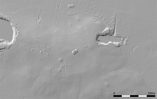
It remains unclear to what extent Hermann Dengler (1890–1945), the technical staff member from the State Museum sent by Bierbaum to Kohlenberg, was actually able to make progress on surveying the burial mound field under extremely adverse conditions. Strangely enough, no map has been preserved in the local archive. This means it cannot be ruled out that the survey may never have been completed. The accuracy of a manual survey conducted in dense forest using a prism, measuring tape, spirit level, and sighting rods could be verified quite precisely today by comparing it with the digital elevation model. The DEM reveals approximately 30 mounds.
Michael StrobelImage Source DGM ©LfA/GeoSN 2023.
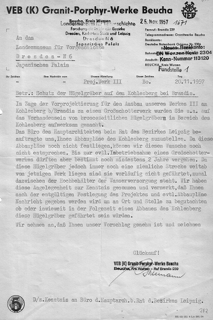
Imminent Danger
Although efforts to divert quarrying operations away from the burial mound field had never succeeded before 1945, the prediction that granite quarrying would proceed even more intensively than in peacetime fortunately did not come to pass during the last two years of the war. Likewise, the plan to expand the western quarry into a large-scale gravel plant for VEB Granit-Porphyr-Werke Beucha never progressed beyond the planning stage. Such a project would have posed a serious threat to the burial mound field.
Michael StrobelImage Source Ortsakte 86090, 282 ©LfA 1957.
Local Recreation
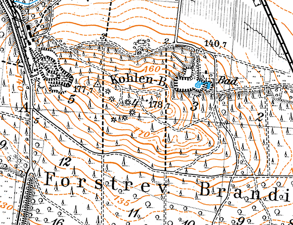
As early as the late 1920s, half of the quarry in the northeast had been used as a forest swimming area. However, because people seeking recreation also regularly roamed the surrounding area, complaints about damage to the burial mounds—or even unauthorized excavations—never completely ceased, even in the postwar years.
Michael StrobelImage Source Meßtischblatt Brandis 1941, 1:25000 ©SLUB.
Big plans—no traces
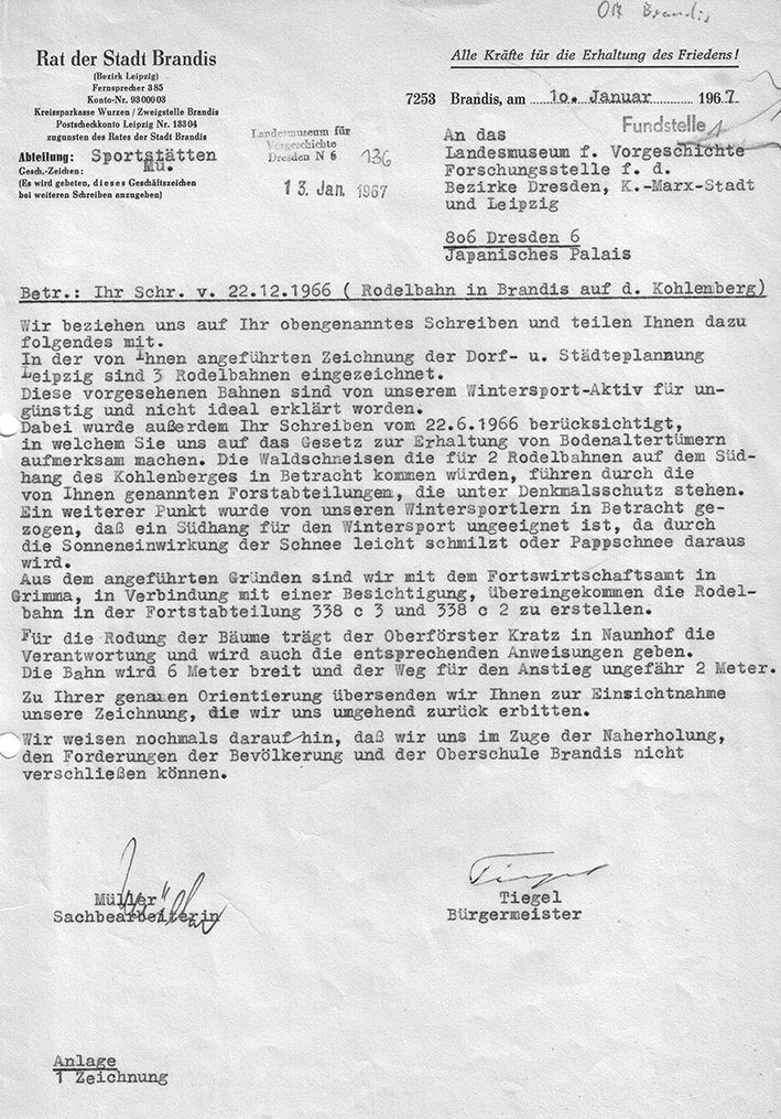
Nevertheless, “recreational use” would certainly have been more compatible with the requirements of historic preservation than the forced operation of a quarry. The plans from the 1960s to transform the Kohlenberg into a local recreational area for the city of Leipzig were very ambitious. However, since the construction of two toboggan runs and a ski jump would also have involved significant ground disturbances, it is not a loss from a historic preservation perspective that the winter sports center was never realized as those in charge at the city and county levels had envisioned. Under today’s conditions, it would no longer be feasible to operate the facilities anyway. As a result, the hills on the Kohlenberg remain one of the best-preserved necropolises in western Saxony to this day.
Michael StrobelImage Source Ortsakte 86090, 361 ©LfA 1967.
Literature
Michael Strobel/Thomas Westphalen, Steingewinnung und archäologische Denkmalpflege in Sachsen zwischen den Gründerzeitjahren und 1945 – Rückblick und Bilanz. Mitteilungen des Landesvereins Sächsischer Heimatschutz 2018, Heft 2 und 3, 27-38.
Note on monument protection
Archaeological monuments are protected by the Saxon Monument Protection Act. A permit under monument law is required for ground interventions or construction measures.
Permalink
https://archaeo-sn.de/en/ort/kohlenberg-bei-brandis/
Citation
Michael Strobel, The Kohlenberg near Brandis. In: Landesamt für Archäologie Sachsen, Website archaeo | SN (23.01.2025). https://archaeo-sn.de/en/ort/kohlenberg-bei-brandis/ (Stand: 29.09.2026)
