

Late Bronze Age fortification on the Oybin
| Place: | Oybin (Oybin, Görlitz) |
|---|---|
| Type: | Fortified system |
| Dating: | Late Bronze Age | Lusatian culture | level of horizontally grooved pottery | 950 - 750 BC. |
Description
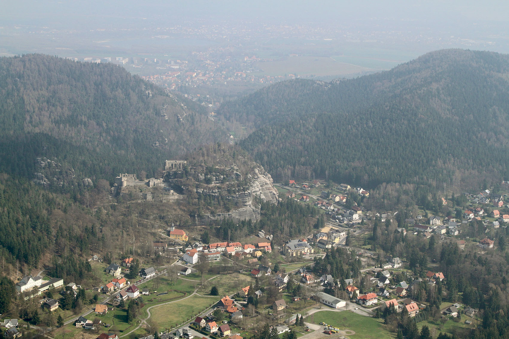
The ruins of a medieval castle and monastery are still enthroned on an imposing sandstone rock north of the spa town of Oybin. Its impressive appearance inspired numerous artists of the Romantic movement, such as Caspar David Friedrich (1774-1840) and Carl Gustav Carus (1789-1869), to create famous works of art. Finds and structures from a Late Bronze Age fortification are hidden among the installations that are still visible today. It apparently only existed for a few decades. The mountain was not inhabited again until over 1500 years later. Oybin experienced its heyday from the middle of the 14th century. In the mid-eighteenth century, when Emperor Charles IV. (1316-1378) had the castle there converted into an imperial residence and founded a Cölestine monastery. During the Reformation, the monastery was dissolved in 1556 and subsequently destroyed by fire and a rockslide.
Annemarie ReckFirst finds in the 19th century
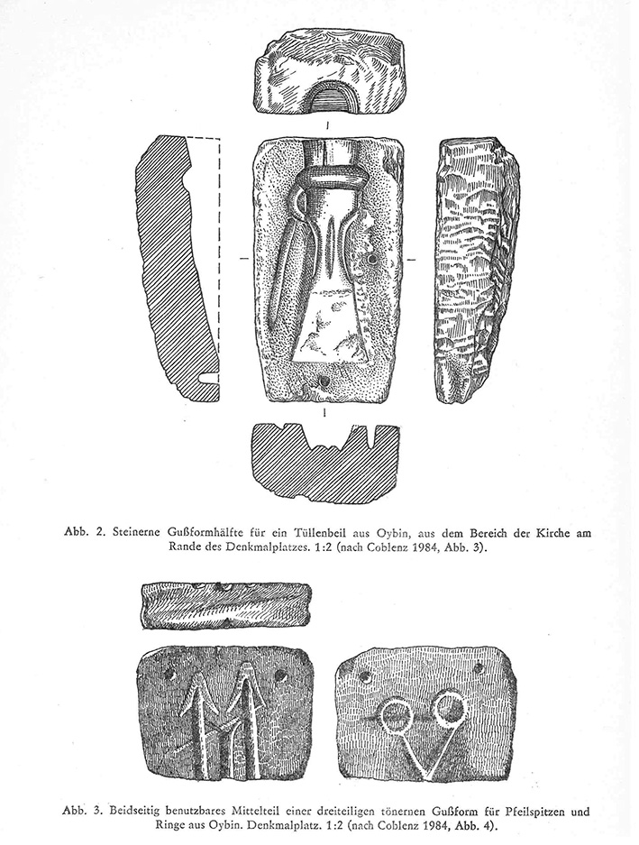
Hidden beneath the ruins of the medieval castle and monastery complex are the remains of a fortified settlement from the later Lusatian culture. The prehistoric entrance was located on the north side of the mountain, in the Hausgrund, and was sealed off with a rampart. Karl Benjamin Preusker already paid attention to the mountain and interpreted it as a place of sacrifice. However, it was not until the middle of the 19th century that prehistoric finds were actually discovered in the area of the slopes and the square in front of the monastery church. During excavation work for the erection of a monument in honor of the Zittau theologian and historian Christian Adolf Pescheck in 1861, several stone bronze casting molds for a tüllenbeil, rings and arrowheads were also found.
Annemarie ReckImage Source W. Coblenz 1988, 153.
Excavation 1951
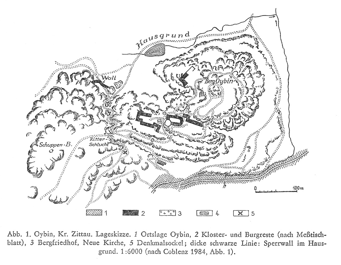
The finds below the plateau raised the question of whether traces of a settlement or perhaps the remains of a bronze foundry could also be found at the foot of the mountain. Excavations in 1951 by the then Dresden State Museum of Prehistory (now LfA Saxony) in the Denkmalplatz-Ritterschlucht area showed that all the prehistoric finds were stored in alluvial layers under the mountain plateau and had probably been washed down or possibly thrown down during downpours. Werner Coblenz noted that the layers containing the finds thinned out further and further with distance from the rising rock and that there was significantly less charcoal and sherds in them. There were also no clear traces of prehistoric habitation such as hearths, postholes or settlement pits. On the other hand, the remains of buildings, such as stables or barns, with medieval furnishings were found in the area.
Annemarie ReckImage Source W. Coblenz 1988, 152.
Dating of the find material
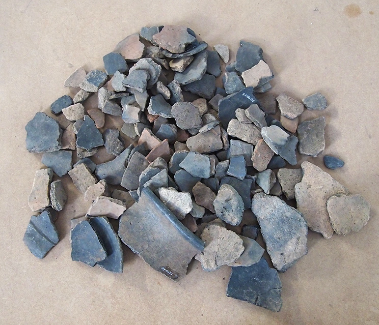
The actual prehistoric settlement was probably located exclusively on the mountain plateau. The very rich find material from the mountain coincides with the finds from the foot of the mountain and can be culturally assigned to the latest phase of the Lusatian culture. Late zone humps, double cones, horizontally grooved wares, plates, game shards, spindle whorls, pierced whetstone remains or slip-roughened storage vessels clearly show the typical forms and decorative styles of the late Bronze Age and early Iron Age. The small amount of material that came to light in 1967 during a sounding of the rampart in the Hausgrund also corresponds to this period.
Annemarie ReckImage Source J. Wojnicz, Foto Altfunde 1951 ©LfA 2014. J. Wojnicz, Foto Altfunde 1951 ©LfA 2014.
The rampart at the bottom of the house
The barrier wall is still recognizable today despite numerous disturbances. It has a length of 50 m and ends at steep rock faces. Taking into account the collapse, Coblenz assumes that the wall was originally up to 4 m high and up to 6 m wide. The rampart is still around 3 m high. On its inner side, the particularly large stone blocks of up to 150 kg, which were stacked on top of each other, were particularly striking. The rampart filling consisted of smaller boulders and layers of charcoal, which indicate beams, similar to the rampart structure on the Eisenberg in Vogtland. Coblenz assumes that the fortified settlement on the Oybin was of above-average importance and was built during intensive use of the transit route between the Zittau region and northern Bohemia. There may have been both economic and strategic reasons for this.
Annemarie ReckImage Source R. Heynowski, Foto ©LfA 2016.
Literature
Stefanie Bilz, Burg und Kloster auf dem Oybin. In: Regina Smolnik/Ronny Zienert (Hrsg.), Höhenflüge. Luftbilder und Archäologie in Sachsen (Dresden 2024) 134–135.
Werner Coblenz, Die bronzezeitliche Höhensiedlung auf dem Oybin mit Zugangssperre. Arbeits- und Forschungsberichte zur sächsischen Bodendenkmalpflege 27/28, 1984, 93–123.
Werner Coblenz, Die Höhensiedlung auf dem Berg Oybin mit Zugangssperre im Hausgrund. In: Heinz-Joachim Vogt (Hrsg.), Archäologische Feldforschungen in Sachsen. Arbeits- und Forschungsberichte zur sächsischen Bodendenkmalpflege, Beih. 18 (Berlin 1988) 152–155.
Note on monument protection
Archaeological monuments are protected by the Saxon Monument Protection Act. A permit under monument law is required for ground interventions or construction measures.
Permalink
https://archaeo-sn.de/en/ort/late-bronze-age-fortification-on-the-oybin/
Citation
Annemarie Reck, Late Bronze Age fortification on the Oybin. In: Landesamt für Archäologie Sachsen, Website archaeo | SN (08.03.2024). https://archaeo-sn.de/en/ort/late-bronze-age-fortification-on-the-oybin/ (Stand: 28.09.2026)
