

Lowland castle near Werdeck
| Place: | Klein Priebus Werdeck corridor 1 (Krauschwitz, Görlitz) |
|---|---|
| Type: | circular structure |
| Dating: | High Middle Ages | Late Middle Ages | 1100 - 1400 AD. |
Description
On the border of the Oberlausitz military training area, directly on the banks of the Neisse near Werdeck (Wjertko), there are the remains of a high to late medieval tower castle, which may have been built to protect a crossing of the Neisse about 150 m away. Overflight of the area is very limited, but the vegetation features are clearly visible on digital orthophotos. Immediately to the north-east is the so-called "Königshügel“ to see. This is a sandy erosion remnant of the former Neisse embankment, which in the past was transfigured into a Wendish royal tomb.
Ronald Heynowski/Annemarie ReckThe findings
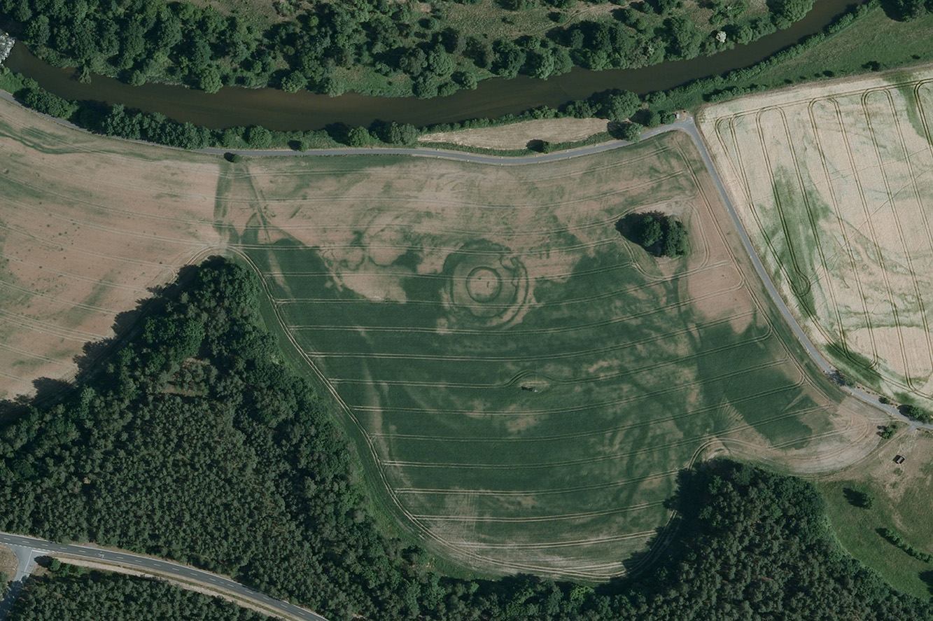
Three concentric circles can be seen in the orthophoto. The two outer circles mark the 13 m wide enclosure ditch. Their diameters are 56 m and 43 m. The inner ring probably dates back to a palisade construction. It enclosed an inner area 23 m in diameter. Based on this typical construction method, it can be concluded that it was a lowland castle from the High to Late Middle Ages.
Ronald Heynowski/Annemarie ReckImage Source DOP 05.-10.06.2008.
Tower castle without a hill?
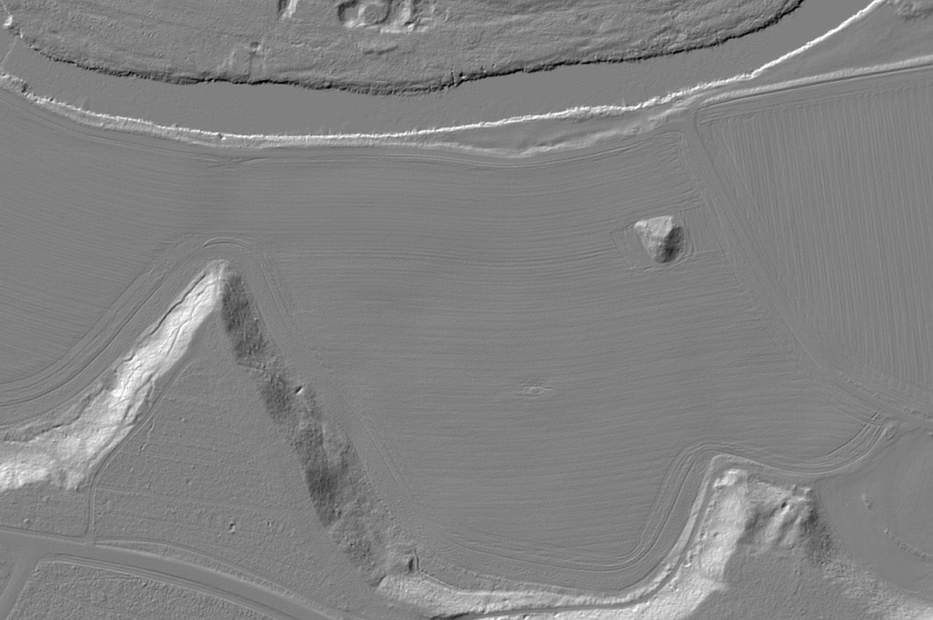
The lowland castle probably consisted of a wooden tower. Remains of wall foundations would most likely have been visible in the vegetation. Such tower castles were often also built on an artificial mound or enclosed by a rampart built from the excavated ditch. If such a mound or rampart existed in Werdeck, they may have been completely leveled in the meantime due to flooding and agricultural use. Even in the digital terrain model (DTM), there is no longer any indication of a mound. The ditch itself was probably once fed with water from the Neisse.
Ronald Heynowski/Annemarie ReckImage Source DGM 2019.
Royal tombs on the Neisse?
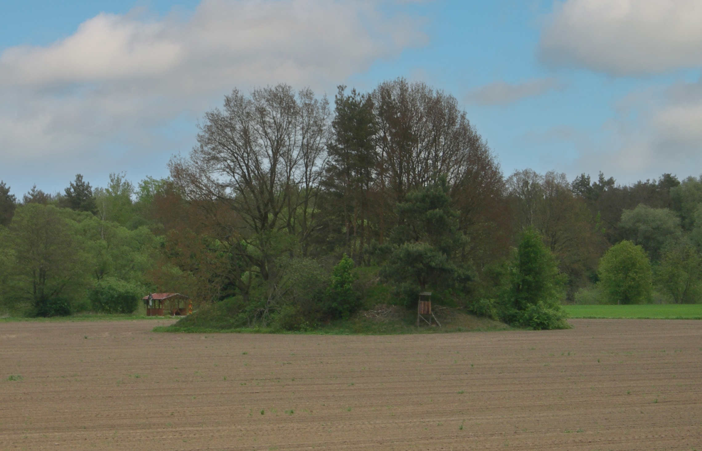
The tower mound may have served to protect a crossing over the Neisse. Since the 19th century, a bridge connecting Werdeck with the village of Pattag (Potok) was only 150 m away. However, a ford may have existed here for much longer. About halfway between the tower castle and the former Neisse crossing is the so-called royal hill "Kreutz B[erg]". However, this is not a burial site, but merely a remnant of erosion on the sandy embankment of the Neisse. In 1670, builders discovered urns in a similar mound near Podrosche during the construction of a church and referred to it as a "Wendish royal grave". This romantically glorified designation was transferred to similar sand mounds in the Neisse valley. Even today, the road leading northwest out of Werdeck is still called "Königshügel".
Ronald Heynowski/Annemarie ReckImage Source M. Strobel/A. Reck, Foto/Bearbeitung ©LfA 2024.
Literature
Walter Frenzel, Urgeschichtsfunde des Kreises Rothenburg nebst einer Einführung in die Urgeschichte der Oberlausitz (Bautzen 1926) 29–31.
Ronald Heynowski, Die Romantik eines wendischen Königsgrabes. In: Regina Smolnik/Ronny Zienert (Hrsg.), Höhenflüge. Luftbilder und Archäologie in Sachsen (Dresden 2024) 80–81.
Note on monument protection
Archaeological monuments are protected by the Saxon Monument Protection Act. A permit under monument law is required for ground interventions or construction measures.
Permalink
https://archaeo-sn.de/en/ort/lowland-castle-near-werdeck/
Citation
Ronald Heynowski/Annemarie Reck, Lowland castle near Werdeck. In: Landesamt für Archäologie Sachsen, Website archaeo | SN (16.04.2024). https://archaeo-sn.de/en/ort/lowland-castle-near-werdeck/ (Stand: 02.10.2026)
