

Wall complex on the Staupenberg
| Place: | Wendishain (Hartha, Central Saxony) |
|---|---|
| Type: | Fortified system |
| Dating: | Later Bronze Age | 1200 - 1000 BC. |
Description
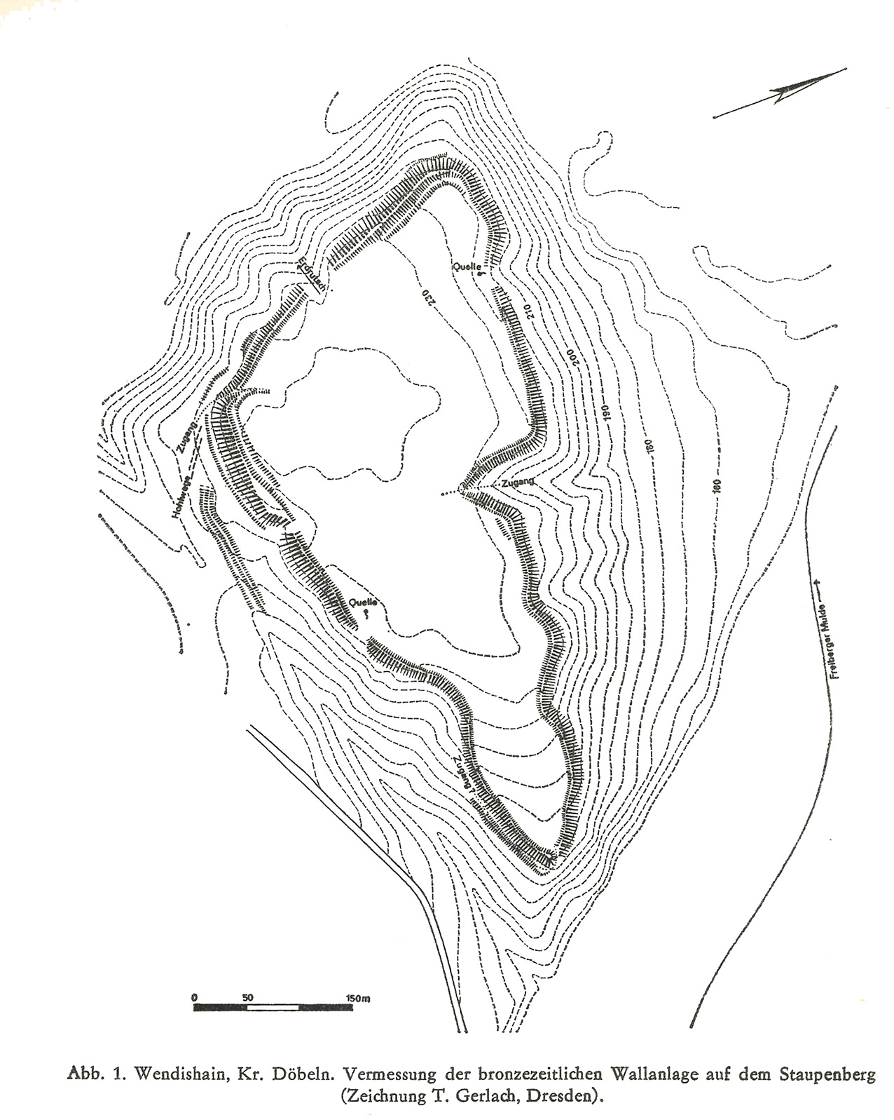
The Staupenberg is conveniently located on the left bank of the Freiberger Mulde about 25 km below the confluence of the Zschopau and close to an old ford near Westewitz. Deep, steep valleys separate the Staupen from the hinterland. Its almost triangular plateau measures 2397 m at its highest point and thus towers above the hollow by approx. 80 m. The entire plateau is surrounded by a ring wall over 3 km long. Finds unearthed during forestry work point to the Late Bronze Age. With its location along the river, not far from a river crossing and its comparatively large area, the Staupen has clear parallels to the Goldkuppe.
Ronald Heynowski/Annemarie ReckDimensions of the wall
The maximum length of the plateau bounded by the rampart is 700 m with a width of up to 330 m and covers an area of 12 ha. Today, the rampart still has a width of 9 m to 10 m with a preserved height of 2 m on average. The rampart reaches its greatest dimensions at the southern tip, where the embankment is up to 8 m high. On the southern front, but also on other sections of the rampart, there is also evidence of a flatter rampart approx. 1.5 m high and a ditch in front of it.
Ronald Heynowski/Annemarie ReckImage Source H. Kaufmann 1988, 147, Abb. 1.
Gate and superstructure
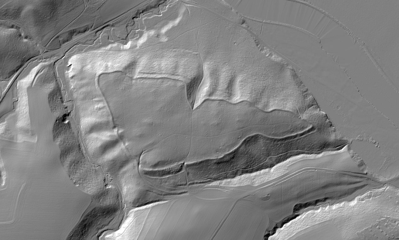
Retracting sections of rampart at the well-secured south-western end indicate a gateway. The digital terrain model (DTM) also shows traces of hollow paths leading from the Mulde valley towards the gate. The other breakthroughs in the wall were probably created more recently. Two springs on the north-western and south-eastern edges of the fortification provided the former inhabitants of the complex with access to fresh water. Outcrops at more recent wall breakthroughs allow an insight into the body of the wall. The original wall probably consisted mainly of earth and stones enclosed in a wooden structure. This is indicated by charcoal remains in the rampart.
Ronald Heynowski/Annemarie ReckImage Source R. Heynowski 2024, 124.
Finds and dating
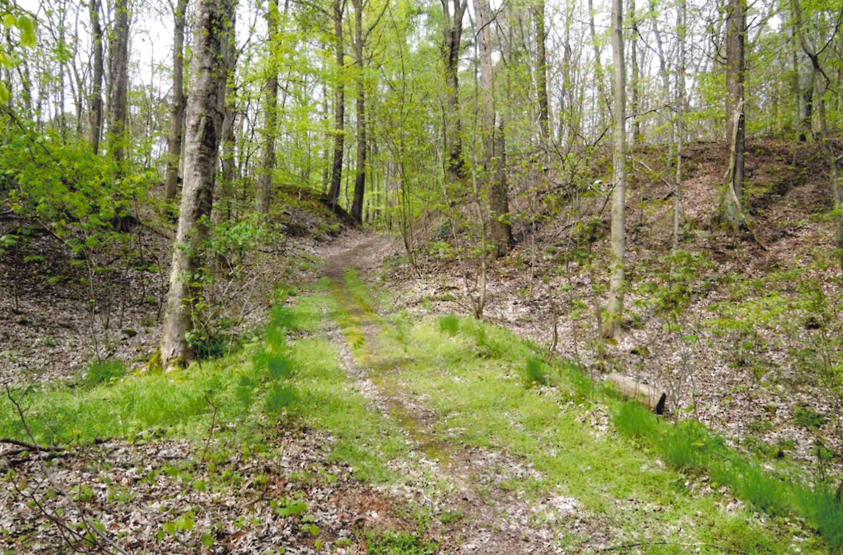
Archaeological finds have repeatedly come to light in the area of the whale outcrops, but also during forestry work. The majority of these are vessel remains from the Late Bronze Age. In addition to characteristic rim sherds and handle fragments, fragments of double-conical vessels with notched rim and pottery finds decorated with finger dots and incised lines have been found. The finds also include the remains of sieve vessels, spindle whorls and burnt clay as well as animal bones. In addition, there are typical Neolithic stone tools, which bear witness to the earlier use of the mountain plateau or could have continued to be used in the Bronze Age. There are also several finds of Slavic pottery from the 9th and 10th centuries as well as individual remnants of late medieval blue-grey ware.
Ronald Heynowski/Annemarie ReckImage Source OA 29830, 486. Nachlass A. Rudolph, Foto ©LfA 2016.
Fortified trading and craft center
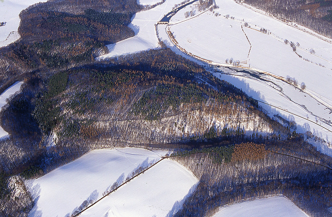
The fortified hilltop settlement on the Staupen was probably built here primarily because of its convenient location. The Freiberger Mulde, Zschopau and Zwickauer Mulde rivers connect the Ore Mountains and Bohemia with the Middle Elbe region. In addition to overland roads, rivers have been important long-distance routes along which people and trade goods have traveled for thousands of years. These transportation and traffic routes required protection and security. Fortifications were therefore built along trade routes in prehistoric times. They served as a port of call for commercial travelers, as a transshipment point for goods, as an attraction for craftsmen and as a demonstration of power for the political upper classes. The location of the Staupen near the junction of the river and ford, as well as the nearby mouth of the Zschopau into the Mulde, suggest such an interpretation as a fortified trading and craft site for the Staupen.
Ronald Heynowski/Annemarie ReckImage Source R. Heynowski, Foto ©LfA 2009.
Literature
Ronald Heynowski, Wallanlage auf dem Staupen. In: Regina Smolnik/Ronny Zienert (Hrsg.), Höhenflüge. Luftbilder und Archäologie in Sachsen (Dresden 2024) 124–125.
Hans Kaufmann, Der Ringwall auf dem Staupenberg in der Flur Wendishain, Kr. Döbeln. In: Heinz-Joachim Vogt (Hrsg.), Archäologische Feldforschungen in Sachsen. Arbeits- und Forschungsberichte zur sächsischen Bodendenkmalpflege, Beih. 18 (Berlin 1988) 146–148.
Note on monument protection
Archaeological monuments are protected by the Saxon Monument Protection Act. A permit under monument law is required for ground interventions or construction measures.
Permalink
https://archaeo-sn.de/en/ort/wall-complex-on-the-staupenberg/
Citation
Ronald Heynowski/Annemarie Reck, Wall complex on the Staupenberg. In: Landesamt für Archäologie Sachsen, Website archaeo | SN (23.02.2024). https://archaeo-sn.de/en/ort/wall-complex-on-the-staupenberg/ (Stand: 30.09.2026)
